EURO1k Examples
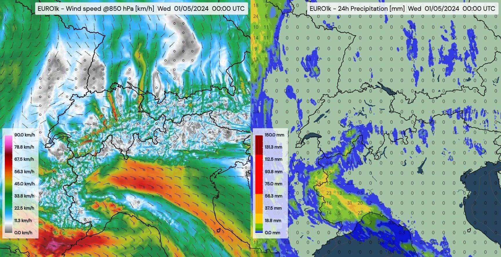
Turbulent days on both sides of the Alps
May 1-3, 2024 — The animation shows a a low-pressure system in the west of Europe leading to moist and warm air being pushed towards the Alps.
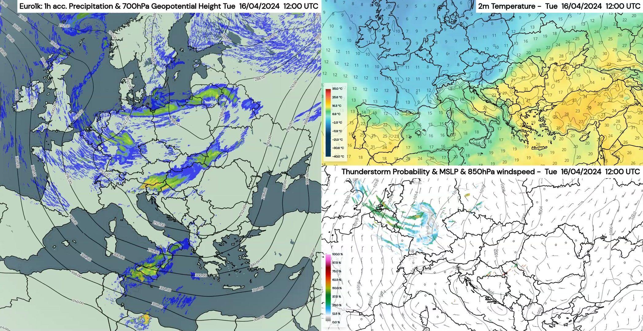
Arctic Air and Thunderstorms
April 16-18, 2024 — EURO1k resolves not only small-scale showers (left panel), but also the probability of thunderstorms as the days progress (bottom right panel).
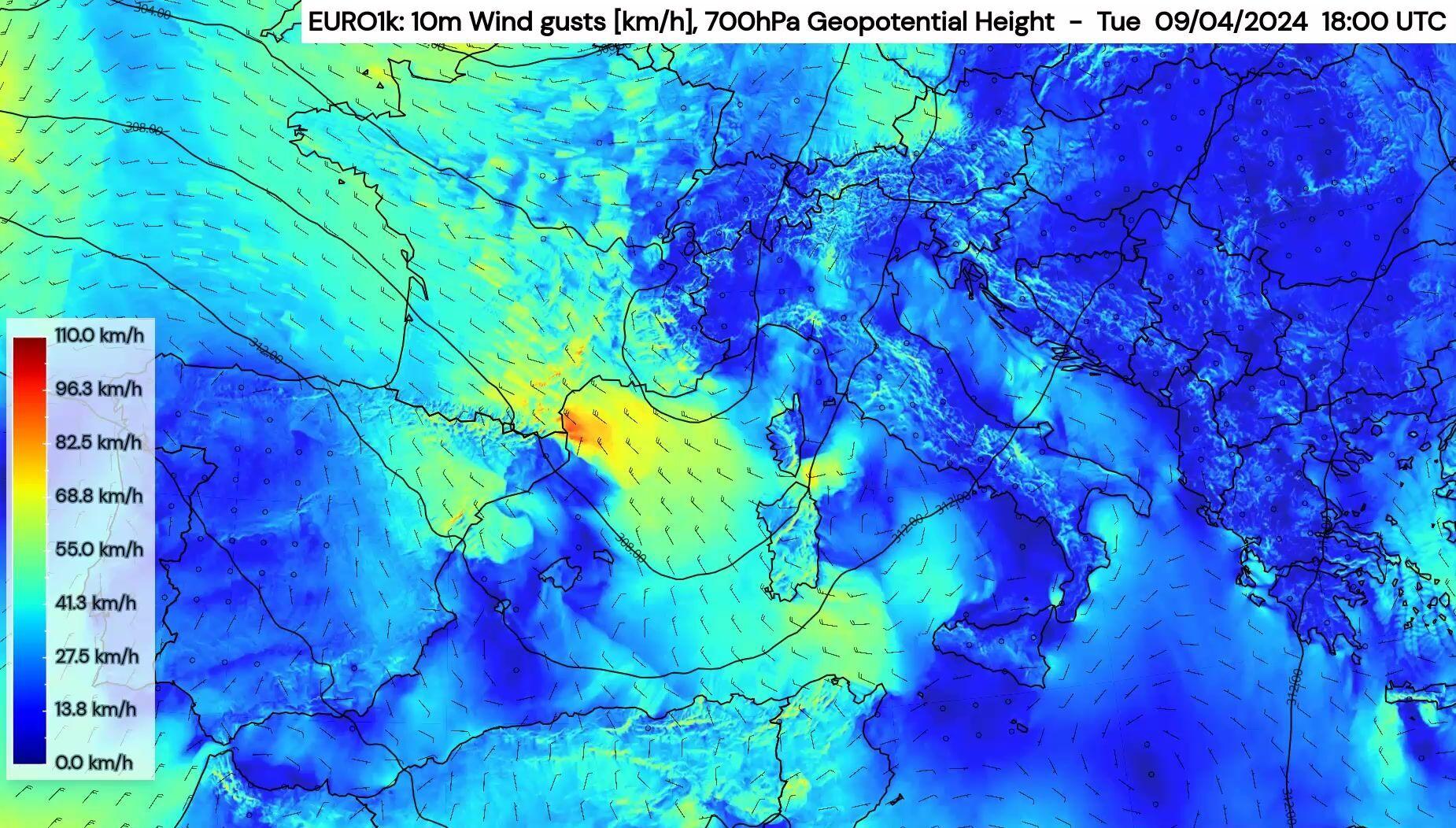
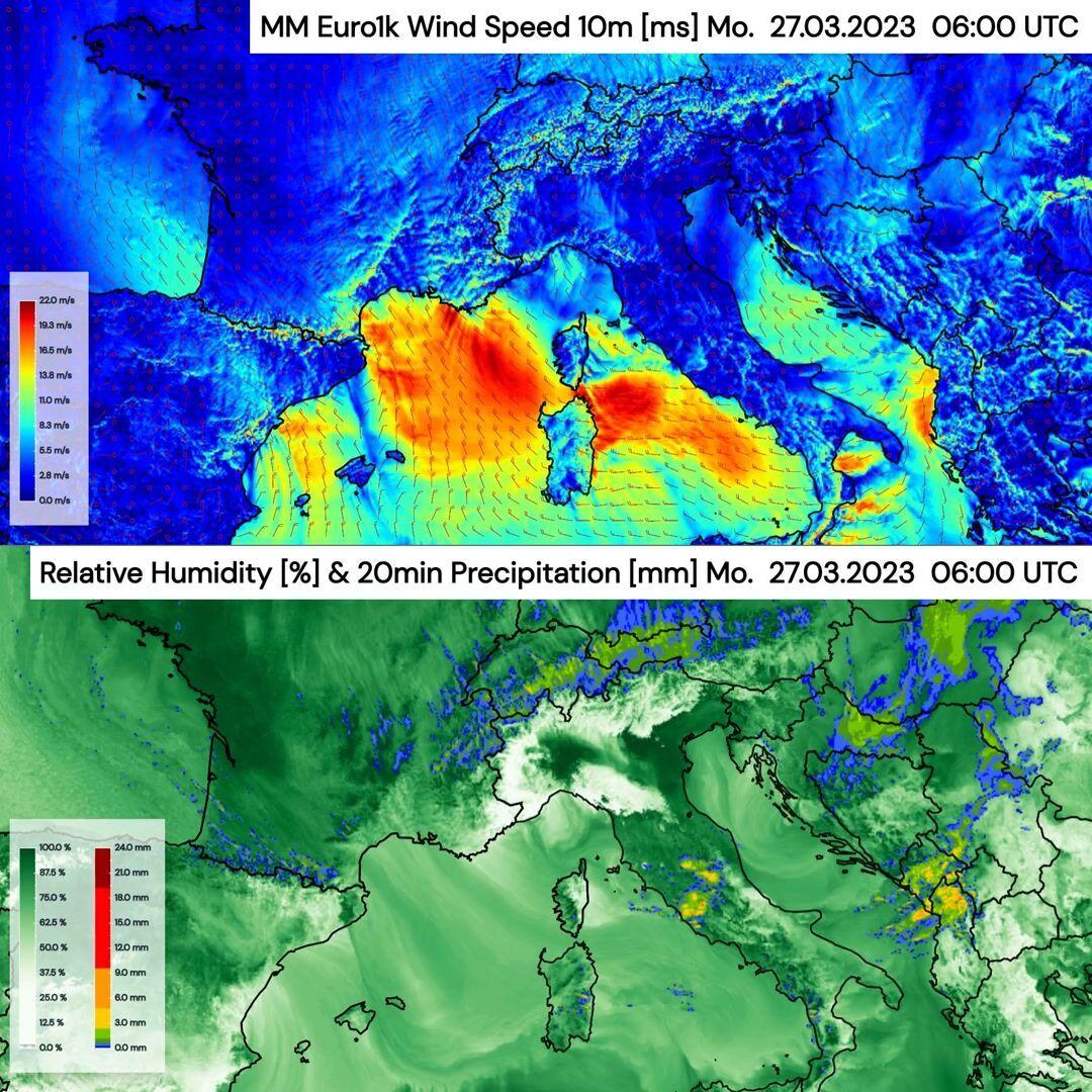
Tracing the Mistral and Gap Winds Across the Mediterranean
April 9-11, 2024 — In addition to the stormy mistral, high-resolution EURO1k wind forecasts also show small-scale effects such as higher wind speeds in the foehn valleys and on the mountain peaks, as well as so-called gap-winds, for example in the Strait of Messina and Gibraltar.
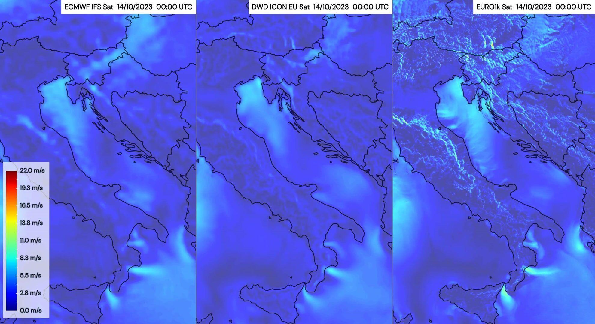
Bora wind along the coast of Croatia
Characterised by strong, gusty winds blowing from the northeast onto the Adriatic region, the Bora occurs when cold air masses traverse the mountains and descend towards the coast.
The animation compares of the ECMWF IFS, the DWD ICON EU and our in-house EURO1k model. Our high-resolution model EURO1k was able to predict the high wind speeds associated with the Bora and to resolve the fine structures of this wind phenomena.
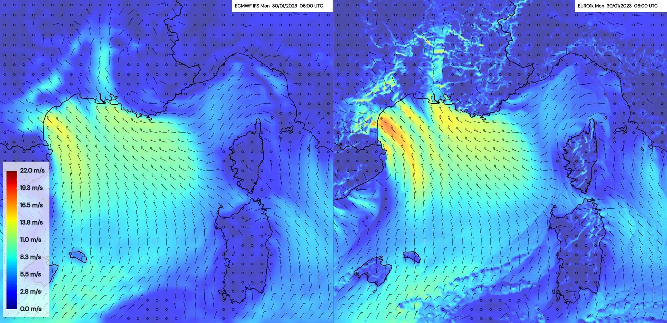
Mistral winds over the Mediterranean
The Mistral wind is a strong, cold, northwesterly wind that blows through the Rhône Valley and southern France into the Mediterranean Sea. It typically occurs during the winter and spring months, although it can happen at any time of the year.
The animation shows a comparison between ECMWF IFS (left) and Meteomatics EURO1k (right). The comparison shows how the higher resolution of our EURO1k model is able to capture the Mistral winds with much more details on local levels than the ECMWF IFS.
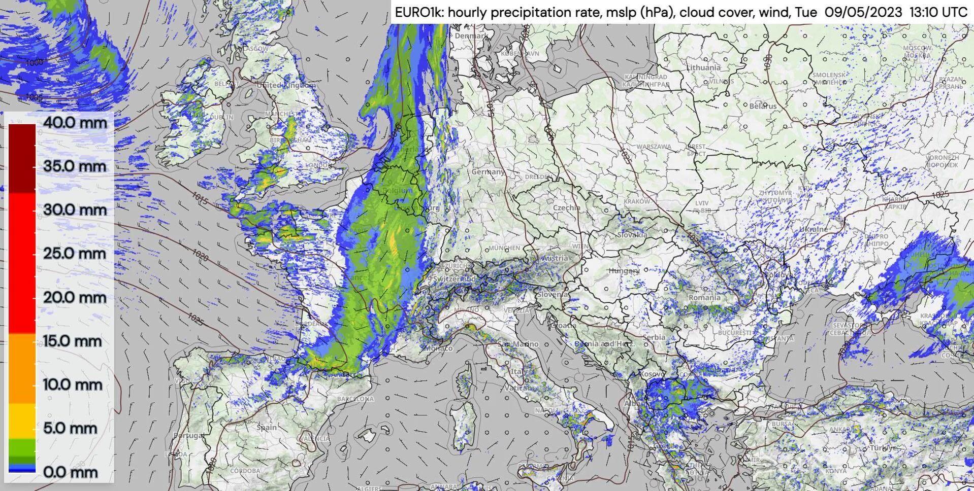
Heavy precipitation over Europe
In May 2023, several low-pressure areas were causing precipitation in the form of showers and thunderstorms, with heavy and sometimes longer-lasting rainfall.
The animation shows precipitation masses moving, with thunderstorms and heavy rain possible in a strip stretching from the North Sea over the Alps to Italy.
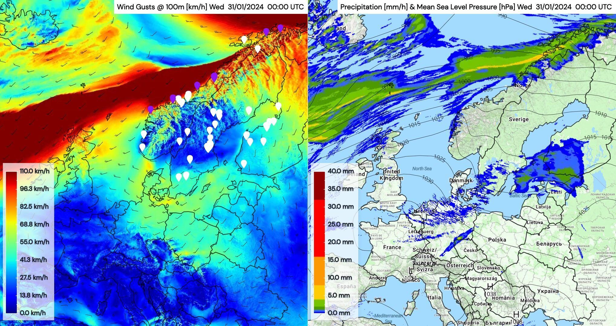
Ingunn storm in Norway
Between January and February 2024, we've witnessed the formidable power of nature as storm "Ingunn" carved its path across the North Atlantic, impacting the UK, the Faroe Islands, and delivering a significant blow to Norway with winds hitting up to 200 km/h and gusts reaching approximately 225 km/h along the Norwegian coast. This event, coupled with heavy rain and snowfall, marks one of the most severe storms Norway has faced in the last three decades.
The animation, using our high-resolution weather model EURO1k, shows wind farm locations with a threshold of 90 km/h (if the threshold is reached, the symbol goes from white to purple, indicating that the turbine will be switched off due to strong wind).
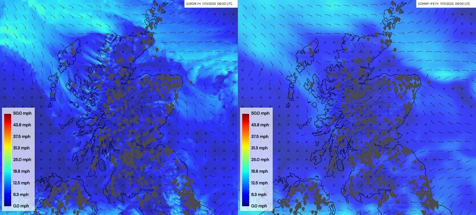
Wind power production in the UK
Accurately forecasting wind / wind generation is vital for effectively balancing supply and demand, and this is a challenge, especially in the kind of complex terrain where many windfarms are located.
The animation shows a comparison between ECMWF IFS (right) and Meteomatics EURO1k (left) considering 100 m winds in the span of 48 hours, with icons indicating the locations of wind farms across Scotland. A threshold of 15 m/s is applied (typically on the steep part of a wind turbine power curve) to highlight the differences which result from the intricate interaction between wind patterns, local topography, land use and other geographical factors.
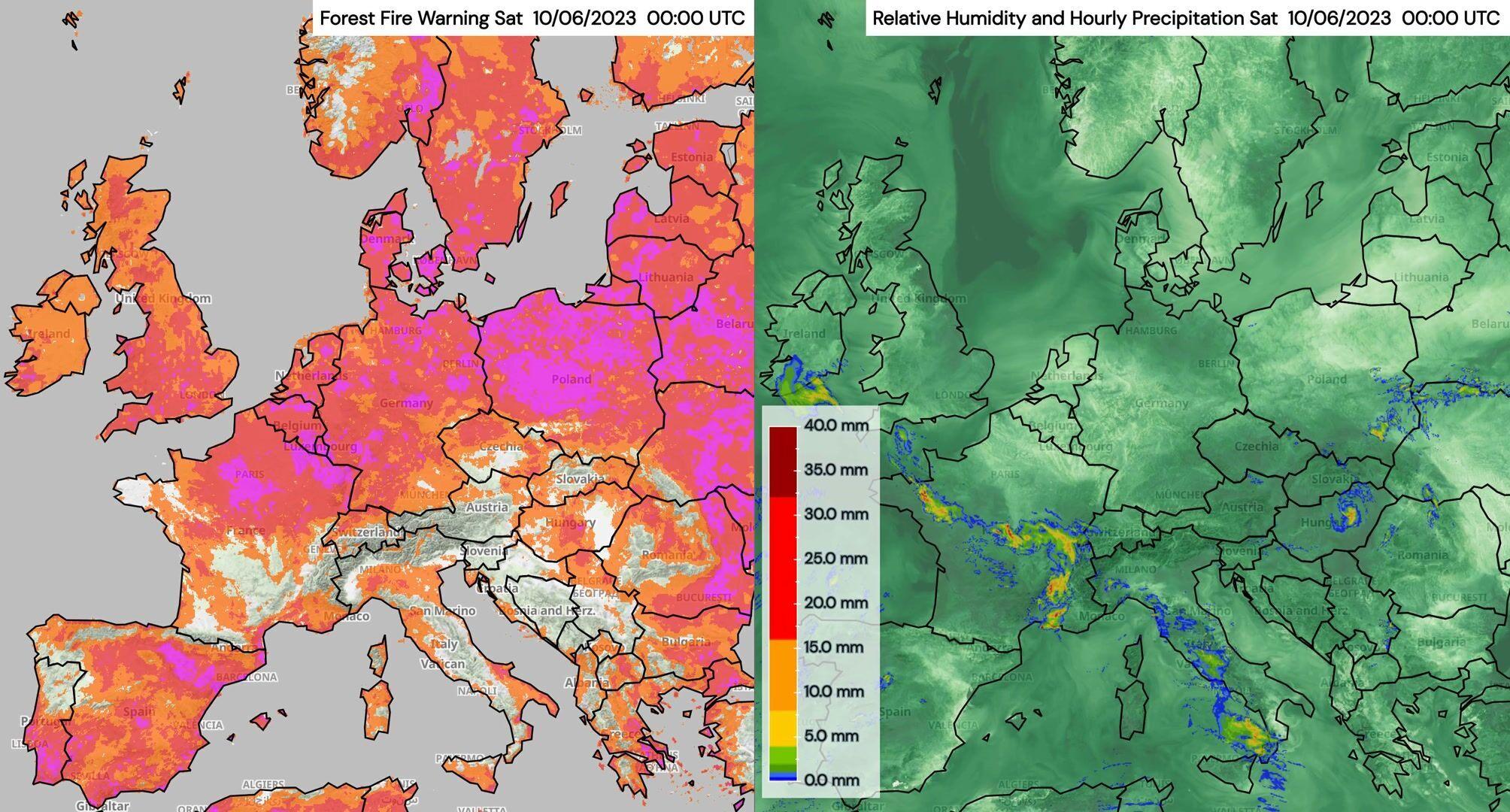
Wildfire risk in Europe
The left hand map shows the forest fire warning. Pink areas have the highest risk. The right hand map shows the hourly precipitation and relative humidity near the surface. In areas of high relative humidity (darker green), the forest fire risk is lower.
Northerly foehn wind patterns
Northerly winds push moist air towards the northern side of the Alps. The Alps force the moist air to rise, which cools the air and leads finally to condensation and precipitation. On the southern side of the Alps the air descends from the mountain tops to the Po Valley. The falling winds accelerate and are accompanied with higher temperatures and dry conditions. This phenomenon is also known as northerly foehn.
EURO1k shows the foehn event very well in the animation (wind speed on top and relative humidity as well as precipitation on the bottom). In addition, a similar event is visible over Sardinia, where moist air is pushed from the west towards the mountains leading to cloud formation over the mountains and dry air in the east of the island. Due to the high resolution of #URO1k, even small-scale eddies in the lee of the Sardinian mountains are visible.
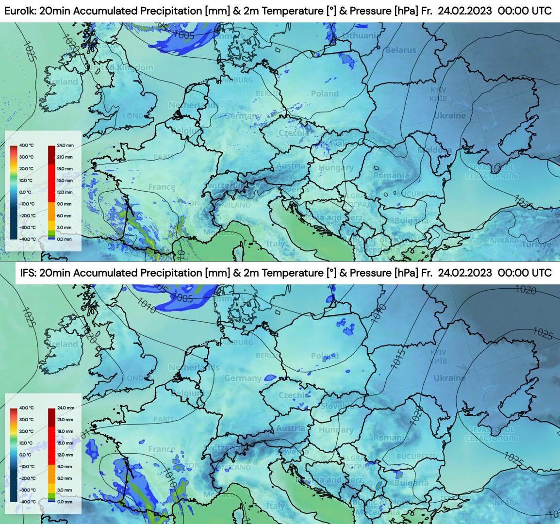
Precipitation over the Alps
The animation shows the forecasted 2 m temperature as well as the accumulated precipitation over 20 minutes for our high resolution model EURO1k (top) as well as the ECMWF-IFS model (bottom).
Precipitation over Denmark
The animation shows the mean sea level pressure with hourly precipitation on top and the wind speed in the bottom window.
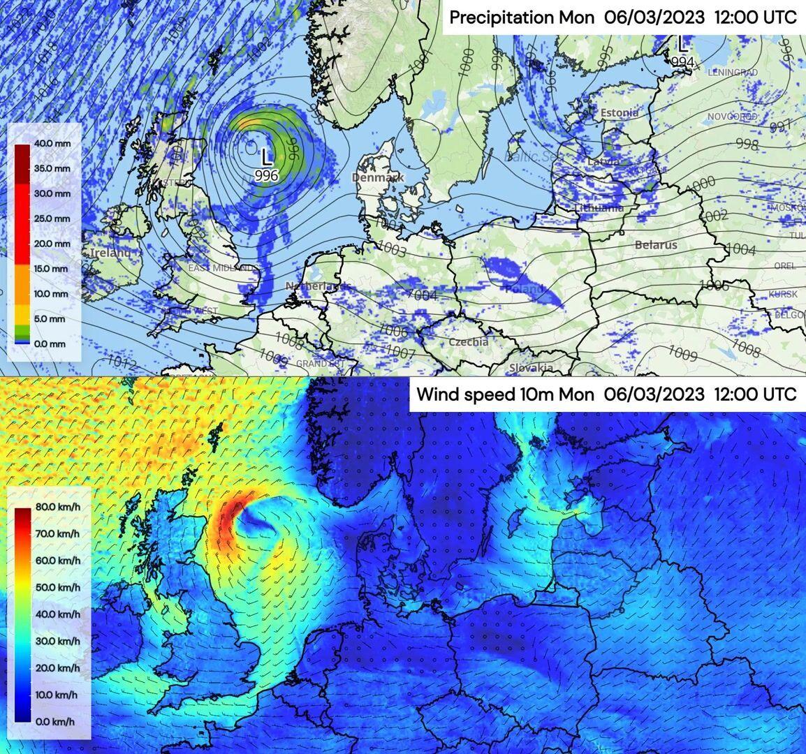
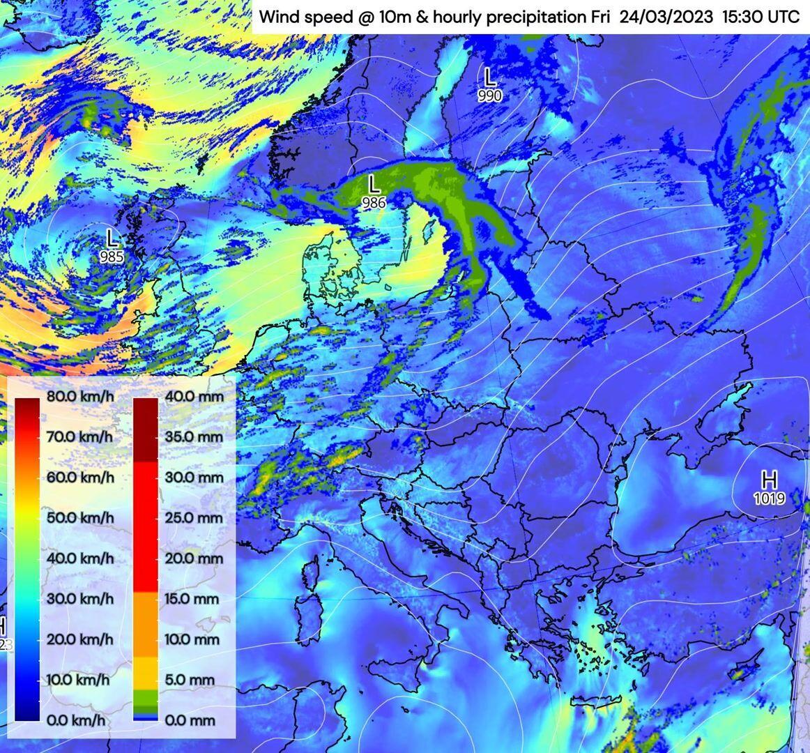
Precipitation and wind over the UK and Scandinavia
The animation shows how two low pressure systems bring higher wind speeds paired with precipitation to Europe.
Ready To Unlock EURO1k? Get in Touch!

Talk to an Expert