
Applications of Weather Data
Make Better Operational Decisions With Weather Data From Meteomatics
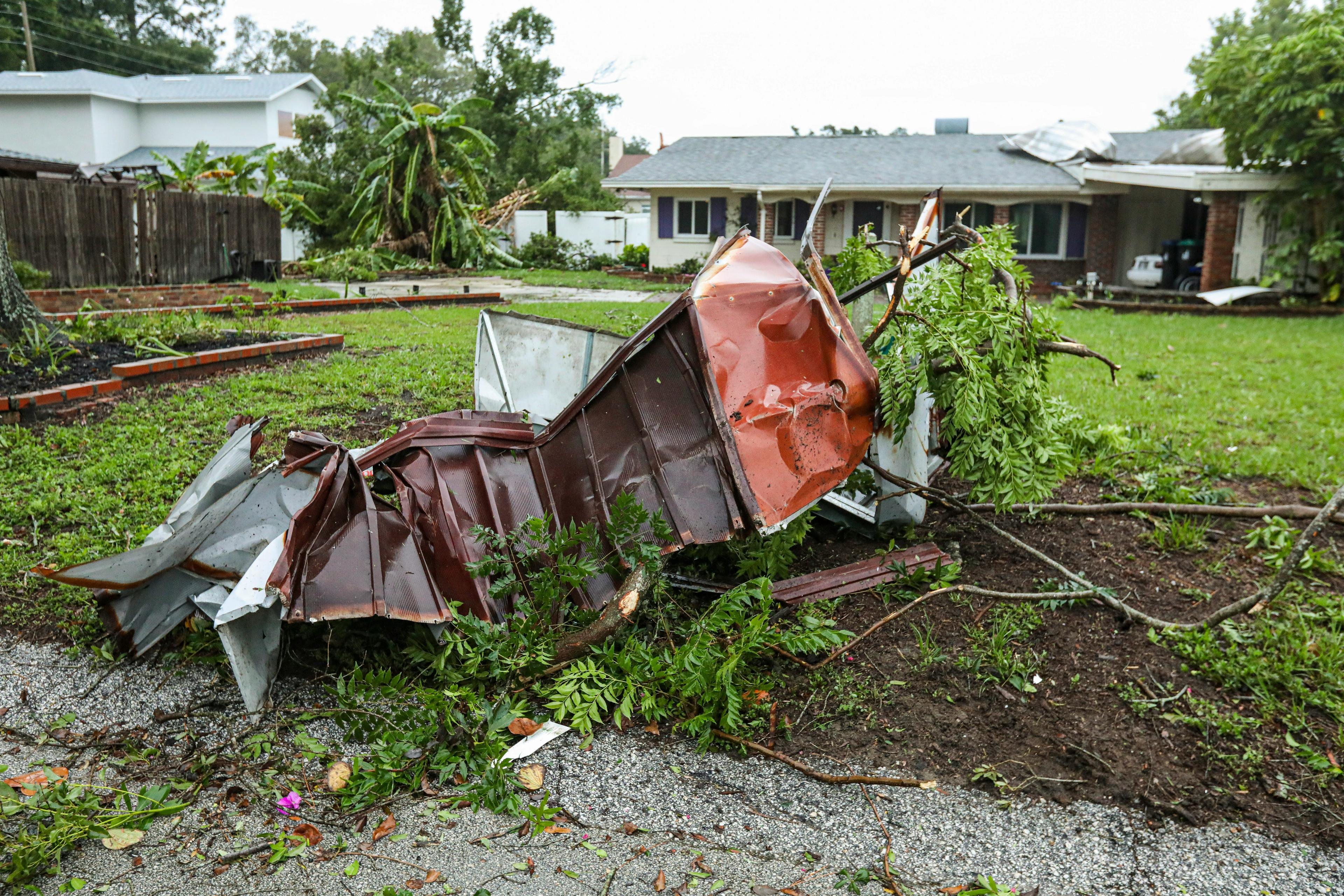
Certain weather conditions can significantly limit the production and day-to-day business of some companies. But not every industry is affected by the weather in the same way. Therefore, with a large selection of specific weather parameters and individual industry solutions, we offer the optimal basis for making better operational decisions. Select your industry and we will create a tailor-made strategy for your company.
Customer Success Stories
Our expert team of meteorologists and scientists is continuously working on the optimization, accuracy and availability of our data to deliver reliable solutions for your business. Select a customer story and get insights from our various use cases.


Data Origin
Where Does Meteomatics Get Its Data From?
We generate weather data using well-established weather models, radar and satellite data, specialized downscaling calculations, and our proprietary drone technology. By refining various measurement data, we achieve unprecedented accuracy, particularly at the local level.
This precision is extremely valuable to many of our customers, whose activities are highly dependent on local weather conditions. These activities include the production of renewable energy, land and sea transportation, and airport operations.
Step by Step Towards Hyperlocal Weather Output:
Weather models run weather data from various sources
Combination of different weather models delivers first-class data
Weather data is automatically post-processed with a 90-meter downscaling technique
Weather data is provided in real time via the Weather API
Combination of High-Resolution Weather Models
We process high-quality weather and satellite data from leading centers worldwide using our own scientific methods and post-processing techniques to produce highly accurate forecasts.
In weather modeling, we differentiate between spatial and temporal resolution. Spatial resolution refers to the number of grid cells in the forecast model. A high spatial resolution means that the grid points are close together. With a resolution of one kilometer or less, we can map many local and dynamic effects, greatly improving local weather forecasts.
Temporal resolution refers to how often the weather model output is updated. A high temporal resolution means changes are provided in intervals of five minutes or less. This allows us to improve the accuracy of weather forecasts concerning the timing of weather events. Our weather data can be provided with a resolution of one minute or less.
Meteomatics offers weather models with different resolutions. For more information, see Models and Data Sources.
Data Sources
Combine data from over 110 weather data sources.
Weather data types | Where does the weather data come from? |
ECMWF, GFS, DWD-ICON, MF-Arome, UKMO, HRRR, Ensembles, and many more | |
FourCast, GraphCast, ECMWF-AIFS | |
Precipitation data from national radar networks from Germany, Switzerland, Austria, France, UK, USA, etc. | |
Meteosat, Himawari-8, GOES-16 and 17 | |
Station networks of national weather services: e.g. German and American weather services and some private providers | |
Global weather model data, radiosondes, drones, models for air pollutants/particles/fine dust (ECMWF CAMS, FMI SILAM) | |
Global ocean models such as ECMWF-WAM, ECMWF-CMEMS, NOAA-HYCOM | |
Global climate model from the Meteorological Research Institute in Japan, climate scenarios based on IPCC's Shared Socioeconomic Pathways | |
Global Reanalysis Model (ECMWF-ERA5) |
Available Parameters
Use Weather and Climate Data From a Collection of Over 1800 Parameters
Meteodrones
Innovative Measurement Technology With Weather Drones
To enhance the accuracy of weather forecasts, we are the only company worldwide that collects atmospheric data using Meteodrones, our self-developed weather drone system, capable of flying up to 6 kilometers.
Weather models often struggle to accurately predict phenomena such as fog, low clouds, and thunderstorms due to insufficient data coverage in the middle and lower atmospheric layers. To address this gap, we developed Meteodrones.
This technology allows for high-resolution, direct measurements of temperature, humidity, and wind. By incorporating this data into weather models, we significantly improve the local prediction of fog, low clouds, and thunderstorms.


CEO / Founder
By downscaling, we are able to extract fine and granular details from existing weather models.
Accuracy of Weather Data by Downscaling
For the most accurate weather data, a much higher model resolution is required than is the case with global weather models today. At Meteomatics, we also break down the information from different weather models using local terrain models with a resolution of 90 meters. We call this approach 90-meter downscaling, i.e. scaling the model data with respect to the local topographical conditions.
These local landscape conditions are thus included in the local weather forecasts we deliver. In this way we achieve a refinement of the weather forecasts based on the existing weather models.
To be able to implement this, we have developed a
proprietary technology that allows us to downscale model output in real
time. The Meteomatics Mix provides the appropriate refined output from
all available weather models for each coordinate worldwide. By providing
nowcasts in 5-minute time steps, we ensure that we can deliver accurate
data for every point worldwide.

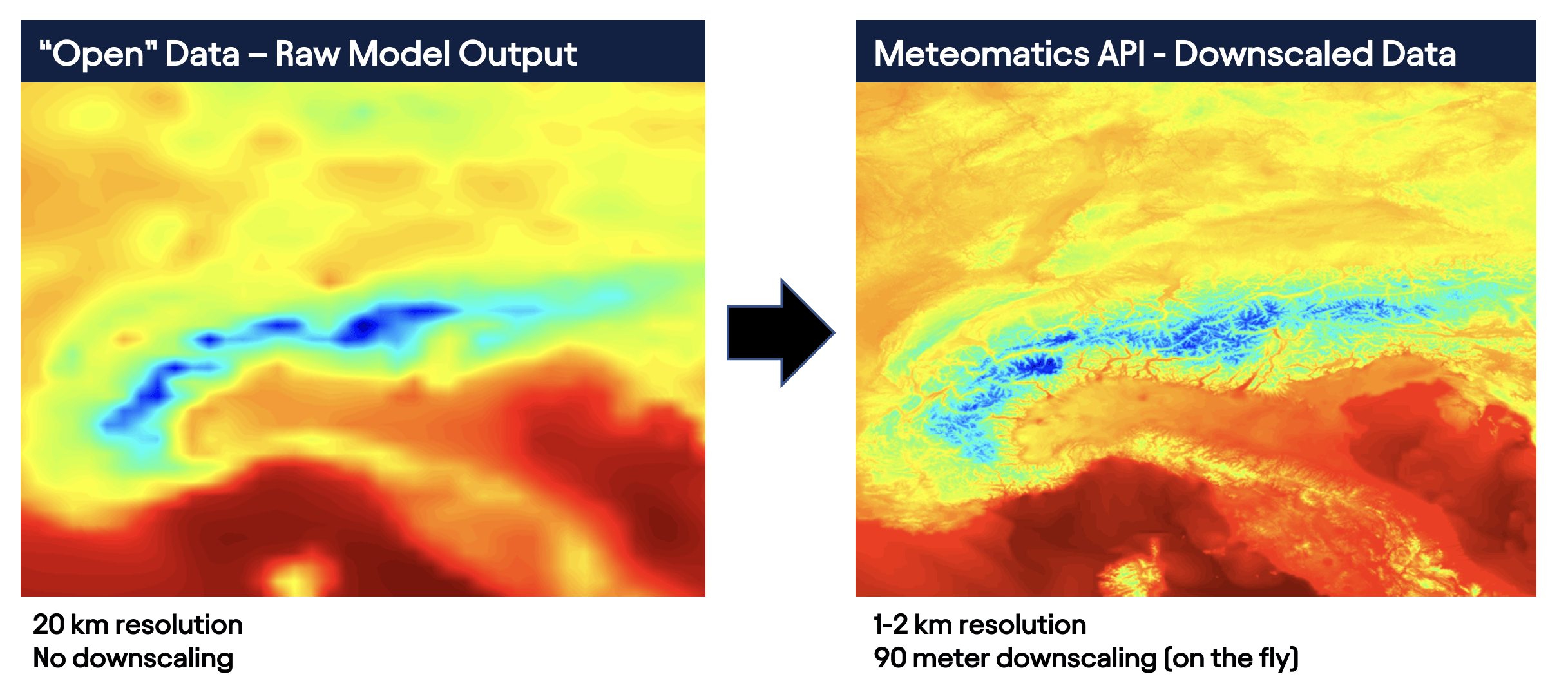
To improve the granularity of our weather data, we add NASA's 90-metre digital terrain model. So by 90 metre downscaling we mean that there is a measured terrain point every 90 metres to validate the weather model information. Downscaling is the general term for a procedure by which information is "scaled down" to a local level. In our case, this means scaling the weather model data with respect to the local topographical conditions.
We offer downscaling for all weather models and for a wide range of parameters. Thanks to our technology, downscaling is applied dynamically, as the calculations are performed in the background of an API query in real time.
Downscaling increases the accuracy of all forecasts from the different weather models, especially at the local level. This creates local forecasts that offer demonstrably higher accuracy compared to the weather model output without downscaling. This accuracy is regularly verified by us, but also by our clients. The following graph shows a comparison of the temperature values for Europe based on the widely used weather models GFS and ECMWF, both with and without downscaling. The graph shows that the output with downscaling (GFS in red, ECMWF in green) is subject to a much smaller error value, especially for short- to medium-term forecasts for the next 6 days.


Historical Weather Data From Meteomatics
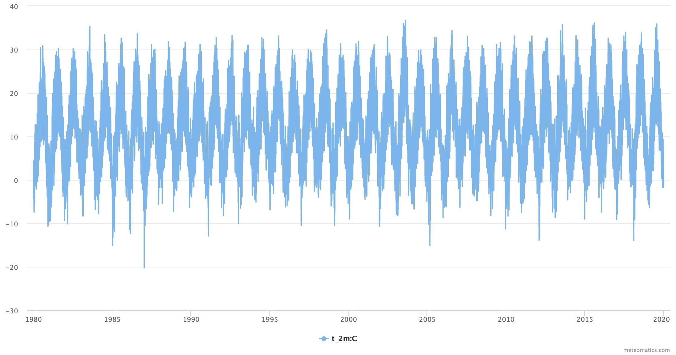
In addition to current and forecast data, we also offer historical weather data from weather stations and historical weather model data including historical forecast data from 1940 onwards.
Historical weather data can be used for machine learning or for location analyses, for example. The historical data can be conveniently obtained in all formats via the Weather API or via the Weather Data Shop.


Climate Data
Climate Data From Meteomatics
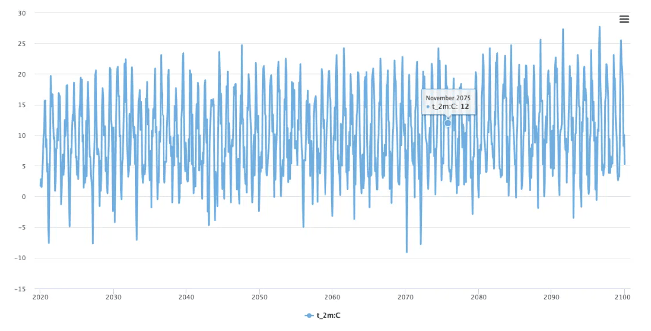
In our Weather API we provide you with various climate data in a compact and simple way. With the integration of climate scenarios, Meteomatics facilitates access to critical meteorological and climatological data for your business and risk planning. This allows you to derive greenhouse gas emission scenarios and make the right decisions regarding climate change.
Standardized time series data extending to 2100 with a single query - available for any location in the world, at your desired temporal resolution.
Standard file formats and integration in various applications

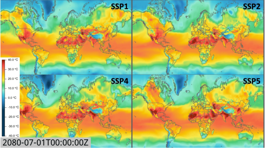
Climate Scenarios
To incorporate socio-economic developments into future climate projections, five climate scenarios (SSPs) are distinguished based on the IPCC's Shared Socioeconomic Pathways. This approach includes uncertainties related to the impacts of climate change as well as socio-economic pathways for adaptation and mitigation strategies.
Sustainability (SSP 1)
Social, economic and technological trends (SSP 2)
Regional rivalry (SSP 3)
Inequality (SSP 4)
Development with fossil fuels (SSP 5)

Climate Change Services
Meteomatics Climate Change Services offer insights from our extensive and readily available database of climate projections (CMIP6 data) spanning from 2015 to 2100. This data is easily accessible through the Weather API, enabling the demonstration of potential climate change impacts. Our climate advisory services assist businesses in identifying their exposure to long-term climate change effects.
Meteomatics offers unique insights into the impacts of climate change, such as:
Quantifying hyper-local impacts of climate change on cities, infrastructure, agriculture, etc.
Transforming commercial problems and issues into analytical frameworks
Adapting the analysis of specific meteorological and business parameters to customer needs
Risk analysis and risk quantification based on scientific climate scenarios
Coping with the impacts of both the "new normal" and extreme events
Scenario analysis with the latest CMIP6 scenarios
Customised reports for locations, countries or areas


Get Access to Weather and Climate Data
Utilize the full range of weather data, including historical data, real-time information, forecasts, and climate scenarios extending to the year 2100. Additionally, we continually develop and integrate new data sources. Our significant investments ensure we provide the most accurate weather data for any location worldwide.

Weather API
Easily access comprehensive weather data from Meteomatics through our Weather API. Multiple connectors and output formats ensure seamless integration of our data into your systems.

Pay Per Dataset
If you require specific historical datasets, current data, or weather forecasts, you can conveniently obtain and download individual datasets directly from our Weather Data Shop.

Weather Map
Visualize all weather events in high resolution using our web-based weather map tool, MetX, powered by the Weather API.
Climate, Weather and Business
We provide all relevant weather and climate data to build up an early warning system for major weather impacts on nature, agriculture and the environment in general. This includes short-term data as well as long term climate data.


We Improve the Business of Leading Brands Worldwide


Talk to an Expert