Meteomatics’ 90-meter Downscaling Technique
Downscaling involves refining or improving the resolution of meteorological data to offer more detailed and localized insights into weather conditions. It is an automated post-processing technique applied to all output data from the Meteomatics Weather API, ensuring that you always receive the highest quality data.
NASA's Global Terrain and Elevation Model
Meteomatics employs a dynamic downscaling technique to refine the output of weather models, enhancing its data through post-processing with NASA's global terrain and elevation model.
With a spatial resolution of 90 meters, NASA's model encompasses detailed information about the Earth's surface, including elevation data, land cover, and terrain features, on a global scale.
How Does Downscaling Improve Weather Data?
The downscaling post-processing step is crucial because weather models typically operate at coarser resolutions, ranging from 1km to 25km or even coarser. Consequently, topographically complex areas such as alpine regions or coastlines may not be adequately represented, leading to significant disparities between actual and modeled elevations. These disparities can significantly impact the calculations of the weather models.
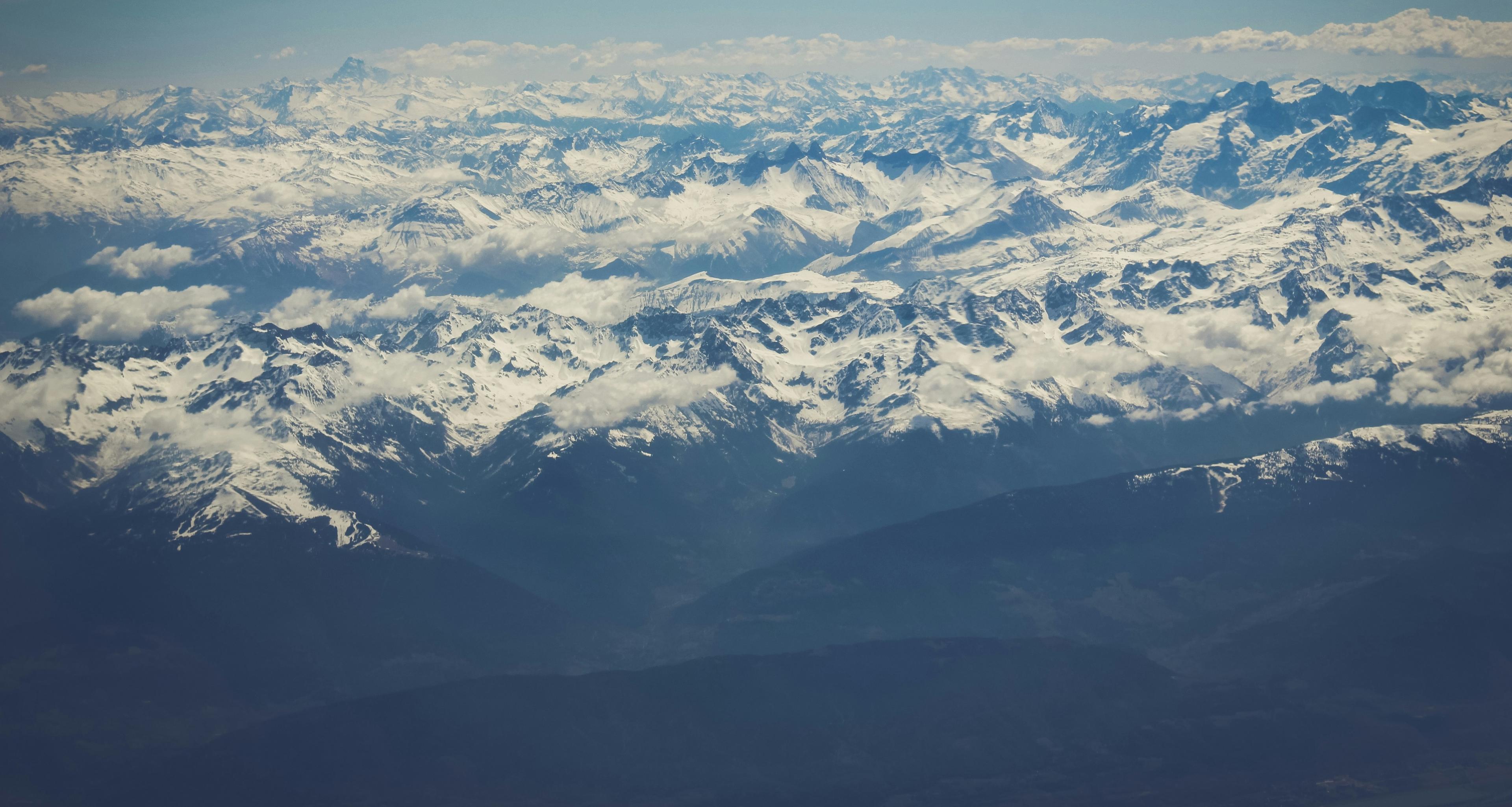
For example, a weather model working at a resolution of 9-10 kilometers, such as ECMWF, may fail to recognize valleys in the Alps and predict similar temperatures for a 600-meter altitude valley as for a 1200-meter altitude peak.
Similarly, it might fail to account for small islands, erroneously predicting identical temperatures for the land and the surrounding sea, even though the sea is usually colder than the land.
That's why incorporating this topographic information into our models and algorithms through downscaling significantly improves the accuracy and precision of the resulting weather data.
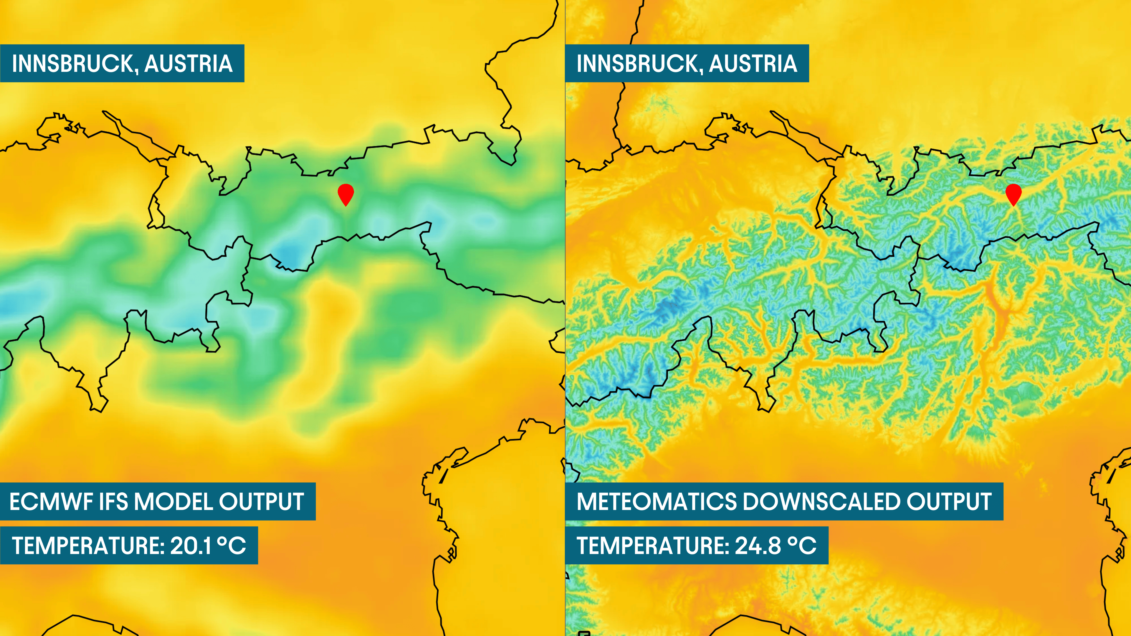
On the map below, you can observe the difference between the elevation identified by the ECMWF weather model and NASA’s terrain model in Innsbruck, Austria. For the highlighted location in red, NASA’s terrain model indicates an altitude much closer to the reality than ECMWF. This altitude difference leads to temperature differences going from 3 to 6 degrees celsius.
Downscaling Adjusts Temperature Values Based on Landscape Conditions, Such as Altitude and Elevation
What Is the Difference Between Weather Model Resolution and Downscaled Resolution?
In essence, weather model resolution sets the foundation, while downscaled resolution fine-tunes and enhances the specificity of weather forecasts for localized areas.
Weather model resolution refers to the grid spacing or spatial granularity at which atmospheric conditions are simulated within a numerical model. Higher resolution models divide the atmosphere into smaller grid cells, allowing for more detailed representation of weather phenomena.
Downscaled resolution, on the other hand, pertains to the level of detail achieved through post-processing techniques applied to model outputs. While weather model resolution primarily dictates the inherent spatial accuracy of predictions, downscaled resolution refines this accuracy further by incorporating local-scale factors and fine-tuning model outputs to match observed conditions.
The Higher the Model Resolution, the More Accurate the Downscaled Data Will Be
Simply put, refining the model output through downscaling enhances its accuracy; however, it does not reveal small-scale weather patterns initially missed. To capture such patterns—like thunderstorms, hail, fog, heavy rain, and wind flow—a higher model resolution is necessary.
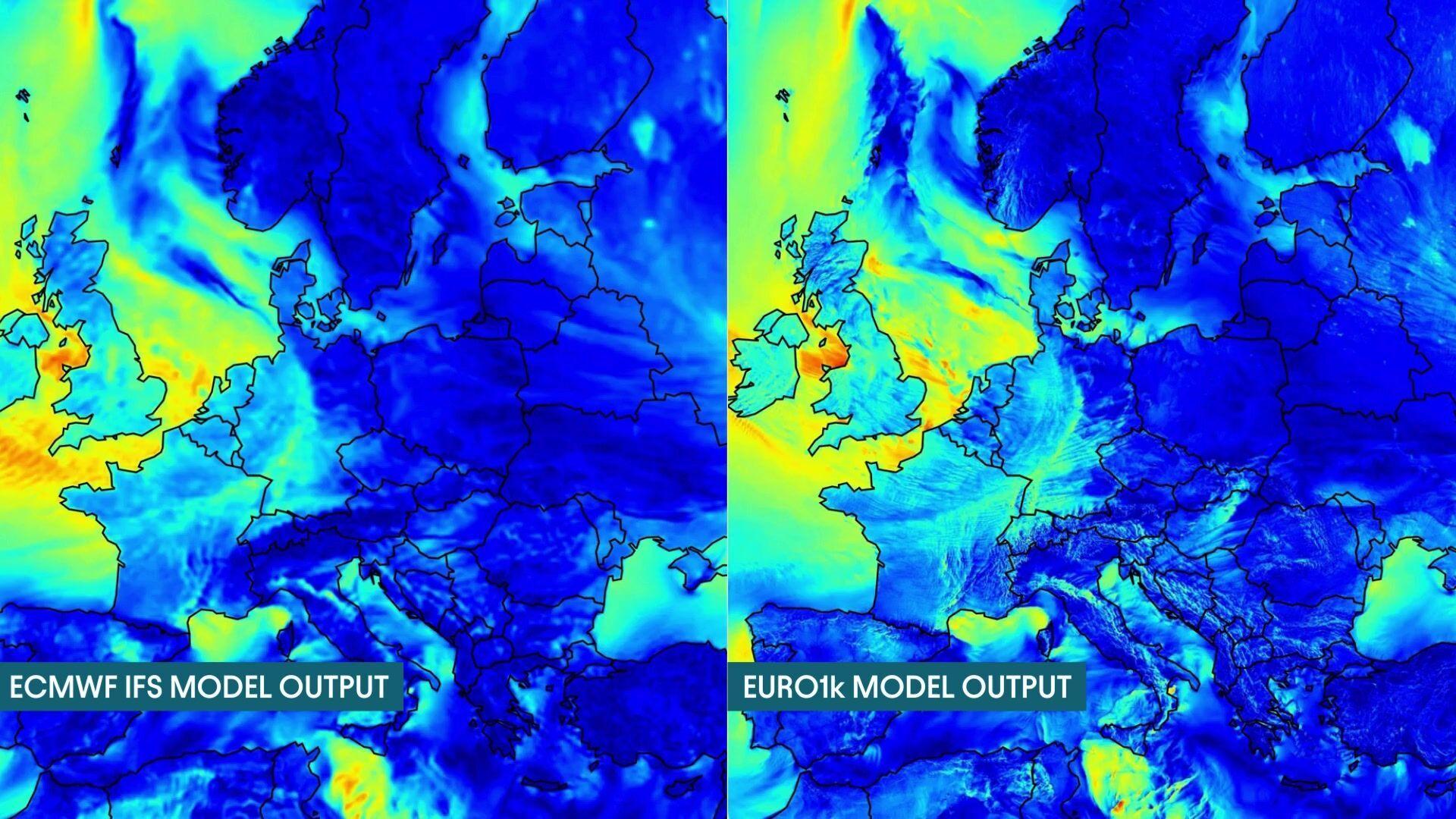
Therefore, refining data from a high-resolution weather model such as Meteomatics’ EURO1k, which offers a resolution of 1 kilometer, leads to superior downscaled forecasts compared to models with lower resolutions.
Watch the animations below and observe the fine differences in wind speed captured by ECMWF and EURO1k downscaled outputs.
Got Any Questions About Downscaling? Our Meteorologists Will Be Happy to Help!

Talk to an Expert
We provide the most accurate weather data for any location, at any time, to improve your business.


