12/19/2022
Meteomatics Supports Future Swiss Aerospace Engineers With Weather Data

Sr. Content Marketing Manager
The aerospace industry is growing and in need of a skilled workforce. University organizations worldwide are getting students ready for the specialized job market. And Switzerland is not behind. ARIS is the Swiss Academic Space Initiative that’s been focusing on space science and research since 2017. Keep reading to learn how weather data supports rocket launching and landing operations.
Who’s afraid of rocket science? The 400 students in the Swiss Academic Space Initiative (ARIS) certainly aren’t!
ARIS is an educational association founded by a group of students from the Swiss Federal Institute of Technology in Zurich (ETH-Zurich) in 2017. Today, students from 6 different Swiss universities work together to develop aerospace technology, including launch vehicles, rocket recovery systems, satellites, and other space-related technology. ARIS trains future engineers and project managers, providing qualified talent to the growing aerospace market.
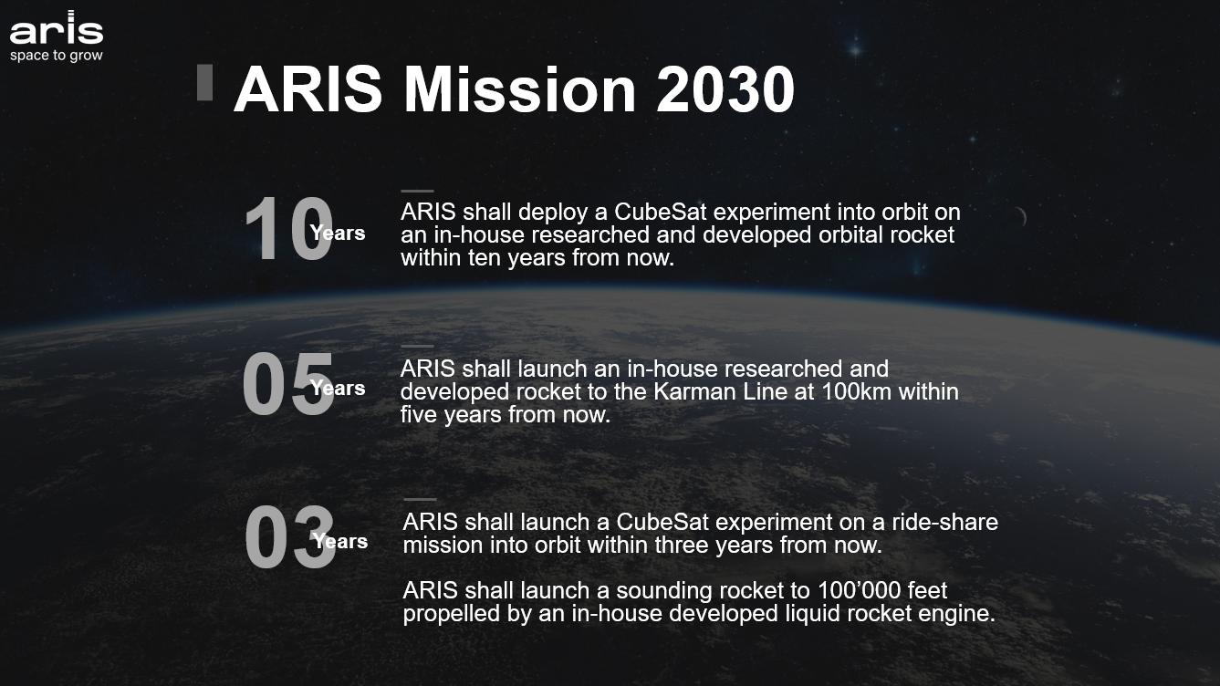
Their goal is to place a small-scale satellite in orbit with the help of a bi-liquid launcher within the next 10 years, using only in-house developed systems. ARIS will then conduct in-orbit experiments and research. To keep track of progress and drive innovation, the teams regularly participate in international competitions with other aerospace engineering student organizations.
Weather Data Ensures Successful Launch and Landing
Earthly weather forecasting tools don’t have any use in space. Space weather is very different from what we experience on our planet. So how does Meteomatics support such a project?
The weather on Earth plays a significant role in the launch and recovery of spacecraft. During the ascent and descent phases, launch vehicles and rockets pass through the planet’s atmosphere, vulnerable to all sorts of weather, especially wind.
Temperature, wind speed and direction, rain, hail, lightning, cloud cover, and clouds with electric fields are some of the conditions closely monitored by NASA before every launch and landing, retrieval operations, and even during refueling.
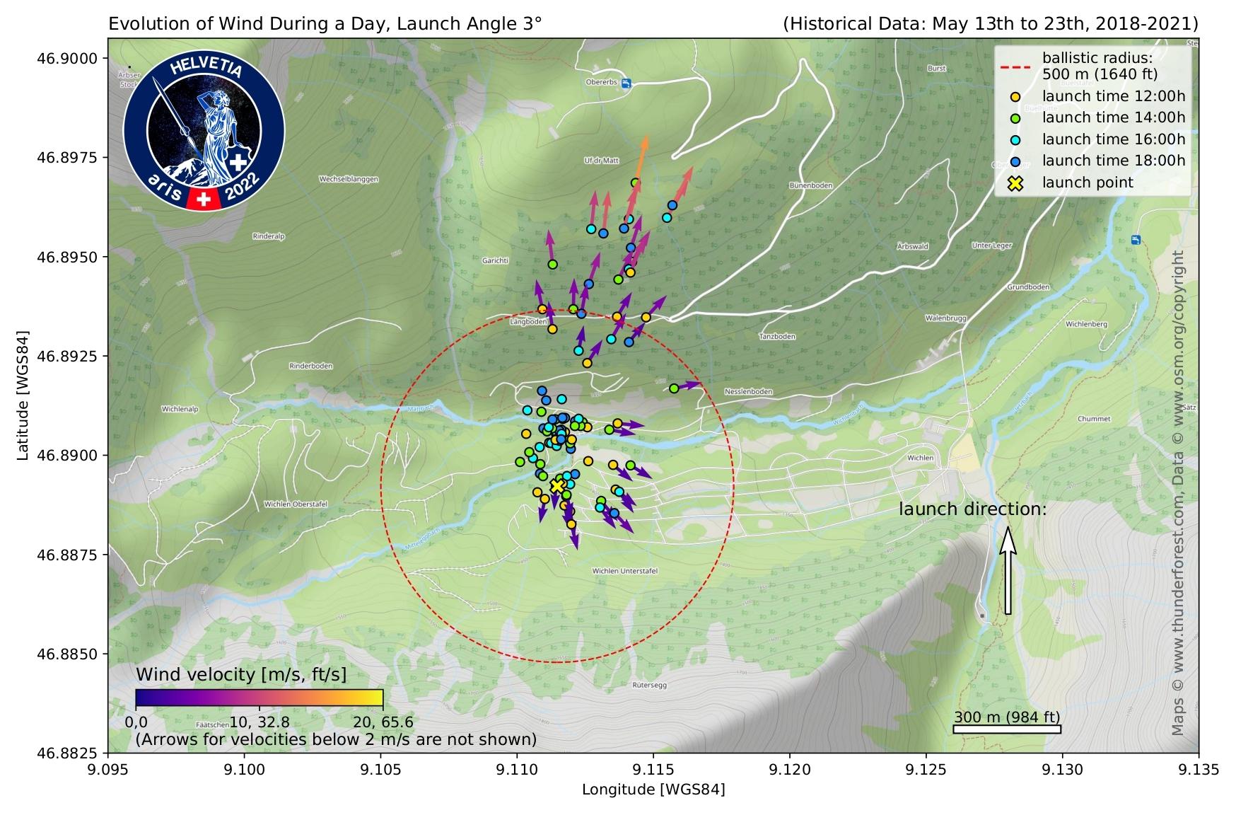
ARIS’s team needs accurate weather data to do flight simulations, assess initial conditions in the launch area, and estimate the highest height the rocket will reach, where it will land, and the danger zone for people on the ground.
When ARIS first contacted us and asked us to sponsor their projects, we didn’t hesitate.
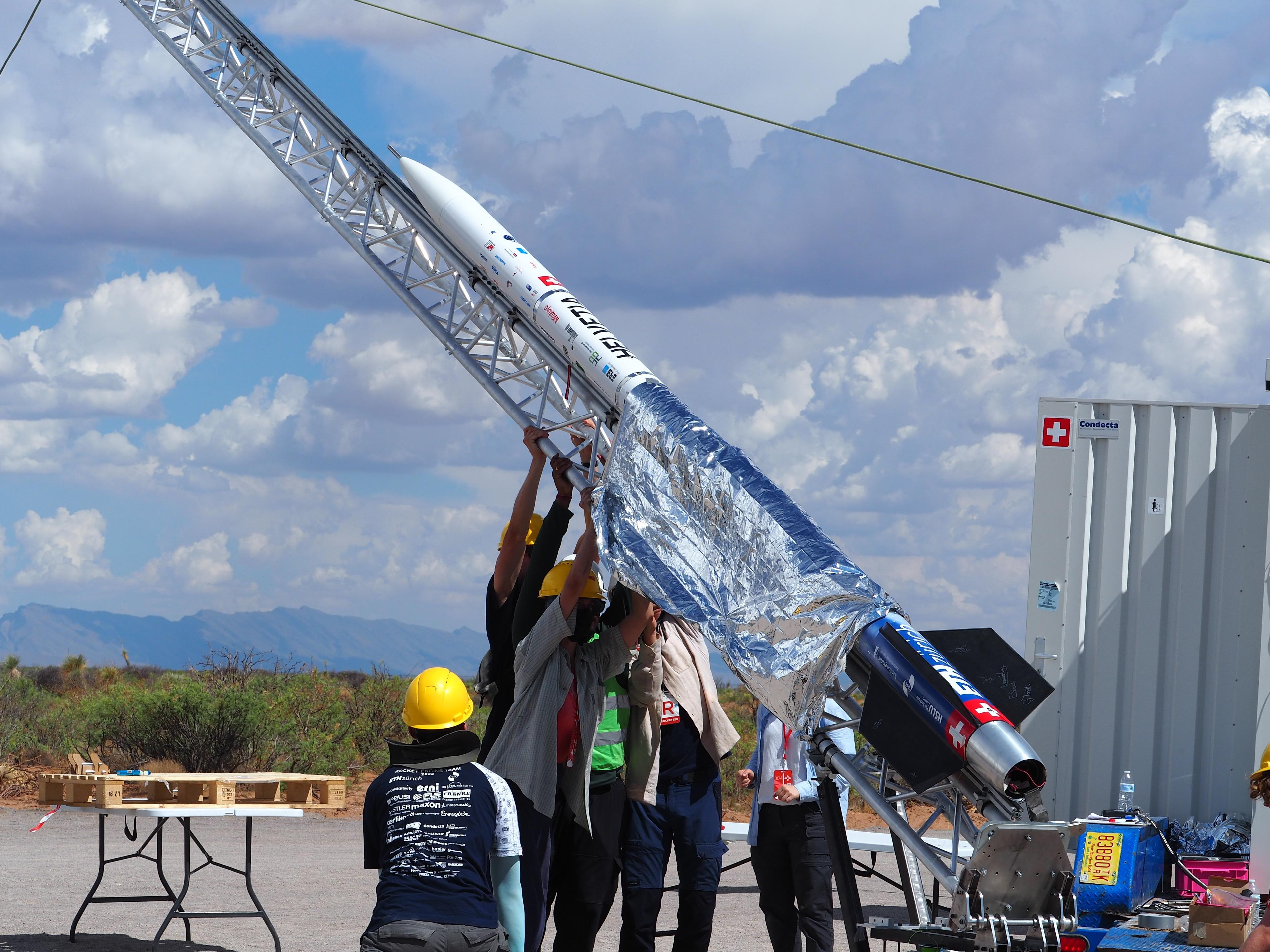
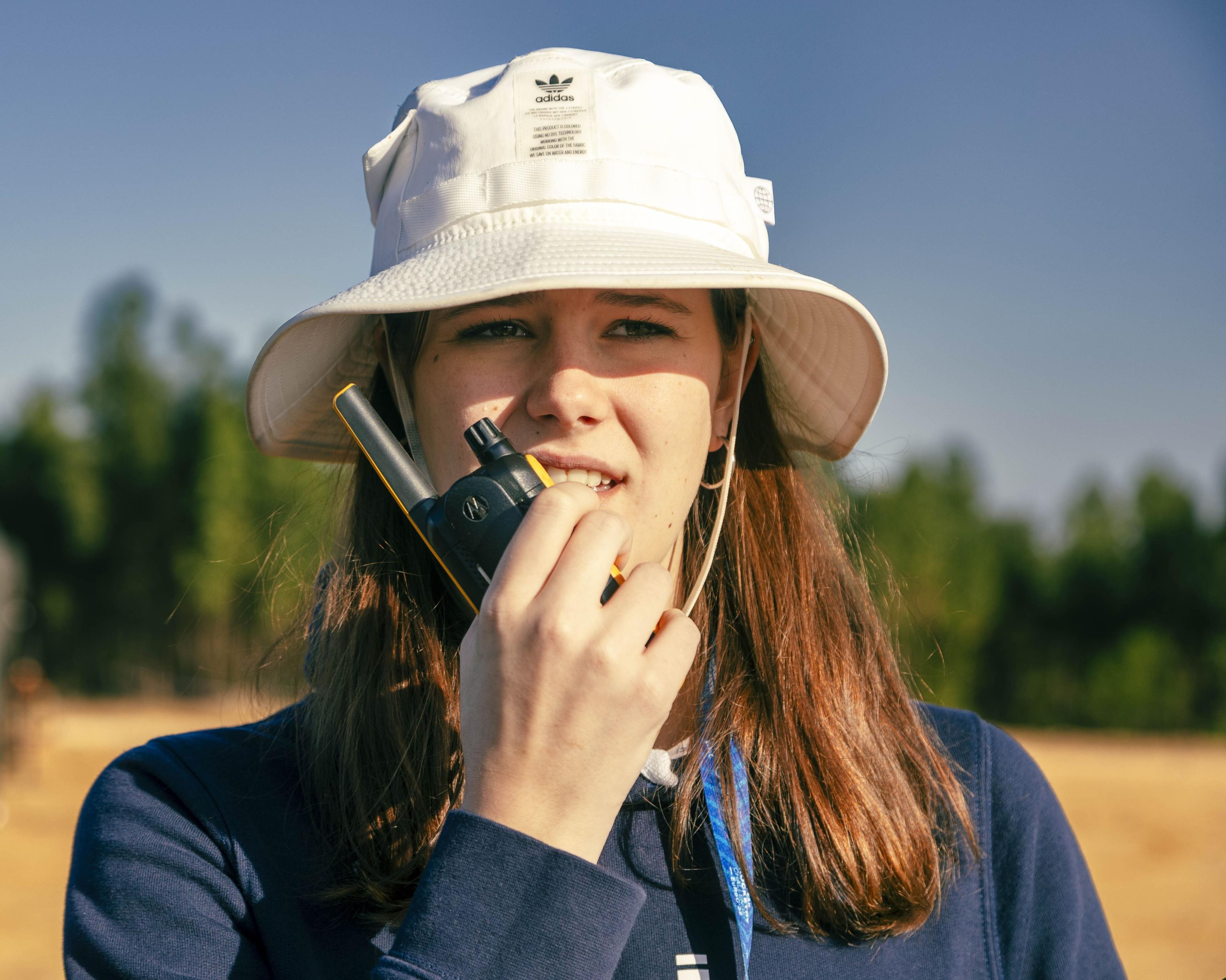
Team preparing the rocket for launch at the Spaceport America Cup competition.
Meteomatics Becomes a Sponsor
In 2022, we had the chance to support them with weather data for two main projects: Helvetia and Periphas.
Helvetia
Helvetia aimed to fly a 4 kg payload to 9 km and recover all parts safely for reuse during the Spaceport America Cup competition. The team used data from our weather API to monitor the atmospheric conditions at the launch location, date, and time for a trajectory simulation.
Rick Röthlisberger, the project manager, explained that they used historical data to assess the danger zone for the first launch during preparation.
They consulted forecasts a few days before the competition to give the team and the jury an estimation of where the rocket would land and how high it would fly. And finally, wind data was instrumental in analyzing the rocket’s dynamic stability.
The successful liftoff and recovery of the rocket won them second place in the competition!

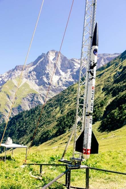
Periphas
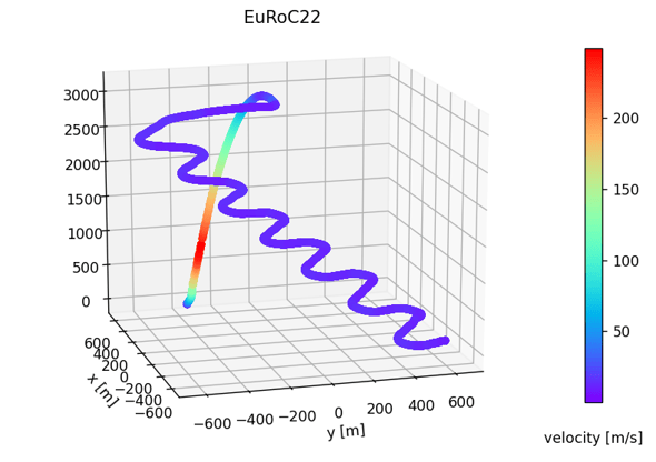
The Periphas project aimed to design, test, implement and launch a guided recovery system. With this project, they competed in the European Rocketry Challenge.
Anna Sulzer, the systems engineer, explains: “The Meteomatics API helped us make decisions during the testing phase of our project. It gave us an initial idea of the wind conditions, and we were able to use it to simulate the wind drift of the system."
"Before a launch or droptest we predicted the wind conditions using the Meteomatics API and ran simulations. On the launch day we then compared that data with the ground-level measurements to confirm our simulations and flight configuration. After all, the wind data from Meteomatics for all altitude levels was really valuable for us to properly prepare the rocket launch leading to a successful mission.”
Again, they achieved excellent results: they were the first student team to incorporate an autonomous recovery system and guide the entire rocket to the ground safely.

System Engineer
Swiss Academic Space Initiative (ARIS)
The wind data from Meteomatics for all altitude levels was really valuable for us to properly prepare the rocket launch leading to a successful mission.
The Sky Is Not the Limit
At Meteomatics, we’re a proud team of nerds. As such, we’re fascinated by space exploration and the study of other planets, its resources, and conditions to sustain human life.
The aerospace industry is thriving–and rightfully so. Exciting new projects are in store for ARIS for the next few years. We’re happy to give our contribution to the training of Swiss space engineers that will help unveil interplanetary possibilities for humanity!
About ARIS
The Swiss Academic Space Initiative (ARIS) is an educational association of around 400 students from ETH-Zurich, the Zurich University of Applied Sciences, the University of Zurich, the Lucerne University of Applied Sciences and Arts, the Zurich University of the Arts and the University of Applied Sciences Rapperswil.
Based on voluntary work, the students develop aerospace technology in the area of launch vehicles, recovery systems, satellites, and space-related technology, participating in international student competitions.


We Work With Groundbreaking Companies
We are proud to work with leading companies in the aviation industry. Together, we realize efficiency benefits, better integration of renewables and help our partners realize digital innovations.


Talk to an Expert
Related Articles


We provide the most accurate weather data for any location, at any time, to improve your business.


