01/26/2022
Airbus Zephyr Goes Beyond the Troposphere
Made Possible by High-Quality Weather Data from Meteomatics

Head of Marketing
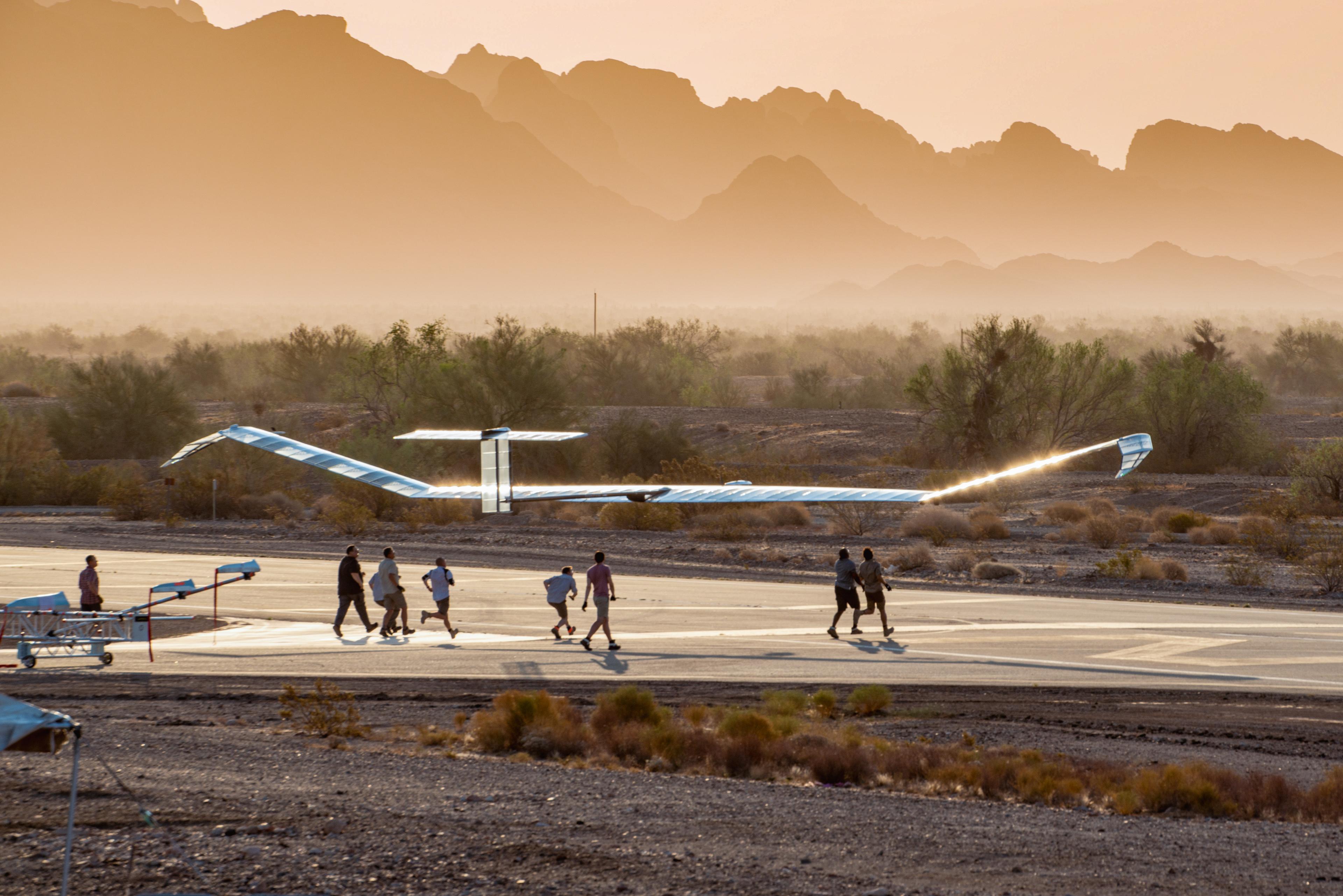
Zephyr is the world’s leading fixed wing, solar-electric, stratospheric Unmanned Aerial System (UAS) and has proved capable of flying at 76145ft (23209m). With a wingspan of 25m and weighing less than 75kg, Zephyr is pioneering the stratosphere, breaking world records as it goes.
Zephyr is an innovative solution under development by Airbus Defence and Space. Zephyr will bring new see, sense and connectivity capabilities to commercial, institutional, and military customers. Zephyr is a carbon neutral system relying on solar energy during the day to power the air system and charge batteries for overnight flight.
High quality weather data is very much at the heart of all Zephyr operations, and critical in ensuring the ability to safely navigate in the stratosphere. It is most critical during the ascent and descent phases as the ultralight solar-electric aircraft moves through the ever changing and volatile environment of the troposphere, but once the aircraft reaches the stratosphere it has the ability to safely navigate for weeks without interruption. At Airbus, we are keen to continually explore, test and develop new technologies as they become available.
Zephyr is categorised as a HAPS: High-Altitude Platform Station and it is the only HAPS to have demonstrated persistent day/night operations remaining within the stratosphere. Zephyr addresses the need for flexible and precise Earth Observation and connectivity services. Complementary to satellite systems, Zephyr is able to return a payload for servicing or upgrades; it has a unique ability to persist and loiter over an area of interest with accuracy and re-tasking capability.
Meteomatics supports Airbus Zephyr by providing high quality weather data to enable safe operations at all altitudes:
“For every mission, we plan a safe passage through the atmosphere. This can be challenging due to the multitude of weather factors to consider and the subtle changes that can occur during the time it takes Zephyr to fly to the stratosphere. Through our flight testing programme we have identified a range of meteorological tools that are well suited to the task. Some of these have been developed in house and others have come from partners such as Meteomatics.
The weather data from Meteomatics adds a new type of dataset which proved to be very accurate across the whole depth of atmosphere. Verified using radiosonde data and surface observations and accessed with visualisation software, it was very easy to integrate into our mission planning and operations, providing the aircrew with clear visual content.
The combination of the Meteomatics data and visualisation software matched with Airbus designed tools provides the most advanced suite of weather forecasting systems available today, guiding Zephyr safely to the stratosphere” - Simon Ashton, Expert Meteorologist for Airbus.

Principal Meteorologist for Airbus Zephyr & Expert Meteorologist Airbus Group
Airbus
The combination of the Meteomatics data and visualisation software matched with Airbus designed tools provides the most advanced suite of weather forecasting systems available today, guiding Zephyr safely to the stratosphere.
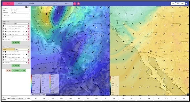
Below are some examples of charts used from MetX, the weather visualisation software or weather intelligence cockpit from Meteomatics.
(Update November, 2024: These charts were created in MetX in 2021. A new version of the user interface is now available.)


We Work With Groundbreaking Companies
We are proud to work with leading companies in the aviation industry. Together, we realize efficiency benefits, better integration of renewables and help our partners realize digital innovations.


Talk to an Expert
Related Articles


We provide the most accurate weather data for any location, at any time, to improve your business.


