06/02/2023
How to Prepare for El Niño?
Important Steps for Business Across Industries

Table of Contents
Article
El Niño is the name given to a climate event which occurs approximately every two to seven years. It is the warm phase of the El Niño Southern Oscillation (ENSO). It is not a new event, nor is it particularly uncommon: approximately a third of all years are El Niño years. However, there are different magnitudes of El Niño events, and when a strong one comes along at the same time as a number of other factors, effects on the world’s weather and economy can be exacerbated. In this article we’ll explore the causes and consequences of El Niño on businesses and the economy, and discuss the possible implications for the planet during the coming event — and how to prepare for it.
What Is El Niño and What Causes It?
There is evidence to support the idea that ENSO is a permanent feature of the Earth’s climate. However, direct observations have only been recorded since the Spanish colonization of Peru, some 300 years ago. At this time, Peruvian fishermen noticed that a warm coastal current which occurred around Christmas time produced a bumper harvest. The pious fishermen attributed this to “the Christchild” — El Niño in Spanish — and, whilst our understanding of the phenomenon has developed, the name stuck.
Several hundred years later and on the other side of the Pacific Ocean, whilst studying the Indian monsoon, a meteorologist named Gilbert Walker proposed a conceptual model to explain the interannual variation in the intensity of monsoon rainfall. The Walker circulation describes a dipole of atmospheric pressure over the equatorial Pacific Ocean — a “great seesaw” which changes phase on timescales of years due to an ocean-atmosphere coupled feedback.
Meteorologists understand well that differences in atmospheric pressure drive winds and ocean currents. Understanding the Walker circulation, though, is challenging because of this coupling: when we observe the ocean and atmosphere in the equatorial Pacific, it’s not clear which components are drivers, and which are being driven — a real chicken-egg situation. What is clear, however, is that on timescales of years, the pattern of atmospheric circulation and ocean currents change in ways that have far reaching implications across the globe. This variability is what we now refer to as ENSO.
By definition, a phenomenon which swings between two phases will feature periods of higher-than-average conditions and periods of lower-than-average conditions. We refer to this as the ENSO phase. Because of the consequences of the ENSO phase which we will discuss shortly, meteorologists want a method for examining which phase we are currently in, as well as predicting changes in the coming months.
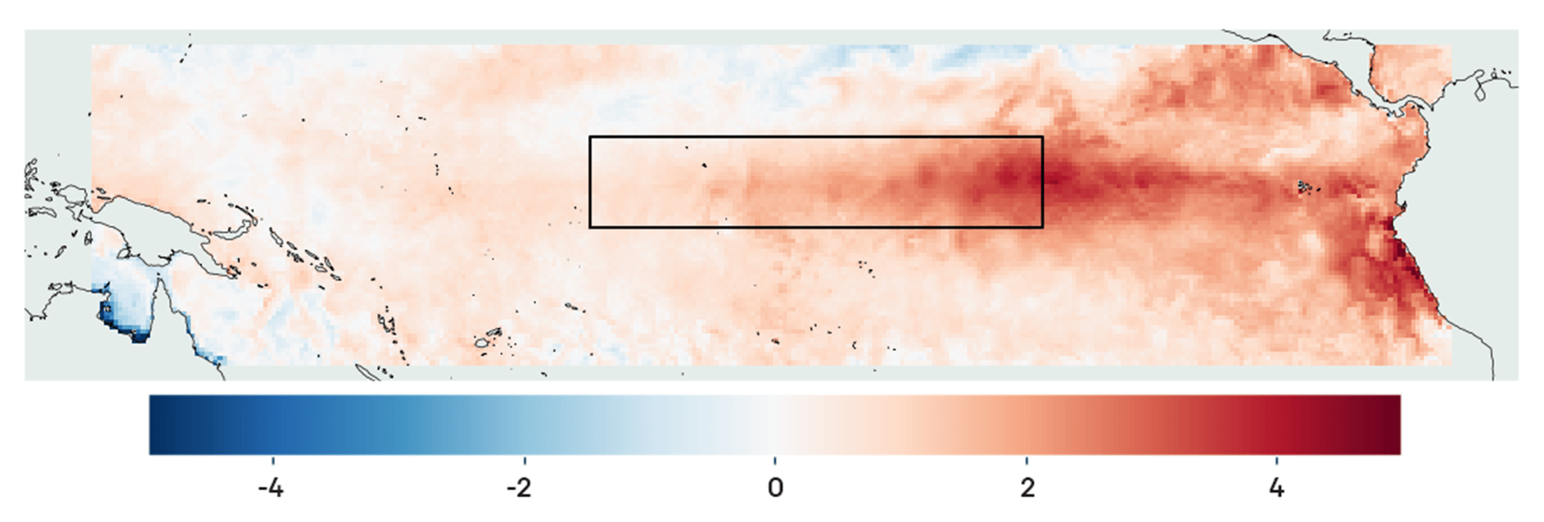
Conveniently enough, one of the consequences of the changes in circulation associated with ENSO is the accumulation of warm water on the surface of the equatorial Pacific Ocean. The phase during which sea surface temperatures are warmer than average is referred to as El Niño, and the cold phase is called La Nina. ENSO is said to be in an El Niño phase if a certain threshold positive temperature anomaly (difference from the long-term average) has been exceeded for several months; La Nina, similarly, is defined by long periods of negative temperature anomalies.

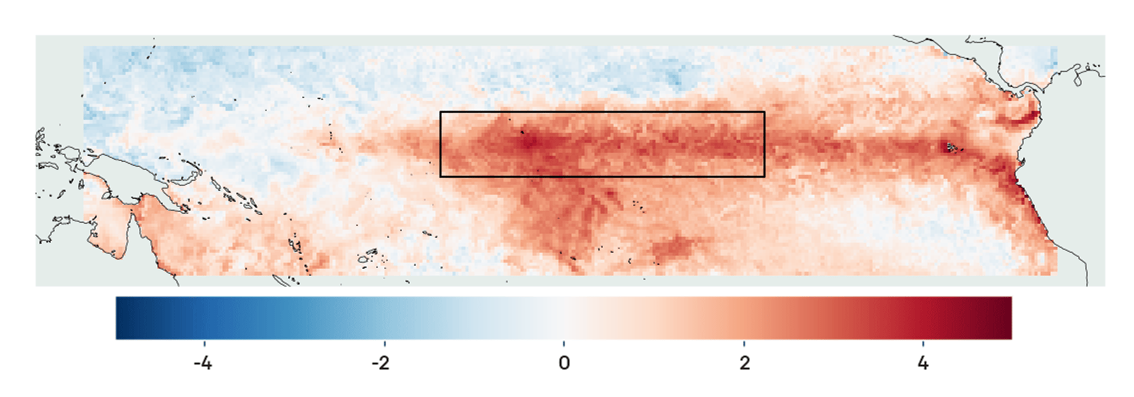

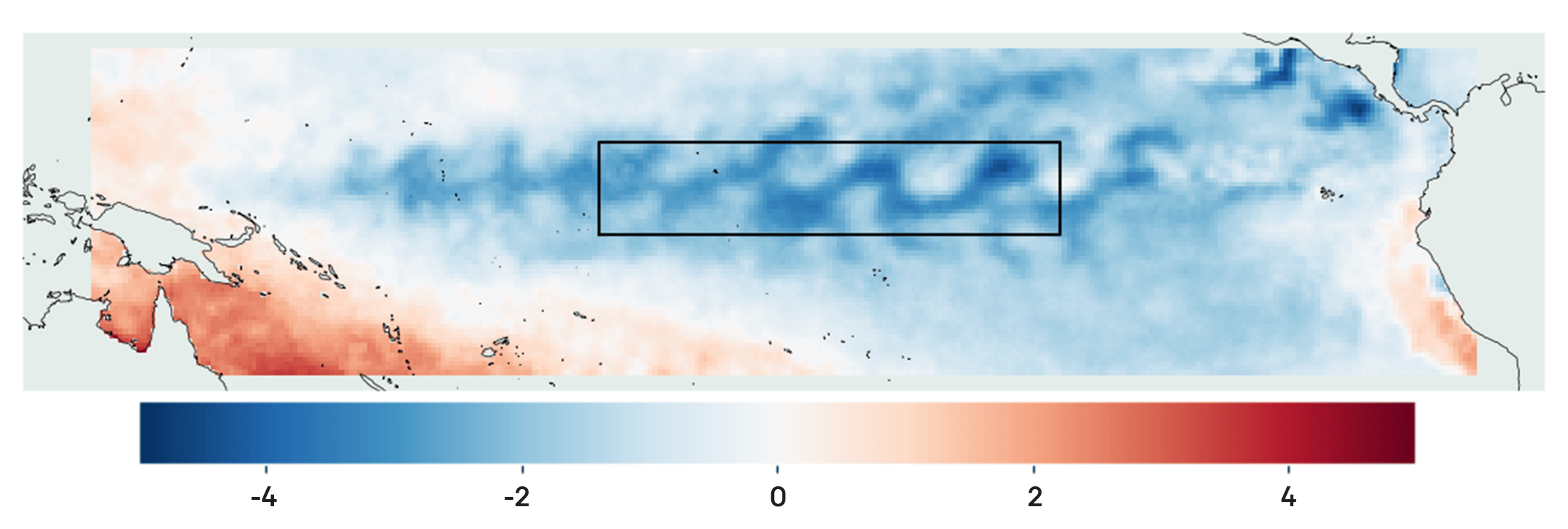
Different meteorological institutions have different methods for defining the two phases, but they generally involve taking a spatial average of the surface temperature of the Pacific Ocean in specific regions of interest and calculating running means. This process filters out short-term fluctuations, showing the slower, long-term variation more clearly.
In addition to the phase of ENSO, meteorologists are also interested in the strength of the phenomenon: if the mean temperature anomaly is very high, then the disruption to the atmospheric circulation may be more pronounced and widespread. At this time, there is agreement in the scientific community that we will enter an El Niño phase in the summer of 2023, and significant evidence to suggest it may be a strong event.
Why Is El Niño Important?
As the events which led to the study of ENSO suggest, the oscillation is not a trivial atmospheric phenomenon, and has wide reaching consequences for the world’s weather and, consequently, the economy.
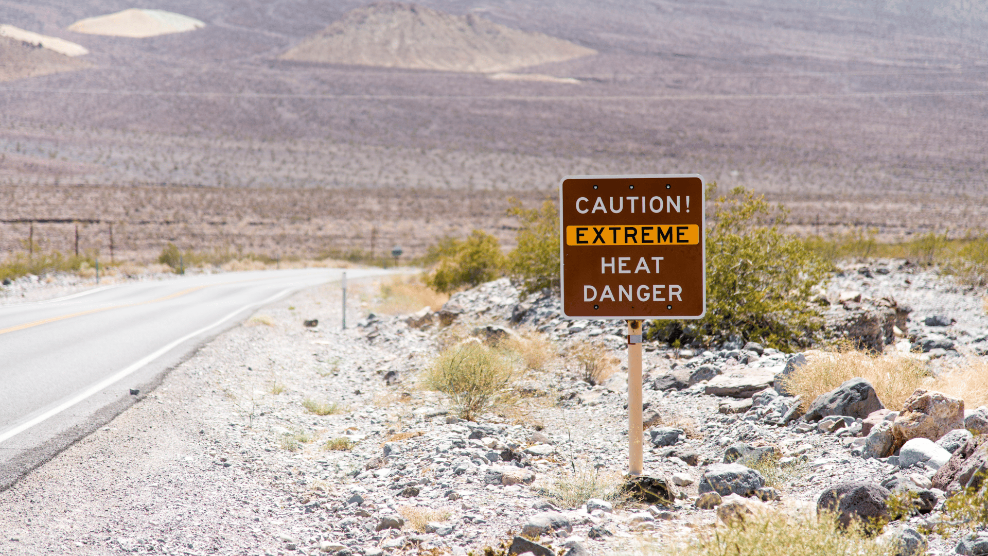
Gilbert Walker was inspired to study ENSO because of patterns he had noticed in monsoon rainfall in India. More recent studies of ENSO reveal that, indeed, during El Niño phases monsoon rainfall is severely reduced, and can lead to droughts in India, Indonesia and northern Australia.
Impacts of El Niño on the Fishing Industry
In contrast to its namesake, El Niño can also have negative impacts on aquaculture in South America. The changes in ocean circulation prevent the upwelling of nutrient-rich deep ocean water, dramatically affecting the marine ecosystem across the whole Pacific. Although typical marine stocks are depleted by the lack of phytoplankton at the bottom of the food chain, the cooler ocean temperatures also mean that certain species, such as tuna, swim into regions which they would otherwise avoid.
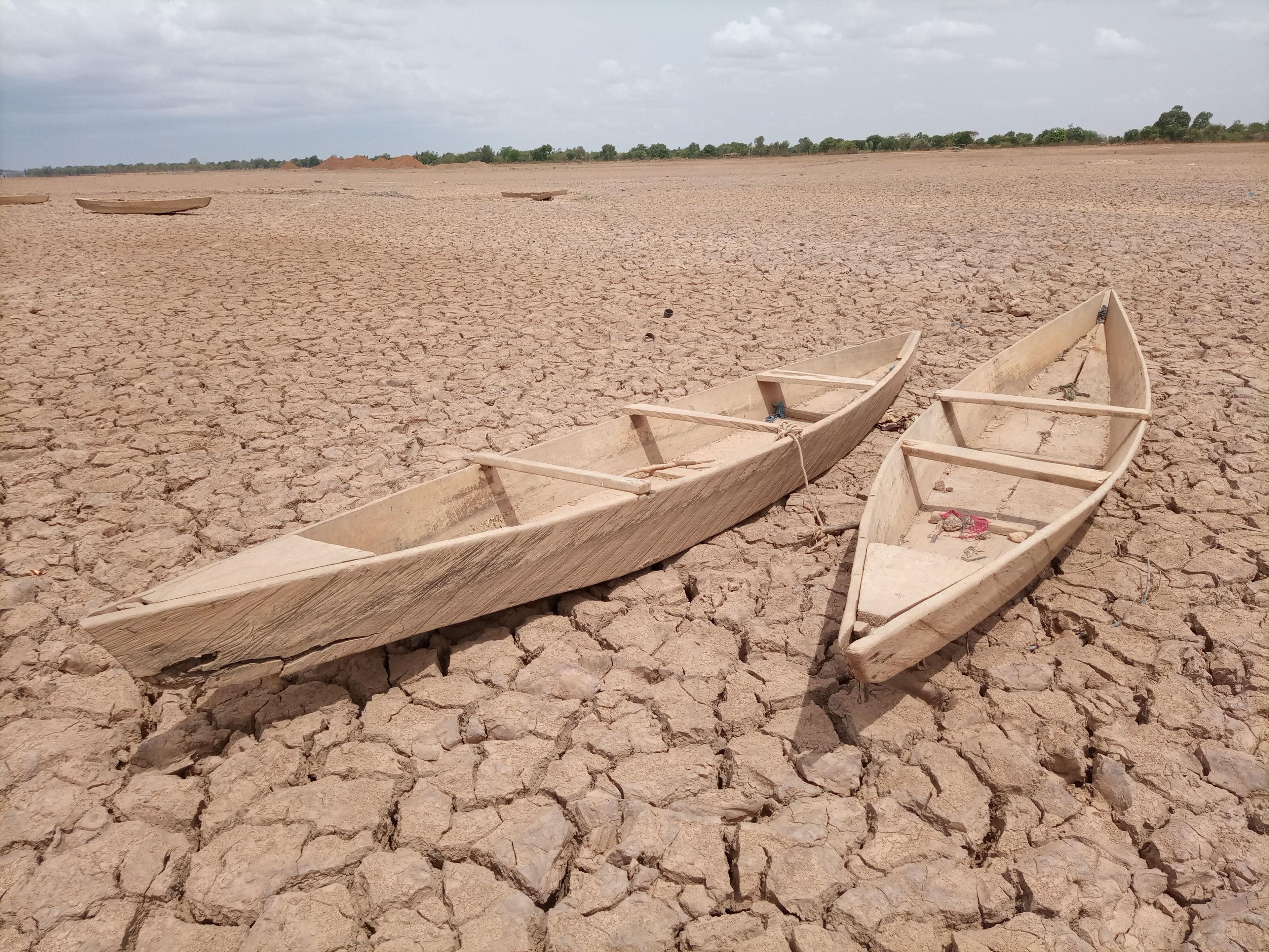
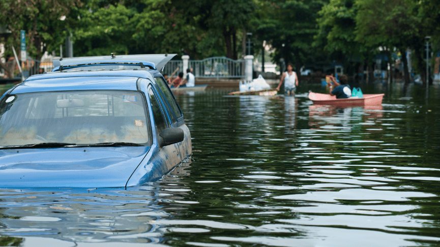
El Niño Can Cause Flooding
Additionally, South America, particularly along the west coast, generally experiences much heavier rainfall during El Niño events, which leads to significant flooding in the area. Both flavors of rainfall extreme have negative effects on agriculture: both these floods and the droughts experienced in the eastern hemisphere damage crops and reduce output.
Both of these regions are right next to the focal point of ENSO though. So, do people in other parts of the world really need to concern themselves with this phenomenon?
How Does El Niño Affect Europe and North America?
First of all, more developed economies should certainly be thinking about how we can prepare to dispatch relief to the developing world in the face of potential humanitarian disasters. In addition to the obvious compassionate grounds, South America and eastern Asia are not isolated economies. Crop failures in these regions — which have not been uncommon during previous El Niño events — have knock-on effects for the rest of the world, which depends on them for exported produce.
El Niño in 2023: What To Expect?
So, if El Niño are not particularly rare, what makes this one worth sitting up and paying attention to? There are two main considerations here.
How Strong Will El Niño Be In 2023?
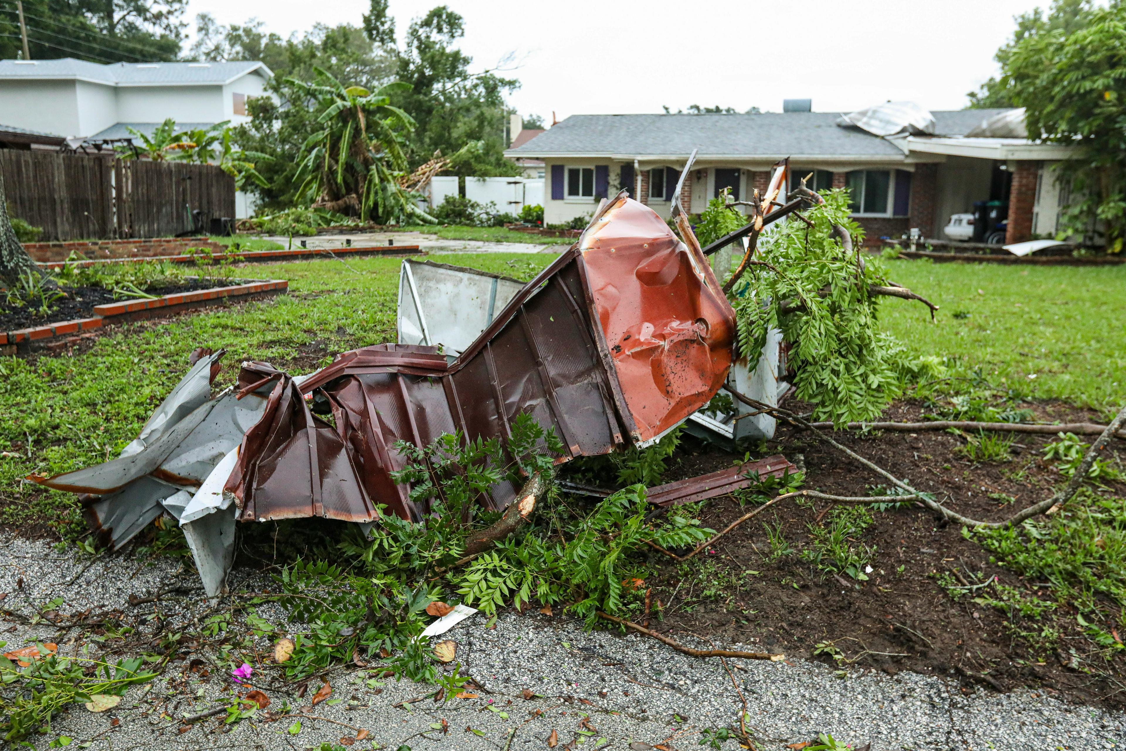
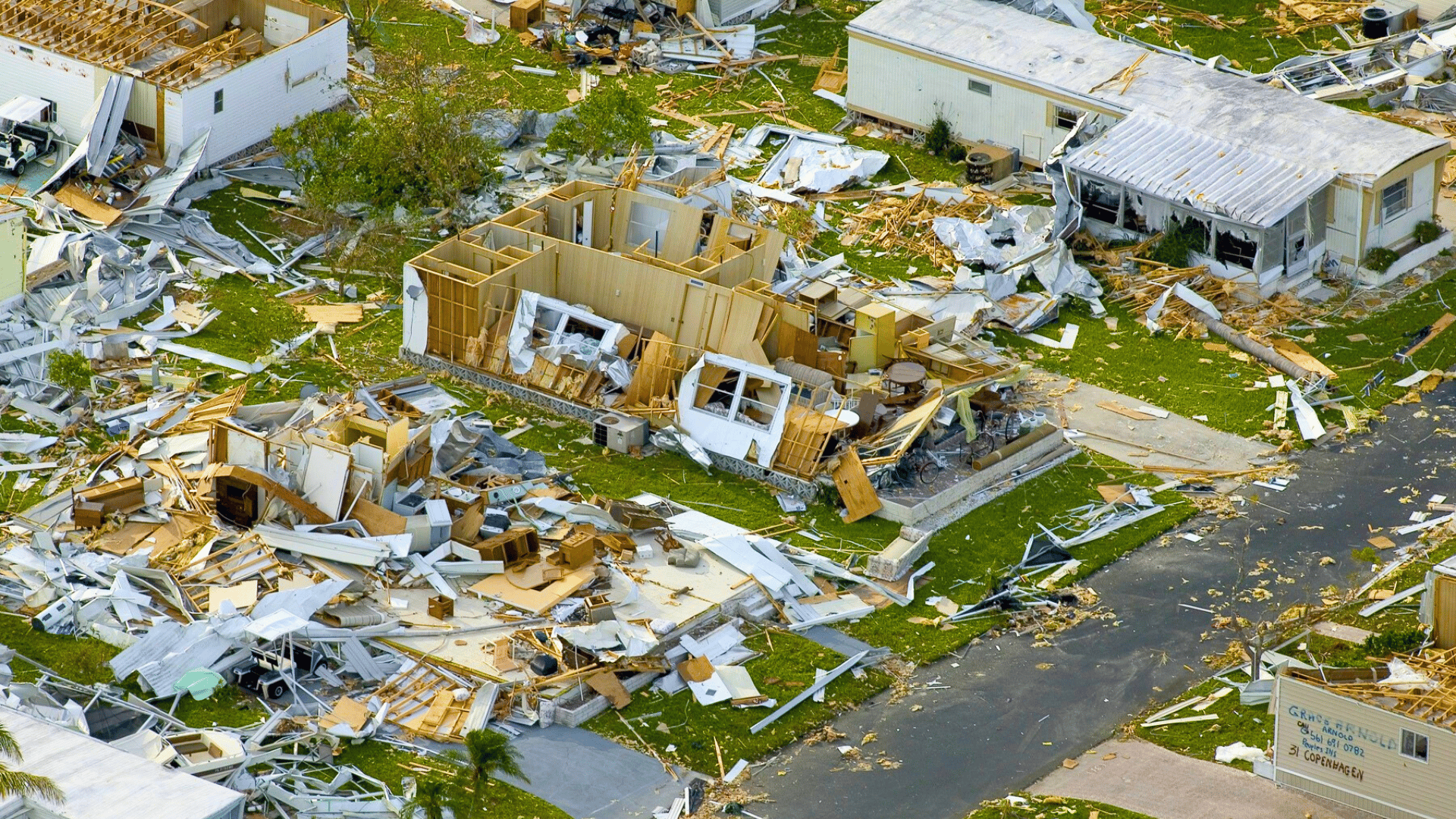
The first is that there is a high likelihood that the coming event will be a strong El Niño. When such an event occurs, the disruption of the atmospheric circulation extends much further afield, causing, amongst other things: significantly warmer than average global temperatures, widespread flooding and increased tropical cyclone activity. Some estimates currently put the probability of a strong El Niño before the end of the year at 40% — a significant number, given that strong El Niños typically only occur 3-10% of the time. A strong El Niño persisting into 2024 could easily see temperature records smashed across the globe. The most recent records, set last summer, should remind us of the consequences of such extremes.
Real, tangible consequences of global scale weather impacts abound for industries such as insurance, which will have to deal with payouts for many more extreme weather events in the next two years; energy, where hydro-power can be directly affected by droughts, whilst increased rainfall in other areas can produce landslides which disrupt oil and gas production; and, not least tourism — another major industry of the developing world — which is likely to see a marked decrease as disasters threaten destinations and whole regions become more unstable.

Combined Impacts of El Niño and Other Economic Disruptors
Secondly, this strong El Niño comes hot on the heels of a number of other crises which still have the world reeling. Not two years ago, the entire planet was still in the depths of the COVID-19 pandemic, which had economic impacts which fortunately (because they were so numerous) don’t need to be described; and more recently the Ukraine crisis has forced inflation even higher in the West. With the already increased cost of living, we can hardly afford to watch as basic commodities become scarcer and more expensive.
Important Steps To Prepare for El Niño for Business Across Industries
At a government level, a readiness to send aid to parts of the world hit the hardest by the coming El Niño is of course advised. It should not be forgotten that economic impacts often have far reaching and unanticipated consequences — there is significant evidence to suggest that the El Niño of 1789-1793 was partly responsible for crop failures in Europe which led to the famines and economic collapse which triggered the French Revolution. The international situation is currently precarious, and western governments should be prepared to treat the cause, and not simply the symptoms, of a potential new condition.
As has already been alluded to in this article, there is a significant chance of the coming El Niño event being strong — a rare and potentially challenging occurrence. However this is far from certain. The consequences of a strong El Niño are substantially different from those of a moderate event, and weather data will help narrow down the range of possibilities that need to be insured against.
Monitor El Niño-related Weather Patterns
The state of ENSO gives meteorologists an indication of what to expect in the coming season. By monitoring the weather in regions known to have strong teleconnections to El Niño, we can foresee the impacts days and even weeks before they arrive.
Prepare for Disruptions From Unusual Weather Caused by El Niño
El Niño is well-known for causing adverse weather patterns that can have significant impacts on the logistics and transport industries. This, in turn, can have ripple effects on the consumer industry, particularly for staple foodstuffs, if appropriate planning is not in place. Regions with strong El Niño teleconnections may experience disruptions to transportation and supply chains, which can lead to shortages of critical supplies, components and raw materials. Companies that rely on these resources should monitor weather patterns closely, and make contingency plans to stock up on supplies or find alternative transportation routes to minimize the impact of El Niño on their operations and ensure continuity of supply.
Build Digital and Operational Resilience With the Meteomatics Weather API
Continuing to evaluate the risk of different types of weather in the coming months is exactly what weather data exists to assist with. At Meteomatics, not only do we provide our own forecast of the ENSO index, but also a range of weather models covering the coming seasons with varying degrees of specificity. Our data can be used to make predictions about events months in advance, and to continue to refine estimates of outcomes as time progresses.
At a lower level, businesses are advised to take steps to increase their resilience to the consequences of a strong El Niño. Agricultural businesses should examine whether their land is at risk of droughts or floods, and plant resistant crops or engineer irrigation systems accordingly. Weather APIs are incredibly powerful for this kind of preparation, as well as in supply chain logistics, allowing users to monitor weather patterns in regions where raw materials are sourced.
By using a weather API, weather data and warnings can be integrated into a digital process. Processes can run on automation by using the latest weather information and thus build digital resilience for the entire organization by using the latest up to date weather information for planning and decisions.
Overall, using a weather API to prepare for El Niño can help businesses make more informed decisions and mitigate potential risks. By monitoring weather patterns, planning ahead, monitoring supply chains, and communicating with stakeholders, businesses can minimize the impact of El Niño on their operations.
Don’t be unprepared for the coming El Niño event. Get yourself and your business the data you need to be resilient. Build digital resilience with Meteomatics’ Weather API.
Contact Our Experts to Learn More About El Niño Impacts on Business

Talk to an Expert
Related Articles


We provide the most accurate weather data for any location, at any time, to improve your business.


