
06/12/2025
Making Fog Visible
Swiss Case Shows Meteodrone Networks Greatly Improve Forecast Accuracy in Challenging Conditions

Sr. Content Marketing Manager
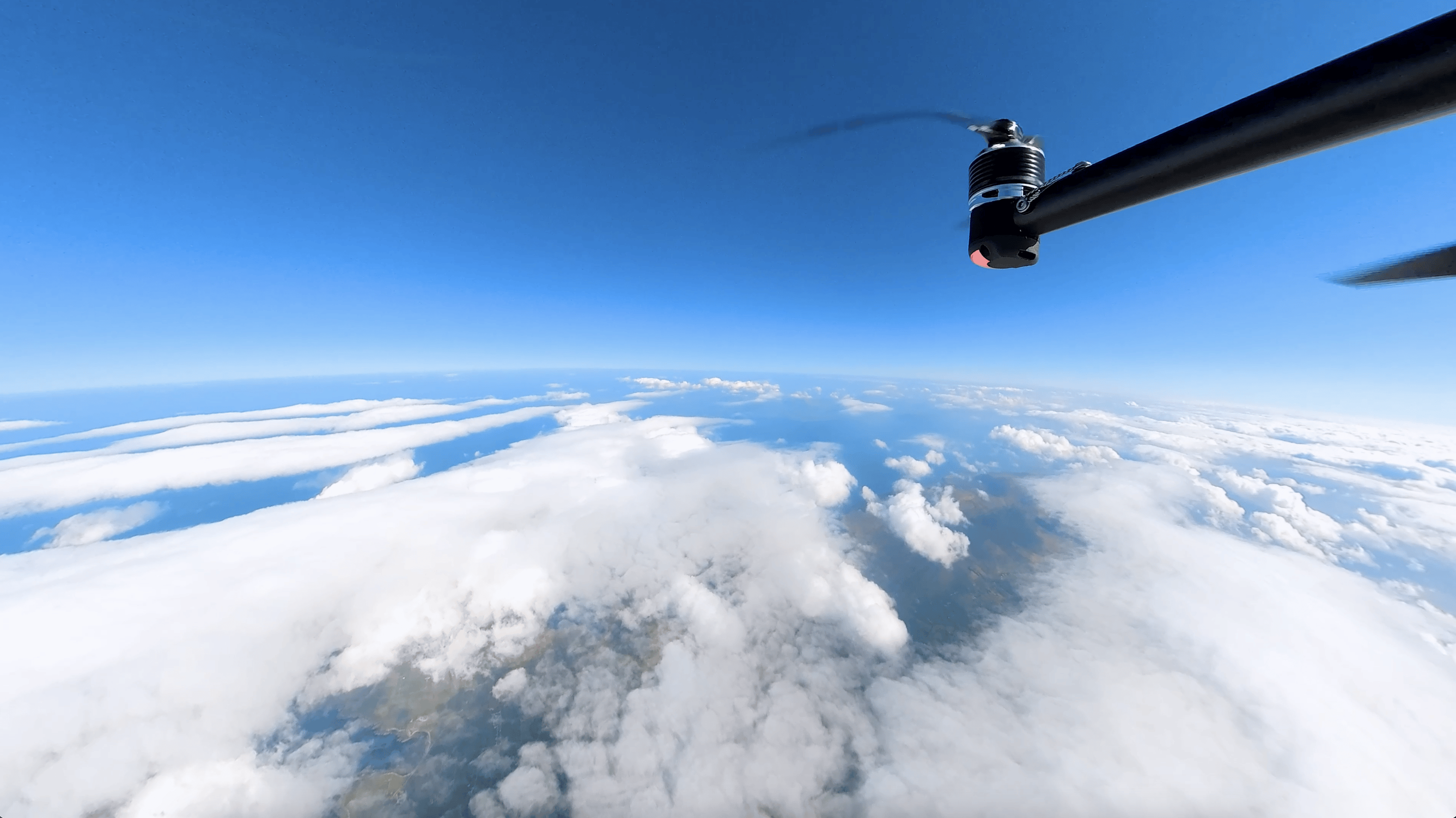
Meteomatics is leading a breakthrough in weather forecasting by combining a network of Meteodrones with high-resolution weather models. In Switzerland, ten Meteodrones collect vertical atmospheric profiles up to an altitude of 6 km (almost 20,000 ft) throughout the night. This real-time data substantially enhances forecasts for hard-to-predict events with benefits that last for hours even after drone operations end.
Switzerland Is Ready — Next Up: Norway
Ten Meteodrones now operate across Switzerland, collecting critical weather data on pressure, temperature, humidity and wind up to altitudes of 6 km (Above Mean Sea Level). From Meteomatics’ headquarters in St. Gallen, one pilot runs hourly missions every night, producing 25-40 vertical profiles — far beyond the coverage of the country’s two daily weather balloons.
This dense data feeds directly into the EURO1k model — Meteomatics’ proprietary weather model with a resolution of 1 km covering the entire European continent with hourly updates.
With the network fully operational in Switzerland, Norway is next. In partnership with NORCE, we’re deploying 30 Meteobases to help the country prepare for growing weather-related risks.
See What Others Can’t, Predict What Others Don’t
Weather forecasts are only as good as the observational data behind them. Yet the boundary layer remains difficult to observe with traditional methods. Meteodrones help close this critical gap by capturing high-resolution vertical profiles beyond the reach of conventional tools.
They improve forecasts for hard-to-predict phenomena in the lower atmosphere — such as fog, low clouds, wind shifts, temperature inversions, icing conditions, and convective storms — by capturing the fine-scale conditions that instruments like radiosondes, ground stations, radars, and satellites miss.
This data leads to more accurate short-term and local forecasts, essential for sectors like energy, aviation, emergency services, agriculture, and defense.
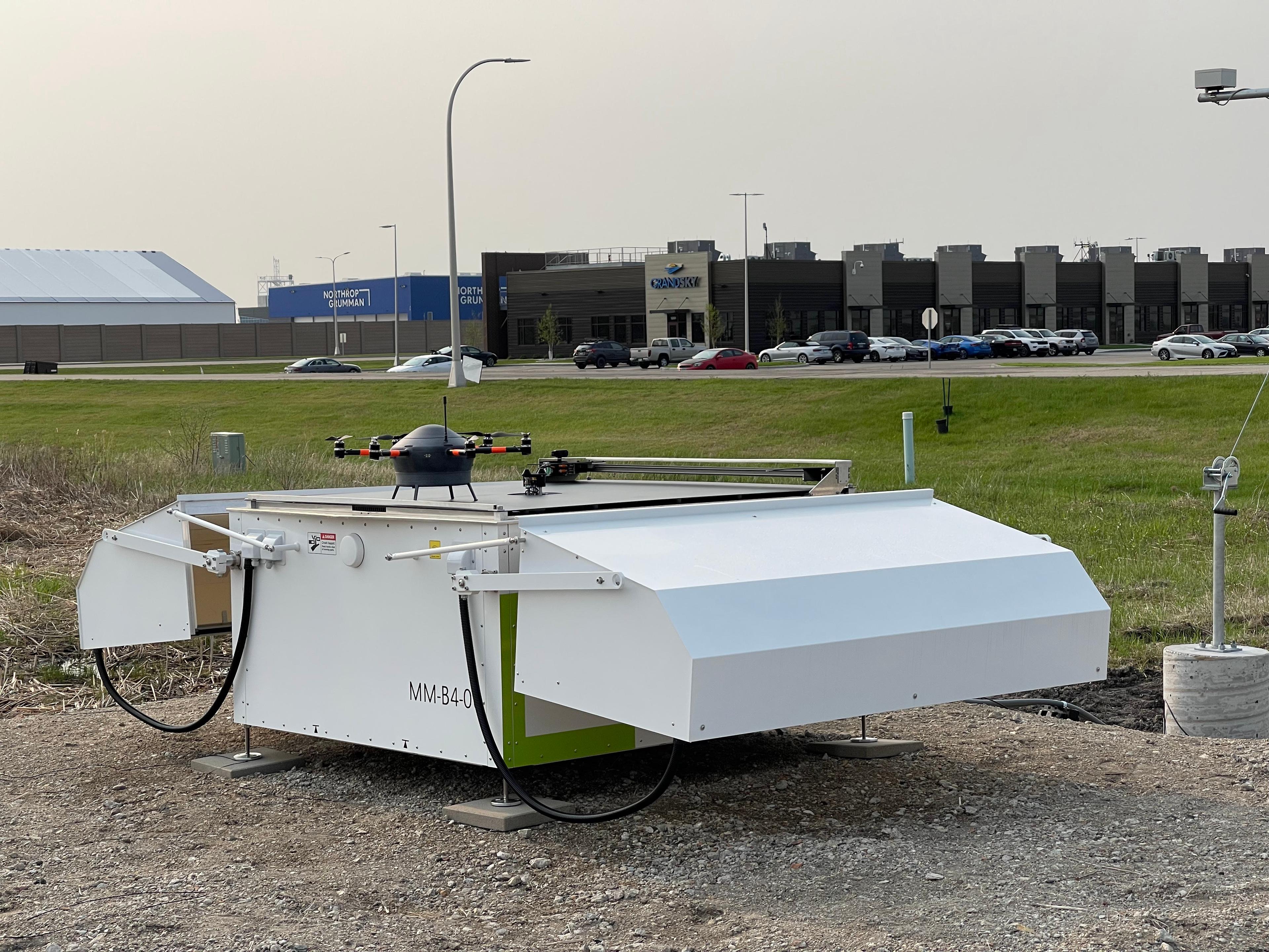
Meteobase Technology
Our Meteobase technology makes the Meteodrone network possible. Each unit houses, charges, and supports drone takeoff and landing — all remotely controlled by a single pilot from the operations control center at Meteomatics’ headquarters in St. Gallen, Switzerland.


Case Study: Assimilating Meteodrone Data Substantially Improves Low-Level Cloud Forecasts

Evaluation Approach
To evaluate the added value of Meteodrone data for weather forecasting, we ran two simulations of low-level cloud forecasts using our high-resolution EURO1k weather model.
One included data collected by Meteodrones (center), while the other did not (left).
We then compared both simulations against real-world satellite observations (right). For this test, we used data from 19 drone flights across four locations (orange dots).
The model simulations started at 9 p.m. (UTC), with new drone data being integrated into the model until 5 a.m.
Why Focus on Low-Level Clouds?
Low-level clouds, such as stratus and fog layers, impact multiple industries. In the energy sector, their influence is particularly critical: by limiting solar irradiance, they can sharply reduce the output of photovoltaic systems and complicate grid planning for solar power. Beyond energy, they reduce visibility and disrupt aviation (e.g., airport delays due to low ceiling conditions), road traffic (increased accident risk), and maritime operations (navigation hazards).
Despite their importance, low-level clouds remain notoriously difficult to forecast, especially in complex terrain like Switzerland.
Given their operational impact and forecasting difficulty, low-level clouds are an ideal test case to assess the value of Meteodrone data. This study shows how drone-based observations improve predictions by adding high-frequency, high-resolution atmospheric data to forecasting models.
What We Found
Just one hour after starting the simulation (10 p.m.), the simulation with Meteodrone data already predicted low-level cloud development over the Meteobase sites, matching what satellites observed. In contrast, the simulation without drone data failed to show any cloud cover at that stage.
By early morning (5 a.m., the end of the assimilation period), the benefits of integrating drone data are already clear:
- The model with drone data correctly predicted widespread low clouds across the Swiss Plateau, closely matching satellite imagery.
- In addition to better overall coverage, the model with drone data also captured specific local effects, such as clouds drifting into the Rhine Valley.
- The positive impact of the drone data lasted for several hours after the end of the assimilation period.
Why Was the Simulation With Meteodrone Data More Accurate?
To understand why the simulation without Meteodrone data failed to predict low-level cloud formation, we looked at the differences in atmospheric conditions between the two models at an altitude of 1,000 m (above sea level).


What we found is that the model with Meteodrone data showed 1-2 °C lower temperatures and up to 30% higher relative humidity, an essential condition for clouds to form. This extra humidity enabled the model to simulate low-level clouds, just like those actually observed via satellite. Without that added moisture, the other simulation simply didn’t have the right conditions to trigger cloud formation.
This demonstrates how differences in atmospheric moisture — that can be captured in real-time by drones — can significantly change the outcome of a weather forecast.
Conclusion
This case study clearly shows that:
High-frequency drone data substantially improves weather forecasts, especially for hard-to-predict phenomena like low-level clouds.
These benefits last beyond the time the drones are flying, helping improve forecast accuracy for hours afterward.
The Impact of More Accurate Forecasts Across Industries
Energy
Improved solar energy production through better planning and increased photovoltaic system efficiency
Enhanced grid stability by anticipating weather-induced disruptions and adjusting energy loads proactively
Improved asset management with real-time weather data for maintenance planning, reducing downtime and extending infrastructure lifespan
Aviation
Enhanced prediction of turbulence, fog, and storm development for safer and more efficient flight planning
Improved airport operations by reducing delays and optimizing takeoff and landing schedules based on real-time weather data
Increased pilot situational awareness with high-resolution atmospheric insights, reducing weather-related risks
Governments
Enhanced early warning systems for natural disasters
Reduced economic impact from disruptions in transportation, agriculture, and energy stability
Improved planning for critical infrastructure protection
Defense
Optimized planning for ground and air operations
Enhanced surveillance and reconnaissance with real-time weather insights
Increased mission success rates through accurate weather forecasting
Agriculture
Enhanced protection of crops through early detection of imminent extreme weather events such as frost, hail, or heavy rainfall
Improved irrigation efficiency with real-time rainfall and soil moisture insights, reducing water waste
Informed decision-making during critical field operations (e.g., spraying, harvesting) based on up-to-the-minute weather conditions
The Future of Weather Forecasting: Meteodrone Data and 1k Models
Meteomatics is shaping the future of meteorology with a next-generation forecasting system that combines cutting-edge drone technology and ultra-high-resolution weather models.
Our Meteodrones collect atmospheric data from parts of the lower atmosphere that were previously difficult to observe with traditional methods. This critical data feeds directly into our 1k models, which deliver forecasts at a spatial resolution of 1 km² and update every 15 minutes across Europe.
Together, Meteodrones and 1k models make real-time, hyper-local weather forecasting a reality, providing the accuracy and detail needed for faster, smarter decision-making.


Expert Call
Let’s Find the Perfect Solution to Your Problem. Talk to an Expert.
Related Articles


We provide the most accurate weather data for any location, at any time, to improve your business.


