06/23/2023
Meteomatics Powers the US’ First Micro-Weather Service With Meteodrone Data and a High-Resolution Weather Model

Sr. Content Marketing Manager
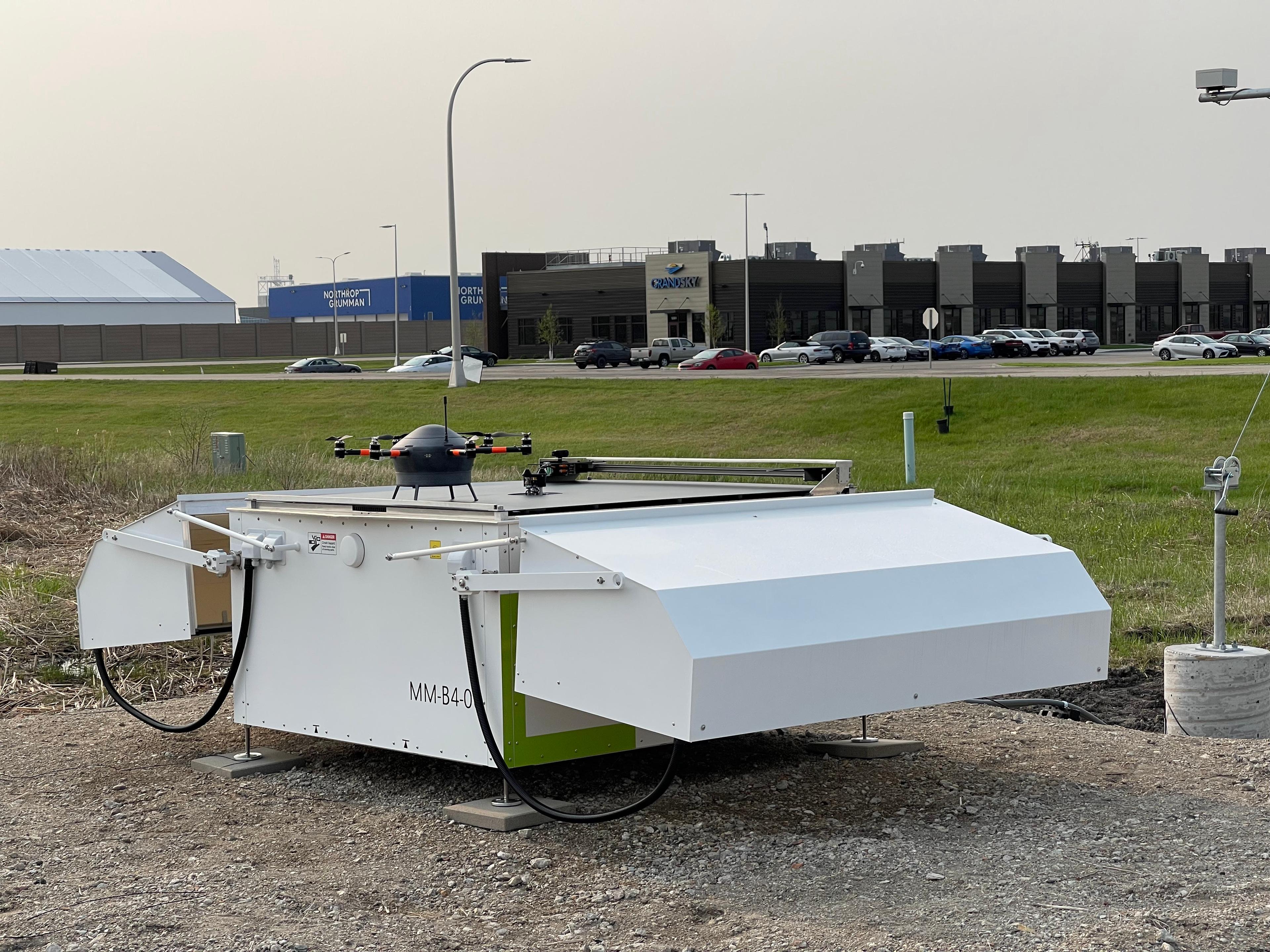
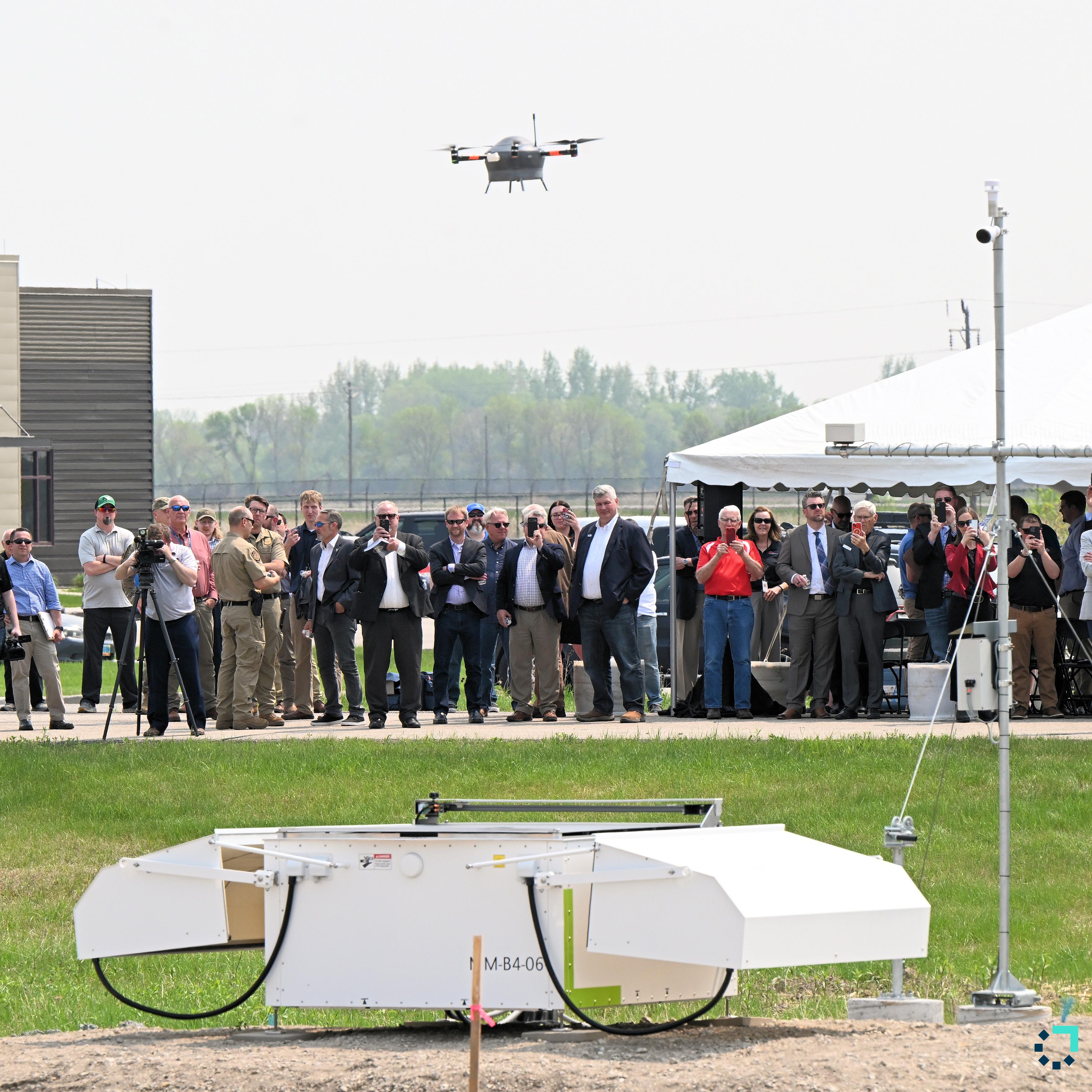
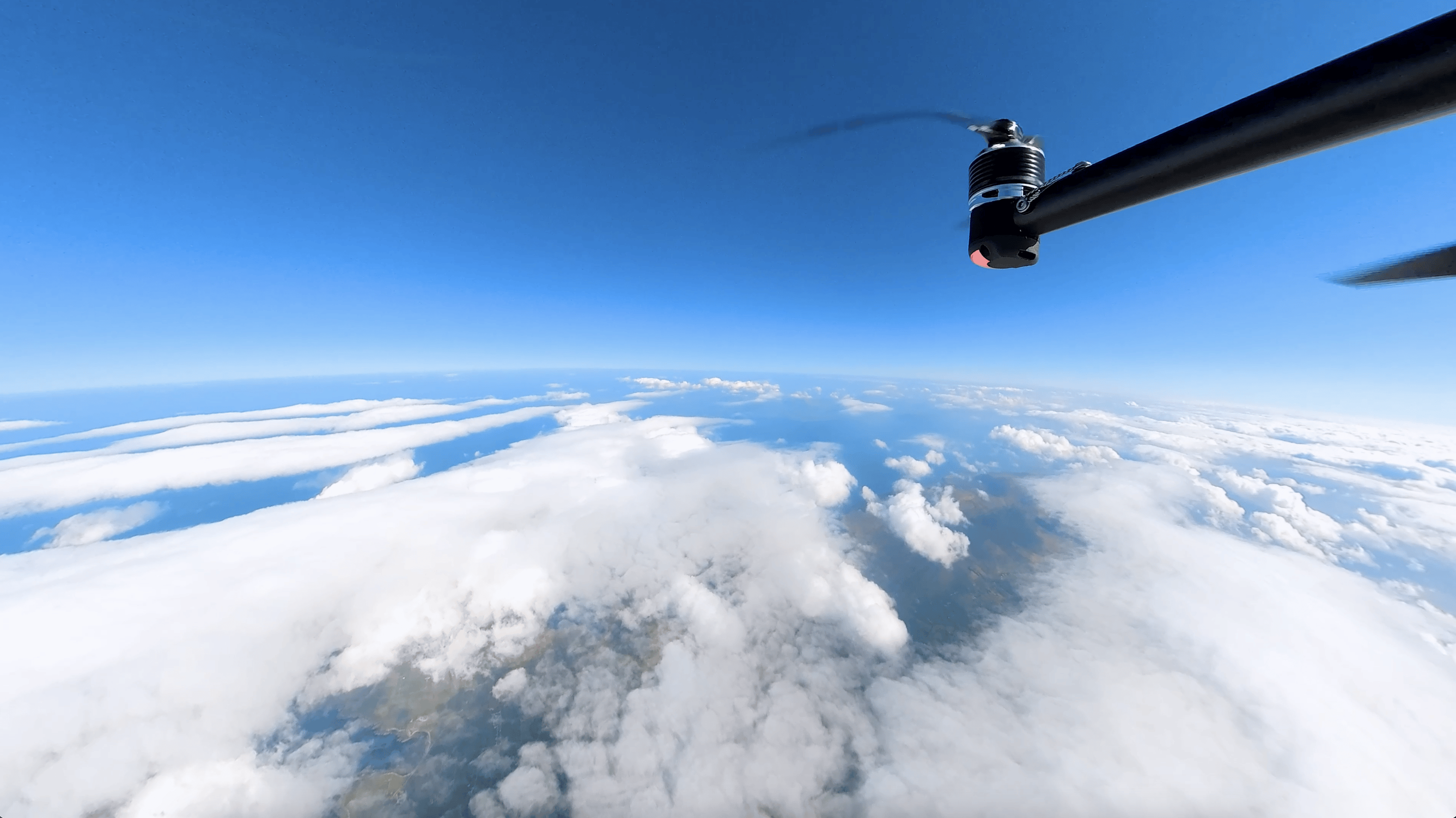
Together with our partner GrandSKY, we launched our first Meteodrone system at the GrandSKY aviation park, located at Grand Forks Air Force Base in North Dakota, along with the North Dakota 1K weather model. Our autonomous flight system is the first drone-based micro-weather service in the United States, capable of reaching altitudes of up to six kilometers above the Earth's surface. This solution will empower the Weather Operations Center at GrandSKY to detect weather phenomena that directly impact flight decision-making, safety measures, and scheduling.
Weather Data From the Atmospheric Boundary Layer Is Essential for Air Mobility
Despite notable advancements, the current national weather observation network in the United States, which comprises technologies such as weather balloons, radar stations, aircraft, and satellites, still faces limitations in effectively detecting and forecasting weather in the lower airspace ranging from 15 to 6,100 meters. It is within this altitude range that local weather phenomena, including fog, precipitation, wind, hail, storms, and fluctuating temperatures, originate. Enhanced visibility at this level is thus of utmost importance for reliable aviation operations and cross-industry business forecasting.
Media Coverage of the Meteodrone System Launch
Meteodrones Effectively Close the Data Gap in the Lower and Mid Atmosphere
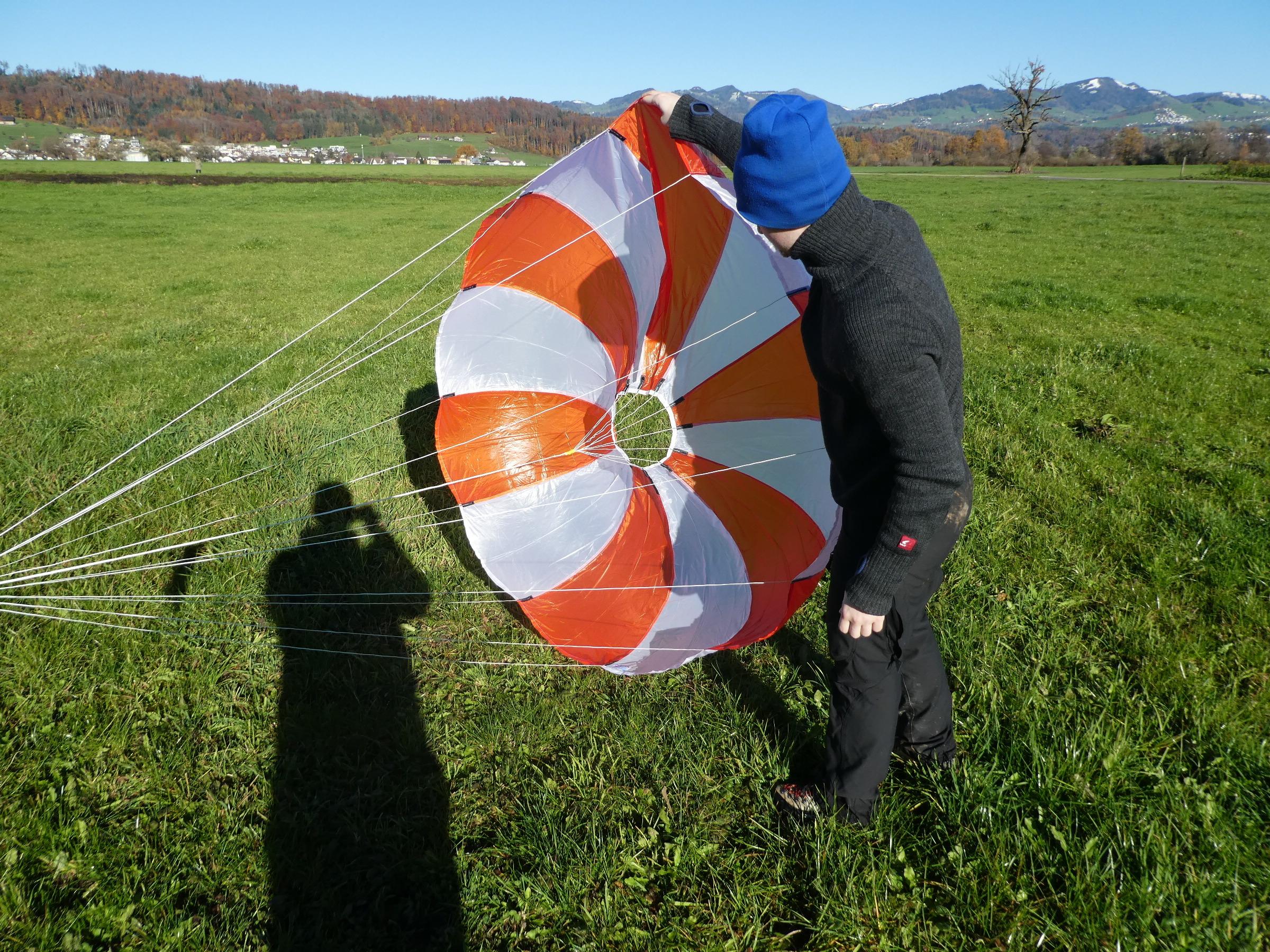
By reaching altitudes of up to six kilometers, the Meteodrone effectively closes the crucial meteorological data gap in the lower and mid atmosphere. The Meteodrone can perform controlled vertical profiles several times a day. Expert drone pilots can operate a Meteodrone directly from a Ground Control Station, ensuring precise control during on-site operations. Alternatively, pilots have the option to remotely control the drones using a Meteobase, a ground station equipped with a central computer. The Meteobase fulfills various essential functions, such as managing the operation, control, and maintenance of the drone, as well as monitoring and logging weather parameters at the site.
The Meteodrone Will Support UAS Operations in North Dakota
Thanks to this unique capability, GrandSKY, TruWeather Solutions and Meteomatics have joined forces to install a Meteobase equipped with a Meteodrone at Grand Forks Air Force Base in North Dakota. The duo of Meteodrone/Meteobase represents the first state-wide micro-weather service in the U.S.
In addition, Meteomatics has developed a weather model specifically for North Dakota called the North Dakota 1K, which boasts a resolution of 1 kilometer. Similar to Meteomatics' European weather model, EURO1k, the North Dakota 1K model will provide highly detailed weather forecasts for the state.
The data collected by the Meteodrone will be integrated into the North Dakota 1K model, generating crucial weather information that will help GrandSKY and TruWeather Solutions detect weather phenomena that may impact flight safety and scheduling.
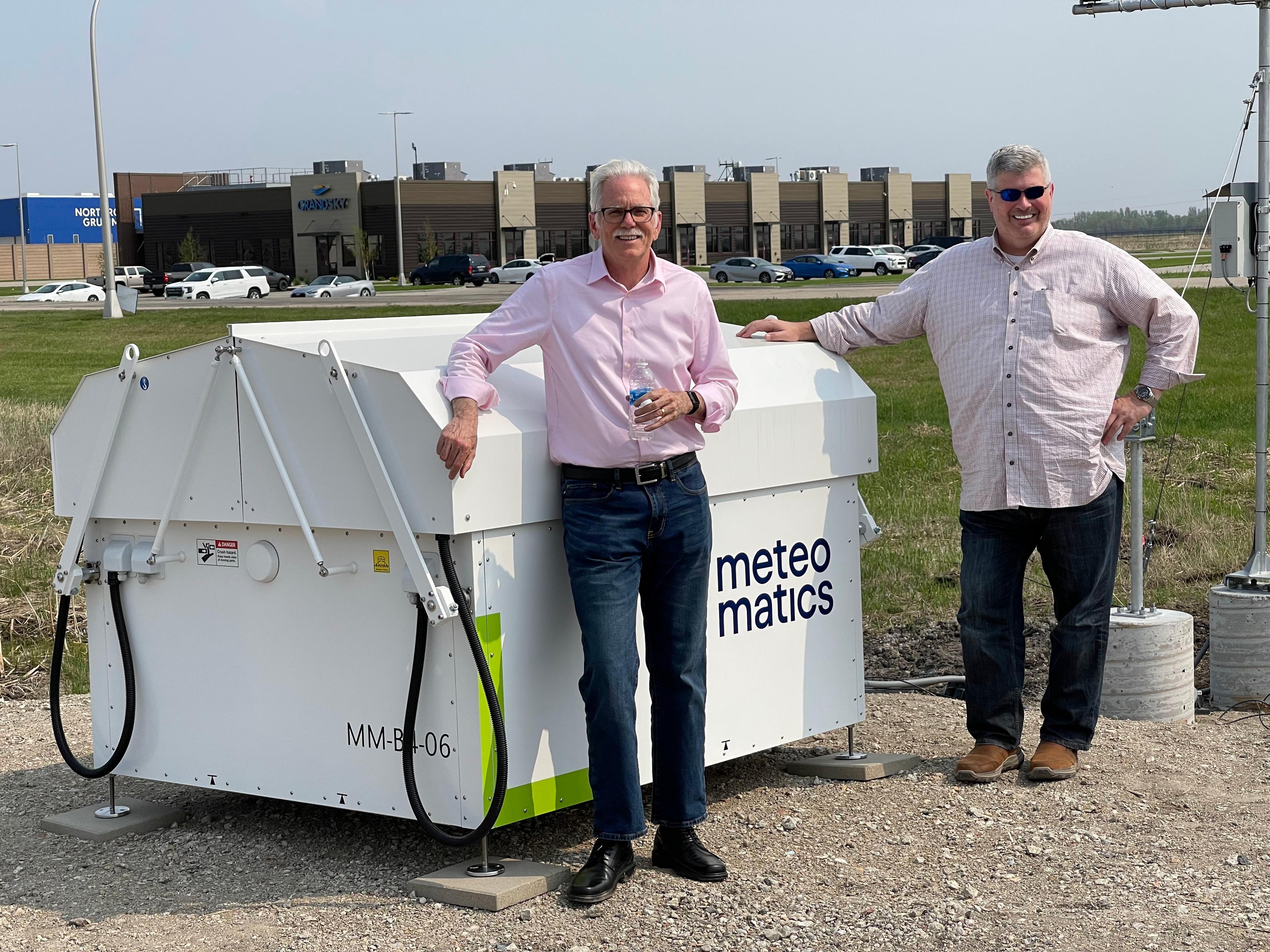
Paul Walsh, the North America CEO of Meteomatics, and Thomas Swoyer Jr., the Founder and President of GrandSKY
Media Coverage of the Meteodrone System Launch
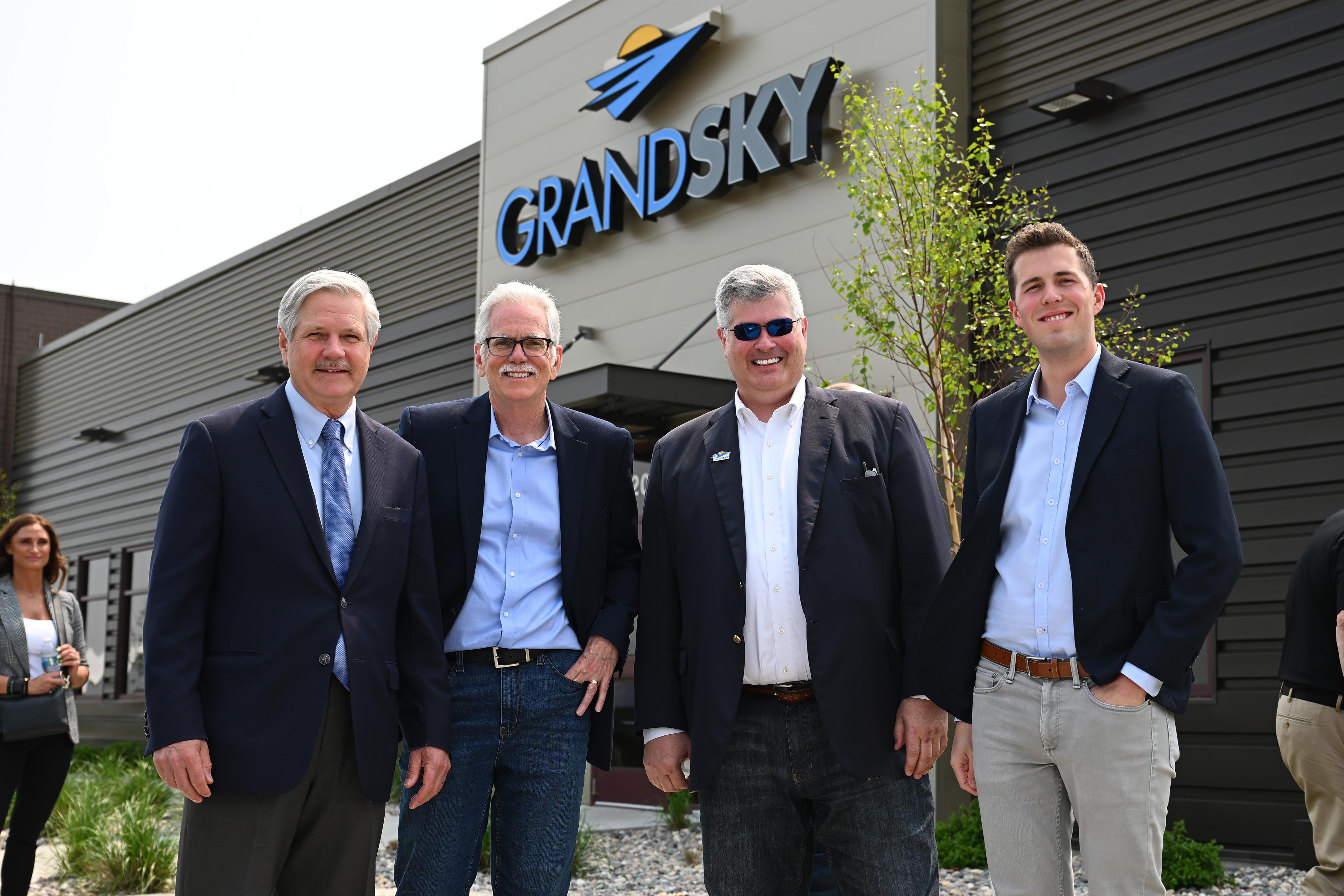
The Meteodrone launch at Grand Forks Air Force Base was attended by U.S. Senator John Hoeven of North Dakota, who has played a significant role in establishing Grand Forks as the country's UAS epicenter. The event was covered and broadcasted by American media outlets, including ABC and Fox Weather.
Additionally, the story captured the interest of several online magazines, resulting in headlines such as:
- Aerotime: First US drone-based micro-weather service to be launched out of an air base
- DroneDJ: Swiss firm Meteomatics' Meteodrone low altitude weather forecast tech makes US debut
- Meteorological Technology International: Weather drones to establish high-resolution weather service across North Dakota
- Fox Weather: North Dakota launching country's first drone-based micro weather service
- Dronelife: What's the Weather Up There? Meteodrone Flies at High Altitude to Get Precise, Real Time Weather Forecasts
- Bollyinside: Latest Weather Clips: North Dakota to Introduce the First Micro-Weather Service Using Drones
- WDAY (Inforum): Grand Sky Launches most accurate weather device in the nation
- UAS Vision: First US Drone-based Mirco-Weather Service
- Grand Forks Herald: Up in the air: Grand Sky's new drone collects important real-time weather data for UAS flights
- Unmanned Systems Technology: Drone-based Micro-weather service launched
- KNOX AM and FM: GrandSKY launches weather center
- 97 KYCK: GrandSKY launches weather center
A Milestone in Meteorological Technology
The successful launch of our drone-based micro-weather service marks a significant milestone in meteorological technology. Its potential implications are vast, empowering businesses and organizations with highly localized and up-to-the-minute weather forecasts. As we continue to expand our drone network, we envision seamless integration into broader weather monitoring systems, transforming our understanding and response to weather patterns.

Talk to an Expert
Related Articles


We provide the most accurate weather data for any location, at any time, to improve your business.


