
11/30/2022
Weather data for Unisphere flight management software
Thanks to Meteomatics' high-resolution weather data, Unisphere improves the safety and efficiency of drone and air taxi flight operations.

Head of Marketing
Thanks to Meteomatics' high-resolution weather data used in Unisphere's flight management software, Unisphere is improving the safety and efficiency of drone and air taxi flight operations.
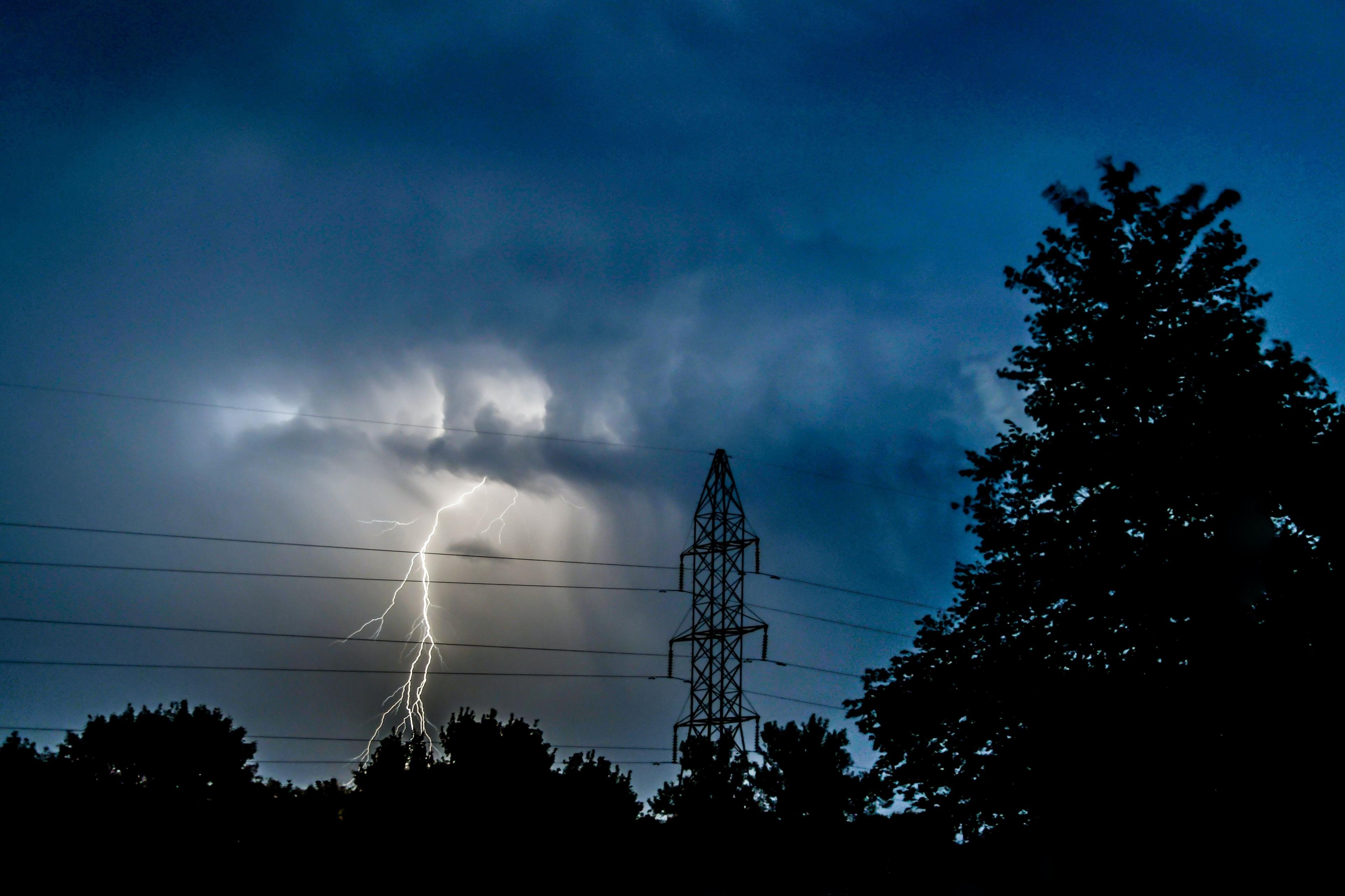
Unmanned aerial vehicles such as drones and, in the future, autonomous air taxis, all have one thing in common: they do not have a pilot on board who can respond directly to the conditions of weather changes and impacts. The response to weather changes is instead controlled by software and autopilot. In addition to the collection of live weather data during a flight, this also requires the availability of weather forecast data so that the flight can be carefully and, above all, safely planned by the software in advance.
Pilot tasks are mapped in software
If it already becomes apparent during the advance planning of a flight (with the help of a so-called flight simulation) that the weather will lead to increased or unacceptable flight risks, the route of the flight or, alternatively, the departure time can be adjusted accordingly so that the flight can be carried out within a safe framework. This leads to a greatly improved reliability of flight operations, a more efficient use of resources and, thus, significant cost savings.
Automated flight management using software solutions has enormous potential to enable industries without aviation expertise, such as agriculture, logistics, traffic management, surveillance and others, to operate drones safely and efficiently in a commercial context. As a result, Germany-based Unisphere has developed a solution for autonomous and automated flight operations.
Unisphere develops operations management platform NOVA
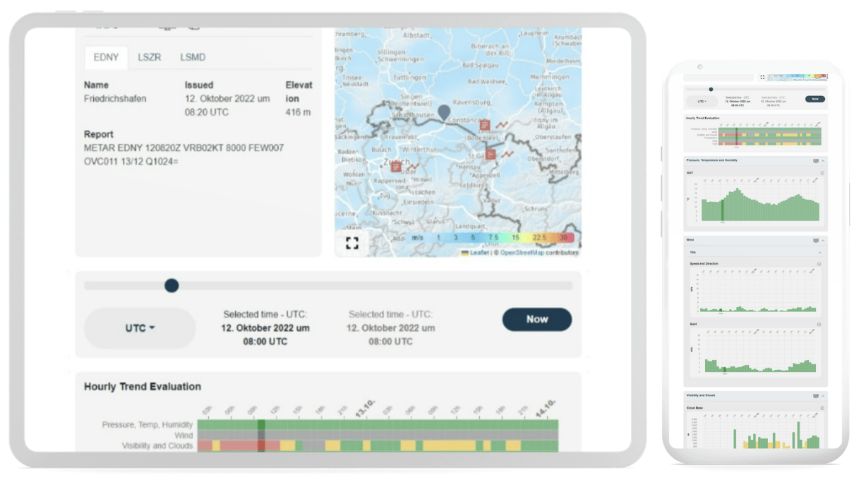
The NOVA Operations Management Platform acts as a digital co-pilot for commercial drone operations. The underlying simulation technology significantly increases the level of automation and enables professional drone operators to map and standardize their flight operations in the platform for efficient and safe scaling.
The platform is designed to be used as a decision support tool for pilot-guided flight operations as well as a decision system for fully autonomous flights. Currently, the platform offers two different solutions - NOVA Cast and NOVA Aware.
NOVA Cast offers forecasts for flight simulations with a timeframe of up to one week in advance. This allows flights to be simulated at an early stage using a digital twin. In the flight simulation, various weather parameters are evaluated with respect to their influence on the feasibility of a flight. If certain weather parameters (such as wind speed, icing, precipitation, etc.) exceed the preset limits of the vehicle, this becomes apparent in the simulation in advance. Thanks to this information, a better flight time or an alternative route can be found, which greatly improves the planning of flight operations and downtime due to maintenance, for example. As a result, resources can be used much more efficiently. In addition, this creates the conditions for fully autonomous and automated flight operations.
NOVA Aware supports the daily weather briefing as well as the scheduling of flights with a forecast period of 48 hours. In addition to weather model data, it integrates observation data (e.g. weather stations or other sensors) and METAR/TAF data from the nearest airports, improving situational awareness and thus flight safety.


Chief Commercial Officer & Co-Founder
Unisphere
The powerful weather data API and the accuracy of the weather information made Meteomatics the logical choice for us.
Permanent availability of high-resolution weather data as a critical success factor
In order for the flight simulation to function properly and always be up-to-date, the software needs permanent access to high-resolution weather data in real time as well as in the desired format. For this reason, Unisphere looked for a reliable weather API solution for the highest demands in aviation.
"The powerful weather data API and the accuracy of the weather information made Meteomatics the logical choice for us. Their enthusiasm to integrate specific requirements will provide our customers with the quality weather data they need to automate drone operations," said Dr. Christoph Selig, Chief Commercial Officer at Unisphere.
Meteomatics weather API as logical choice for Unisphere
In addition to the accuracy of the weather prognoses, which offers a resolution of 90 meters using downscaling, other features of the Meteomatics weather API also impressed Unisphere.
Michael Anger, CTO at Unisphere, reports: "In addition to forecast accuracy, the Meteomatics weather API offers a uniquely large scope of more than 1800 weather parameters. This includes, for example, wind speeds at different altitudes, which are absolutely critical for our use case. In addition, the weather API is extremely easy to integrate and everything worked smoothly from the start, with the extensive online documentation being very helpful, especially when setting up the API."
The integration of the Meteomatics weather API thus helps Unisphere to provide a software solution that meets the high demands of weather forecasting in aviation. "With the Meteomatics Weather API, we can retrieve weather data for any coordinate in the world, allowing us to map all of our flight routes with the most accurate and up-to-date weather data. In addition, the weather API provides the ability to query weather data directly along a certain route. This allows us to quickly query all weather data along a route directly using simple API calls and incorporate it into our flight simulation." Michael Anger continues.
Meteomatics understands the benefit of flight planning software from its own experience
Since Meteomatics is also in the drone business, we understand all too well the benefits of planning and automation software for efficient and safe flight operations. "At Meteomatics, we have been operating Meteodrones ourselves since 2012. We see Unisphere's flight management platform as an indispensable service to enable highly automated flight operations of unmanned aerial vehicles and are proud to support flight safety," adds Dr. Martin Fengler, CEO of Meteomatics.

Exciting prospects in a market with a strong future orientation
As the drone market continues to grow and more and more use cases emerge in various industries, the need for efficient and automatable planning solutions will also increase strongly. Unisphere has thus positioned itself in a promising market with an excellent product. Meteomatics is proud to support Unisphere in this market in the best possible way and to help them establish themselves as a market leader with clear competitive advantages based on unique weather data.
About Unisphere:
Unisphere specializes in intelligent solutions for automated flight operations. Its operations management platform, NOVA, is used by leading BVLOS drone operators and air taxi companies. It supports piloted and fully automated flight operations with its unique simulation technology, which creates a digital twin for each individual flight. Operational analytics provides a data-driven foundation for strategic decision making in planning vertiports and designing air taxi services. This is done by analyzing the impact of weather conditions on future flight operations based on historical weather data.
We Work With Groundbreaking Companies
We are proud to work with leading companies in the aviation industry. Together, we realize efficiency benefits, better integration of renewables and help our partners realize digital innovations.


Expert Call
Let’s Find the Perfect Solution to Your Problem. Talk to an Expert.
Related Articles


We provide the most accurate weather data for any location, at any time, to improve your business.