
Meteodrone Partners
We partner with top-tier global collaborators, leveraging the advanced capabilities of Meteodrones to enhance local weather forecasting.


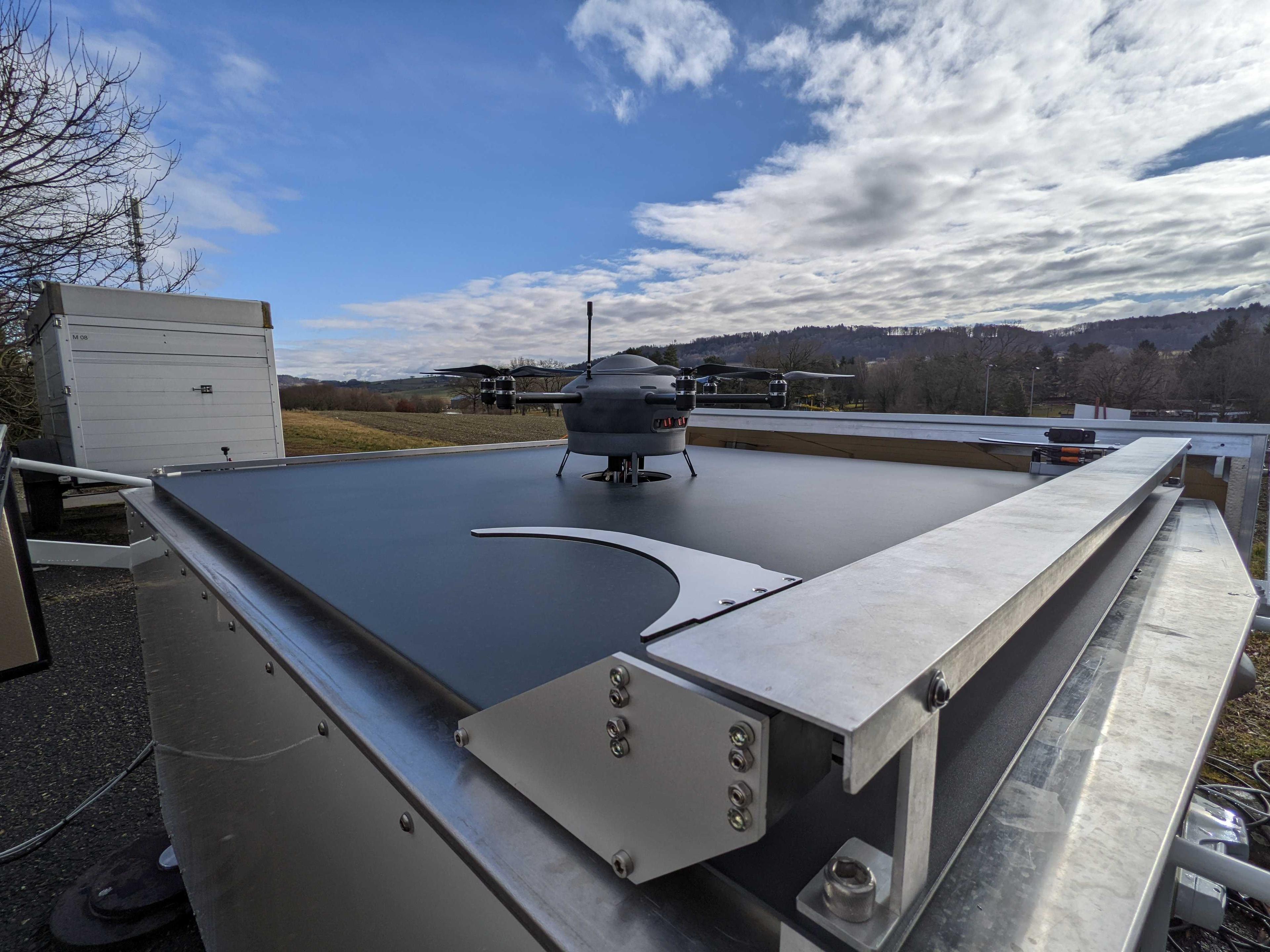
Move the 3D Model Around To Get a 360° View of the Meteodrone
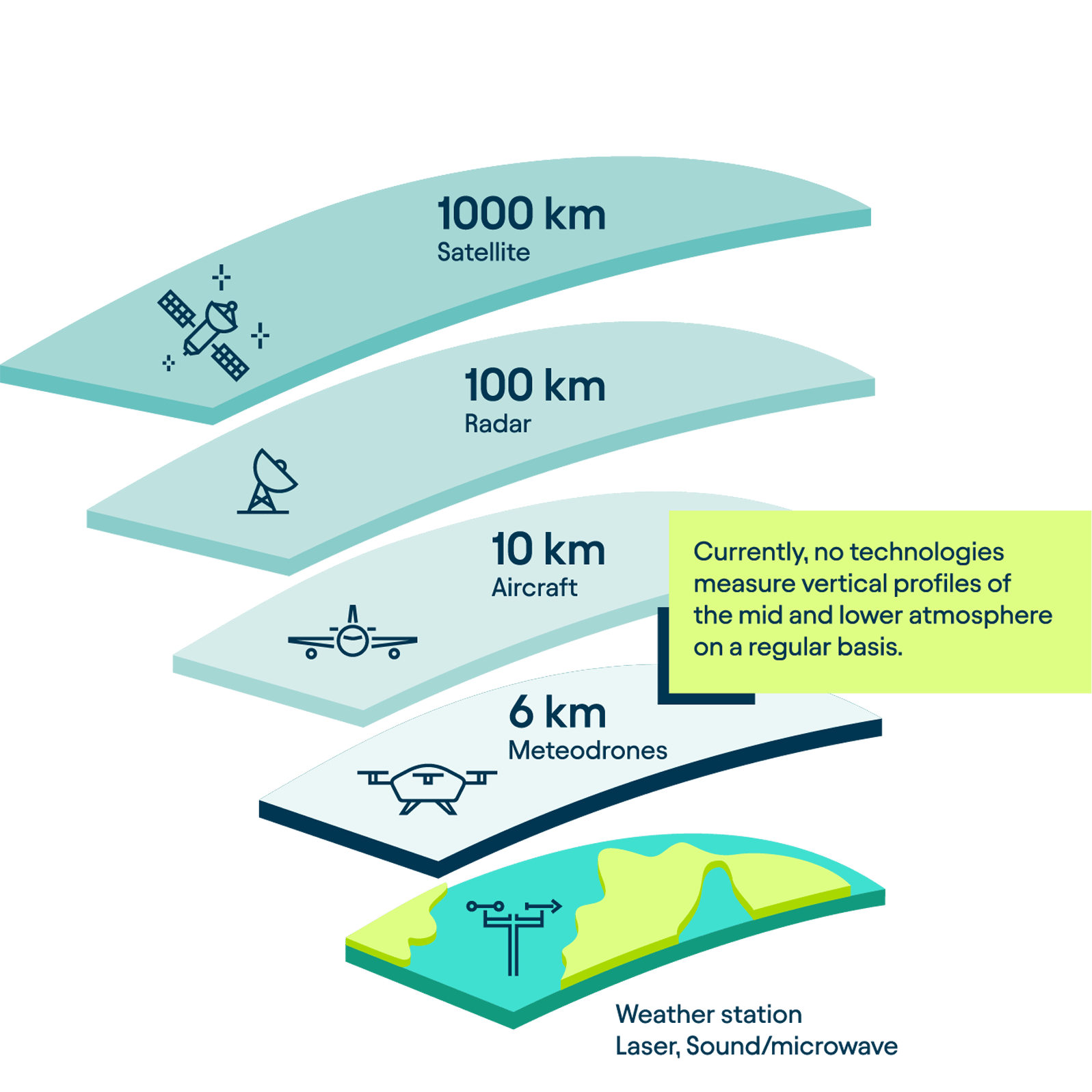
Challenges of Weather Data Collection
The boundary layer, the lowest layer of the atmosphere, is where the majority of our weather occurs. Everyday weather conditions are influenced by a multitude of variables and factors that are difficult to capture. Consequently, the data currently fed into weather models often lacks the comprehensiveness needed for precise weather predictions.
Weather Stations
Traditionally, weather data has been collected using weather balloons and ground-based weather stations. However, these stations, with their fixed locations and proximity to the Earth's surface, have significant limitations in capturing atmospheric measurements. Being grounded, they are unable to assess conditions in the higher regions of the boundary layer.
Satellites
Satellites represent another method for collecting weather data. They are particularly effective in gathering information on water vapor and cloud formation. However, satellites are less suitable for measuring parameters like temperature, humidity, or wind. Additionally, satellite data is often collected intermittently and may lack the necessary quality and resolution for integration into weather models. While weather satellites are instrumental in collecting atmospheric observations and have significantly enhanced weather forecasting, they fall short in accurately profiling wind fields in the colder, lower atmosphere.
These data are crucial for industrial applications and for initializing weather models. Moreover, the presence of clouds can obstruct satellites from capturing measurements beneath them. Consequently, satellites offer limited coverage of the planetary boundary layer, leading to gaps in observational data.
Aircraft
Aircraft are another means of collecting weather data, frequently deployed during storm events. However, their operation entails significant costs. Additionally, piloting an aircraft into a storm poses considerable risk to human life.
Weather Balloons and Radiosondes
Weather balloons carrying radiosondes can ascend to much higher altitudes. However, they come with their own set of drawbacks. Lacking controlled navigation, they are at the mercy of wind currents and cannot return to their launch points. This often leads to coverage of unintended areas, making it challenging to collect consistent and targeted weather data in the form of a vertical profile or through vertical atmospheric surveys.
Moreover, the production of these radiosondes can be costly. They also require helium for operation, a natural resource that is becoming increasingly scarce. Post-deployment, radiosondes frequently drift as far as 250 km from their launch sites due to wind patterns, which often leads to the loss of the equipment.
Meteodrones: a Game Changer
What Are Weather Drones?
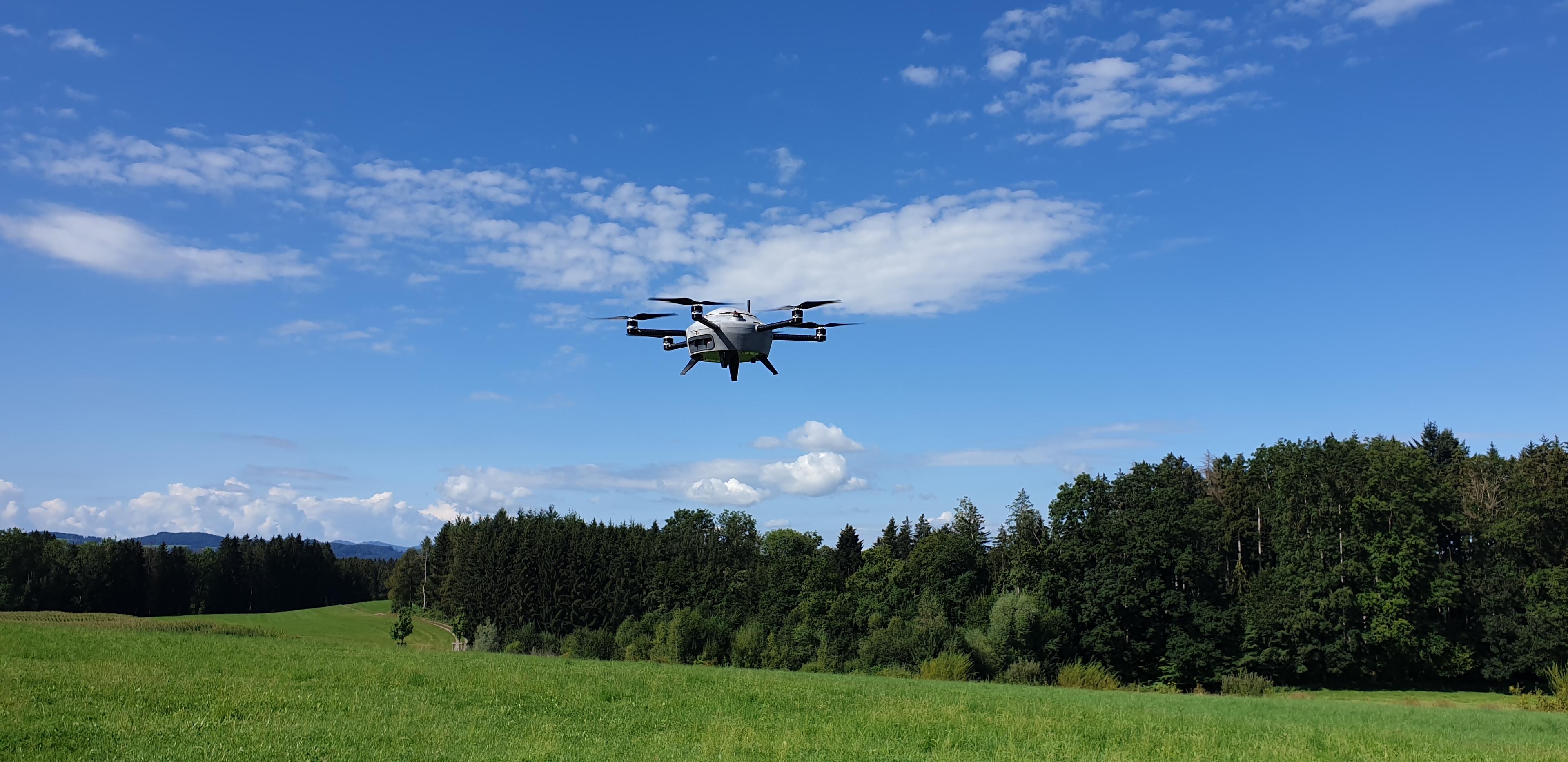
Weather drones are specifically engineered for meteorological purposes. Operating within the Earth's lowest atmospheric layer, known as the boundary layer, they are equipped with sensors for weather data collection, gathering key atmospheric data such as temperature, humidity, and wind conditions. The information collected by these drones is instrumental in enhancing the accuracy of weather forecast models, providing a more comprehensive understanding of atmospheric dynamics.
What Makes Meteodrones So Special?
Made in Switzerland
Meteodrones are a product of Swiss precision and innovation. Entirely designed and engineered in St. Gallen, Switzerland, the development process of Meteodrones is an in-house endeavor from conception to final product.
Mobile weather station
We call our Meteodrones "the future of radiosondes." Each Meteodrone functions like a mobile weather station, offering numerous benefits over conventional radiosondes. Unlike these probes, which often take measurements in an uncontrolled manner due to their flight paths, our Meteodrones are capable of precise, controlled operations. They can be manually directed on-site or operated remotely, providing flexibility in data collection. This allows the Meteodrones to hover over a specific location or venture into remote areas where traditional weather stations are absent and other forms of measurement are unfeasible.
Cost-Effective and Sustainable
Meteodrones serve as a more sustainable and cost-effective method of collecting atmospheric data compared to radiosondes, as they can be deployed and reused as often as needed. Additionally, their robust construction enables operation in a variety of weather conditions, making them highly effective in capturing a wide range of local weather phenomena. This reusability and versatility underscore Meteodrones' role in promoting environmentally responsible meteorological practices.
How Do Meteodrones Enhance Weather Forecast Accuracy?
Data Collection up to 6km
Meteodrones can ascend up to 6 kilometers above ground to collect atmospheric weather data. Our Meteodrones can efficiently gather data both during the day and night, which is then seamlessly integrated into weather models for processing. This ensures that local weather data is consistently included in forecasts, resulting in more precise predictions.
Reliable and Continuous Weather Data
Meteodrones can remain stationary over a specific area for the entire duration of their flight. This capability allows for the continuous collection of atmospheric profiles. Furthermore, the practical design of Meteodrones, including replaceable batteries, enables immediate redeployment after a flight, ensuring an uninterrupted stream of weather data.
How Do Meteodrones Process Data?
The raw weather data is recorded at a data rate of 4 to 20 Hz, meaning at 4 to 20 measurements per second, and stored on the integrated SD card. After a flight with a Meteodrone, the weather data undergoes evaluation and processing. It is saved in various formats that facilitate meteorologists in integrating it into their respective weather models, including time-resolved representations. Once this additional data is incorporated into the model, it enhances the accuracy of the weather forecast within a radius of up to 50 km from the starting point of the measurement flight. These measurements significantly enhance the forecasts of phenomena critical for aviation, such as fog, thunderstorms, icing, and hail.
Our Meteodrone in action in Switzerland.
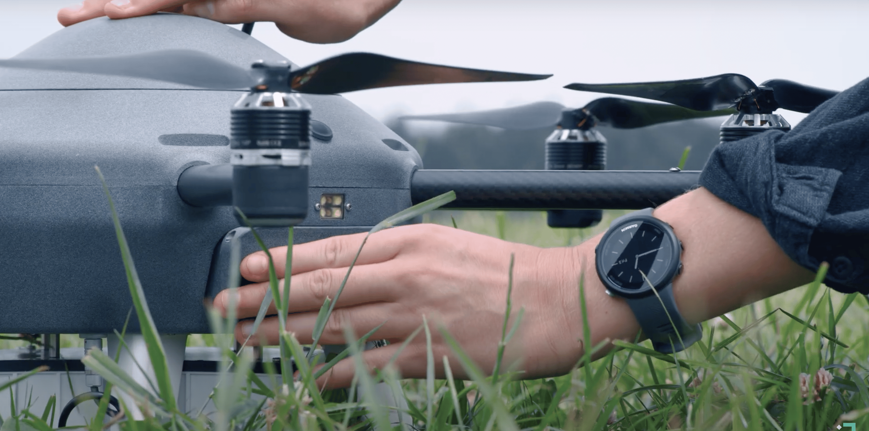
Meteodrone MM-670
The Meteodrone MM-670 (ML) is perfectly suited for commercial use or reconnaissance missions. Its design allows for customization with various instruments to meet specific requirements, offering flexibility for diverse operational needs.


Sensors
- Temperature
- Pressure
- Relative humidity
- Dew point
- Wind speed and direction
Technical details
- 6 engines (brushless motors)
- Battery powered
- Typical flight profile: 22 minutes
- Max. wind speed: 90 km/h
- Flight altitude: 6‘000 m AMSL
- Parachute rescue system
- De-icing function (optional)
- Ø : 70 cm; 5 kg
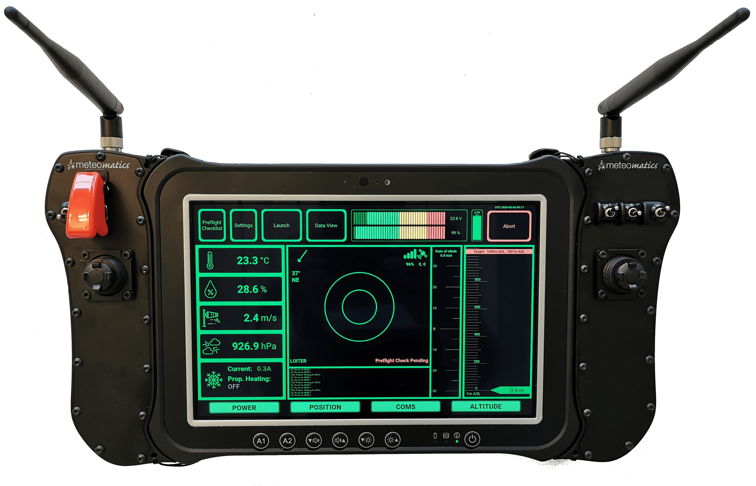
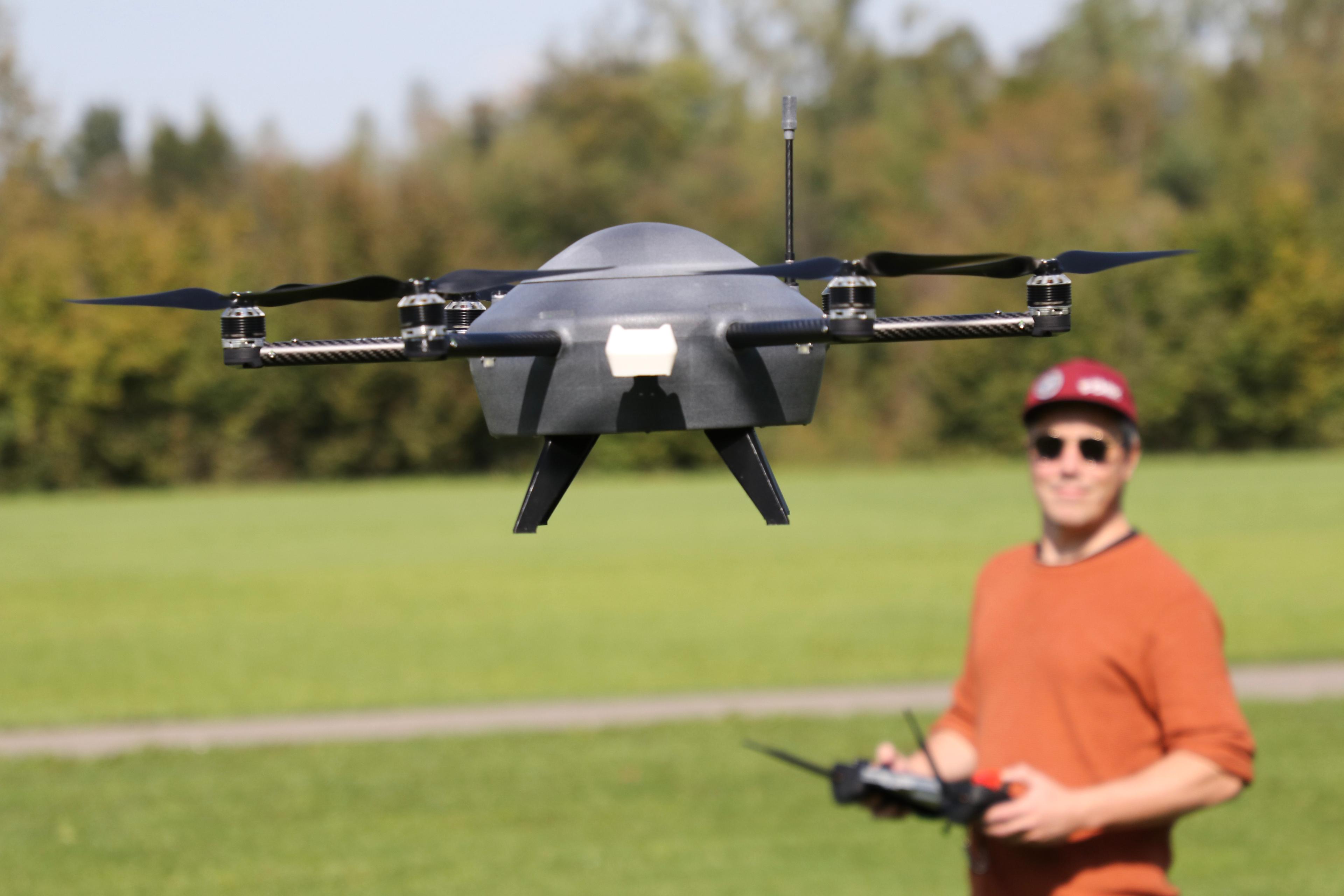
Ground Control Station
Each drone comes equipped with a Ground Control Station, which establishes a telemetry link with the drone. Launching the Meteodrone is simplified to a one-click action on the Ground Control Station. Upon activation, the drone ascends and immediately begins gathering weather data. This data is consistently transmitted back to the Ground Control Station, where it undergoes real-time analysis and is visually displayed. Such a setup not only provides instant insights into atmospheric conditions but also allows the pilot to continuously monitor the flight. The display clearly presents:
- Relative position
- Altitude and direction
- Energy consumption
- Current weather conditions
Wind conditions
The Ground Control Station also records key parameters on an SD card for detailed analysis. Similarly, the Meteodrone itself stores all collected weather data on an onboard SD card for easy retrieval and review.

Transport Case
The IP67-rated carrying case include:
- A Meteodrone
- A Ground Control Station and its charger
- Tools
- Spare batteries


Emergency Recovery System (ERS)
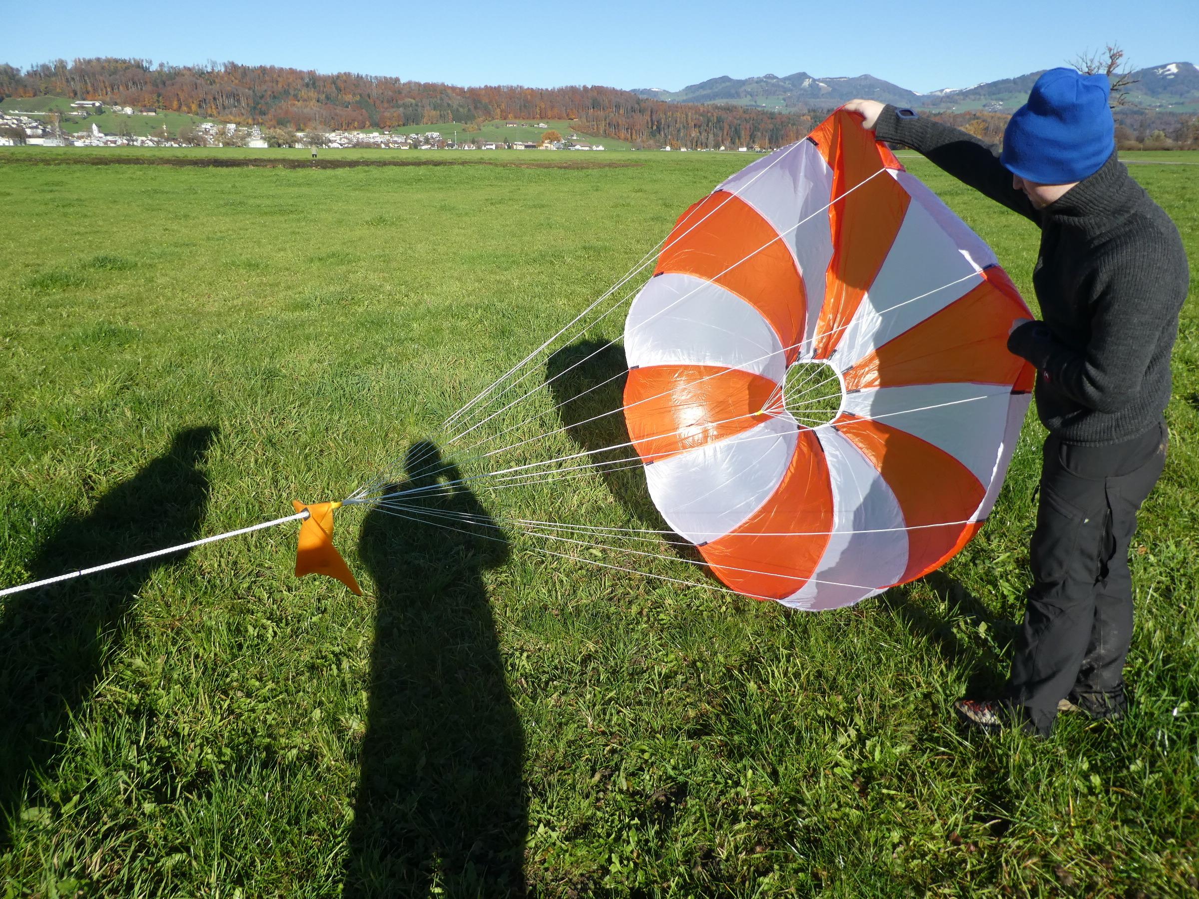
Additionally, the Meteodrone MM-670 is equipped with an Emergency Recovery System (ERS), essential for operations Beyond Visual Line of Sight (BVLOS). This system, which can be activated from the ground, includes parachute mechanisms to safeguard property, people, and the drone in case of emergencies such as engine failure or external interference.

Deicing Function
We have equipped our Meteodrones with a deicing function to address the risk of ice accumulation on the propeller blades, a common issue in conditions below 0°C with high humidity. It activates upon detecting icing conditions, heating the rotor blades to ensure safe operation. In selecting components, we prioritized robustness, ensuring functionality in temperatures as low as -45°C. The optimized frame design also renders the drone waterproof, making it suitable for use in various weather conditions, including rain and snow.
Additionally, the propellers have been adapted to withstand high wind speeds, enhancing flight stability and reliability. To enable operation in wind speeds of up to 50 knots, we have also upgraded the Meteodrone's airframe and drivetrain. Such improvements are essential for high-altitude flights.

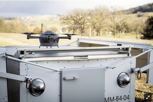
Meteobase — The home of our Meteodrones
The Meteobase — The Home of Our Meteodrones
Serving as the Meteodrone's "home base," the Meteobase is where it autonomously takes off, lands, and charges its battery.
As a ground station, the Meteobase provides local support for the operation of our Meteodrones. It functions as a communication hub, facilitating seamless interaction between the pilot and the drone while also serving as a control center for autonomous flights.
The Meteobase is a comprehensive system comprising a central computer that oversees various operational, control, and maintenance tasks for the drone.
Capabilities of a Meteobase
- Monitoring and logging weather parameters at the deployment site.
- Autonomously launching and landing a Meteodrone.
- Serving as a charging station for the Meteodrone.
- Offering real-time visual oversight of the drone's immediate surroundings thanks to strategically positioned cameras.
- Maintaining an internal climate control system, incorporating heating and air conditioning, to uphold optimal environmental conditions for the Meteodrone, its electrical components and batteries.
- Withstanding various weather conditions, being both waterproof and snowproof.


Nationwide Meteodrone Operations
With the Meteobase, our goal is to facilitate nationwide Meteodrone operations, significantly enhancing the precision of weather forecasts through autonomous Meteodrone missions. We envision a network of Meteobases, each designed to automate and remotely control Meteodrones. Ultimately, the Meteobase system will enable a single pilot to simultaneously operate up to 10 different drone systems remotely, at any time and from any location. This innovation is a step towards revolutionizing weather data collection and forecasting.
Read an article on the roll-out project of autonomous drone systems with Meteobase and Meteodrones in Switzerland.
The construction site monitoring project began in the first week of August 2020 and concluded by the end of October 2020, with Wiggen selected as the designated construction site. In this project, an autonomous Meteodrone system was deployed for monitoring and remote control operations from a centralized operations center, eliminating the necessity for an on-site pilot.
The Meteobase was strategically positioned on a CKW substation, with permission to operate secured from Meteomatics for its placement. Approximately 34 flights were conducted under favorable weather conditions.
The Meteodrone, stationed centrally on the Meteobase before take-off, is outfitted with a 4k camera system capable of capturing images from various angles. Furthermore, the Meteodrone features position lights for orientation and strobe lights to alert other air traffic, employing flashing white lights for enhanced visibility and safety.
Flight Profile
The flight geography in Wiggen ran along the tracks and from the Meteobase to the end in Beibräche and to the entrance of the tunnel before Wiggen at the other end. At the request of In-Terra, a third loop was added to the trajectory to extend the recording area. This supported easier processing of the images.
Flight distance: 3 km
Flying time: 13 min
Flight altitude: 50 m
Cruising speed: 5 m/s
Sequence of Automatic Construction Site Monitoring:
The operator starts the drone mission
The drone starts operation from the base
Images are downloaded after flights and uploaded to a server
Images are processed on the server and end products are created
The products enable the builder to accurately monitor the site and make informed decisions.
The Illgraben project started in 2019 with a first prototype deployment of the system and continued in 2020 by ETH and 2021 by WSL.
The idea of the project was to operate an autonomous Meteodrone system that is monitored and remotely controlled from an operations center. For this purpose, approx. 70 autonomous flights along the Ilbach were carried out in good weather, depending on what made sense.
Flight Profile
The flight profile was a horizontal flight path of 6 km. As the drone is equipped with RTK GPS for spatial precision, images could be captured every second with an overlap of >80 %.
The aim was to capture images for the calculation of a high-resolution DEM to investigate erosion movements. From the images taken on the trajectory, 3D images could be created to visualize the terrain.

The image shows the three-dimensional trajectory through the Illgraben. Each white dot stands for a picture taken at that exact spot.
Lessons Learned From the Project
Accurate geotagging is a challenge with the on-board RTK, as a fixed RTK in the back of the canyon cannot always be guaranteed
Synchronization of image resolution and geotagging is mandatory if markers cannot be placed in the environment.
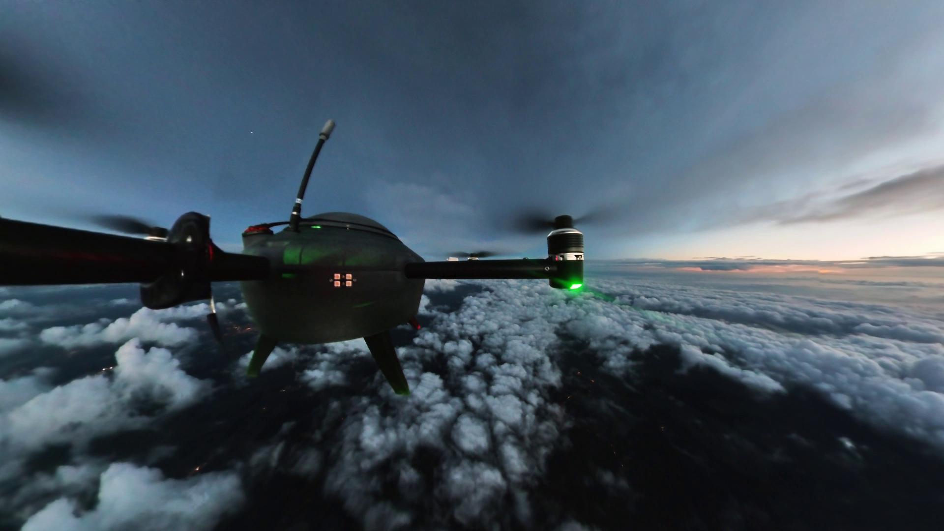
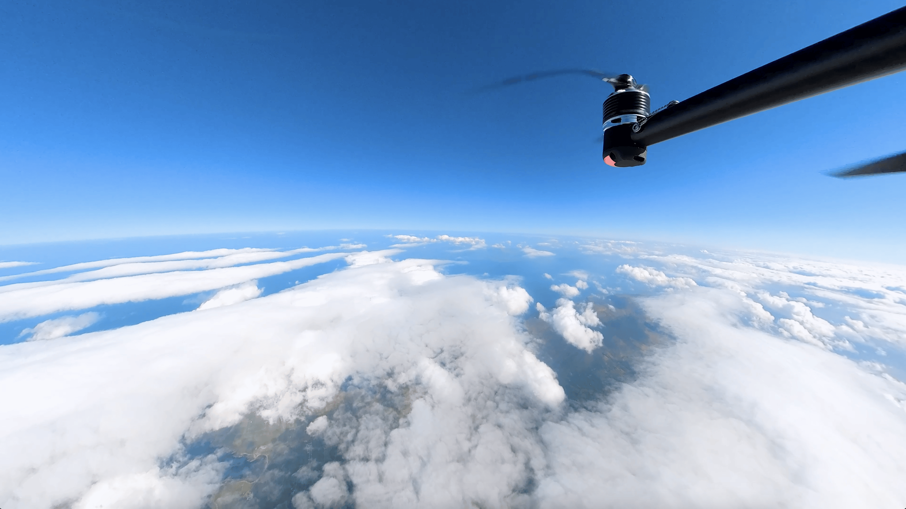
Meteodrone flying up to 6 km, above two different kinds of cloud layers.
Meteodrone Use Cases
Replacing Radiosondes
The main use case for Meteodrones lies in their ability to replace radiosondes in all areas where these devices are currently employed. Radiosondes have long been the go-to method for gathering atmospheric data, providing invaluable insights into temperature, humidity, pressure, and wind patterns at various altitudes. However, they come with inherent limitations.
Meteodrones offer a compelling alternative to traditional radiosondes, providing enhanced capabilities for atmospheric data collection. Their ability to operate in challenging environments, repeated usability, and autonomous navigation make them invaluable tools for researchers, meteorologists, and weather enthusiasts. As technology evolves, Meteodrones are expected to play a vital role in advancing atmospheric data collection and analysis.
We fly our Meteodrones operationally in Switzerland to collect data, gain meteorological insights and improve our high-resolution regional EURO1k weather model.
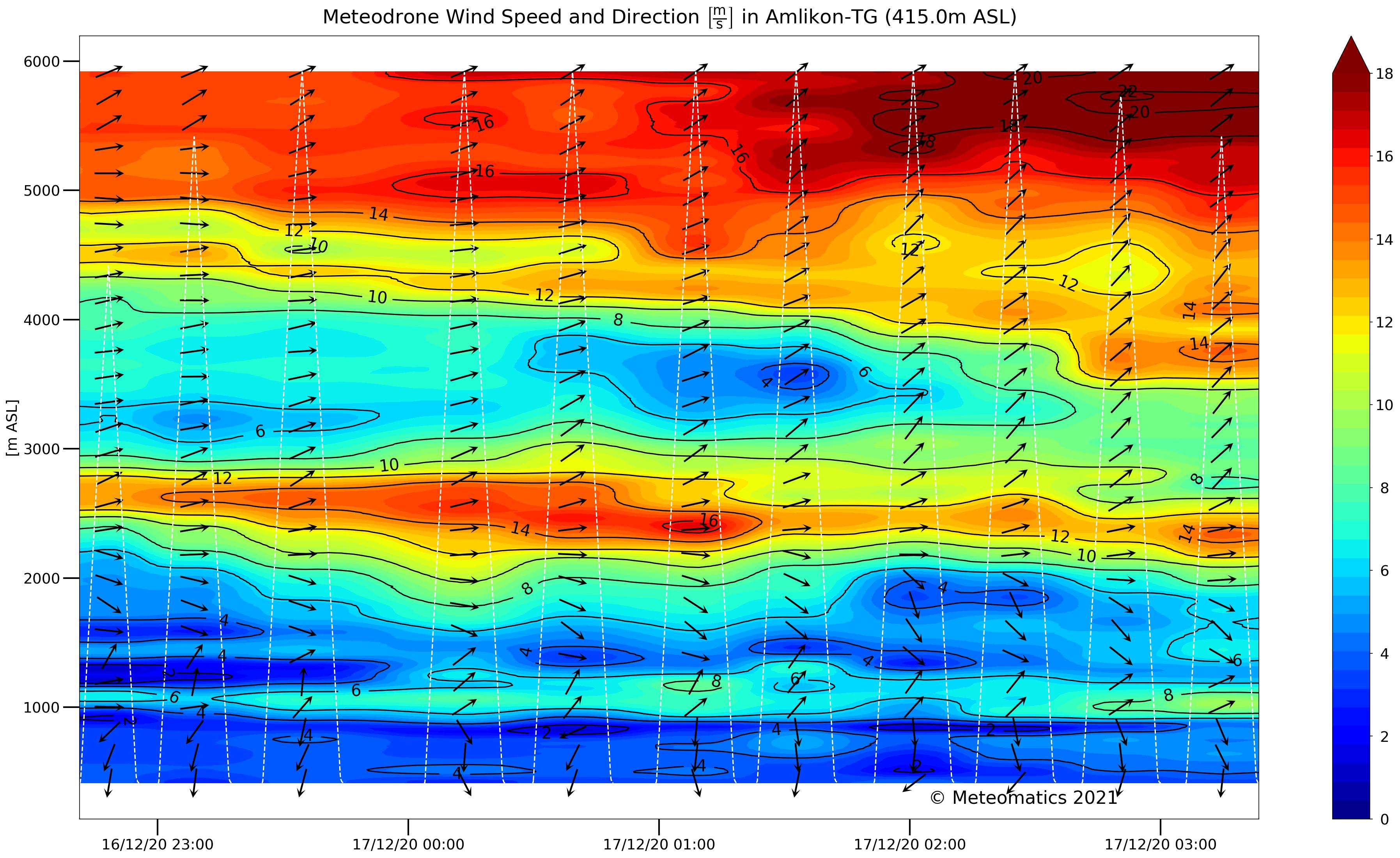
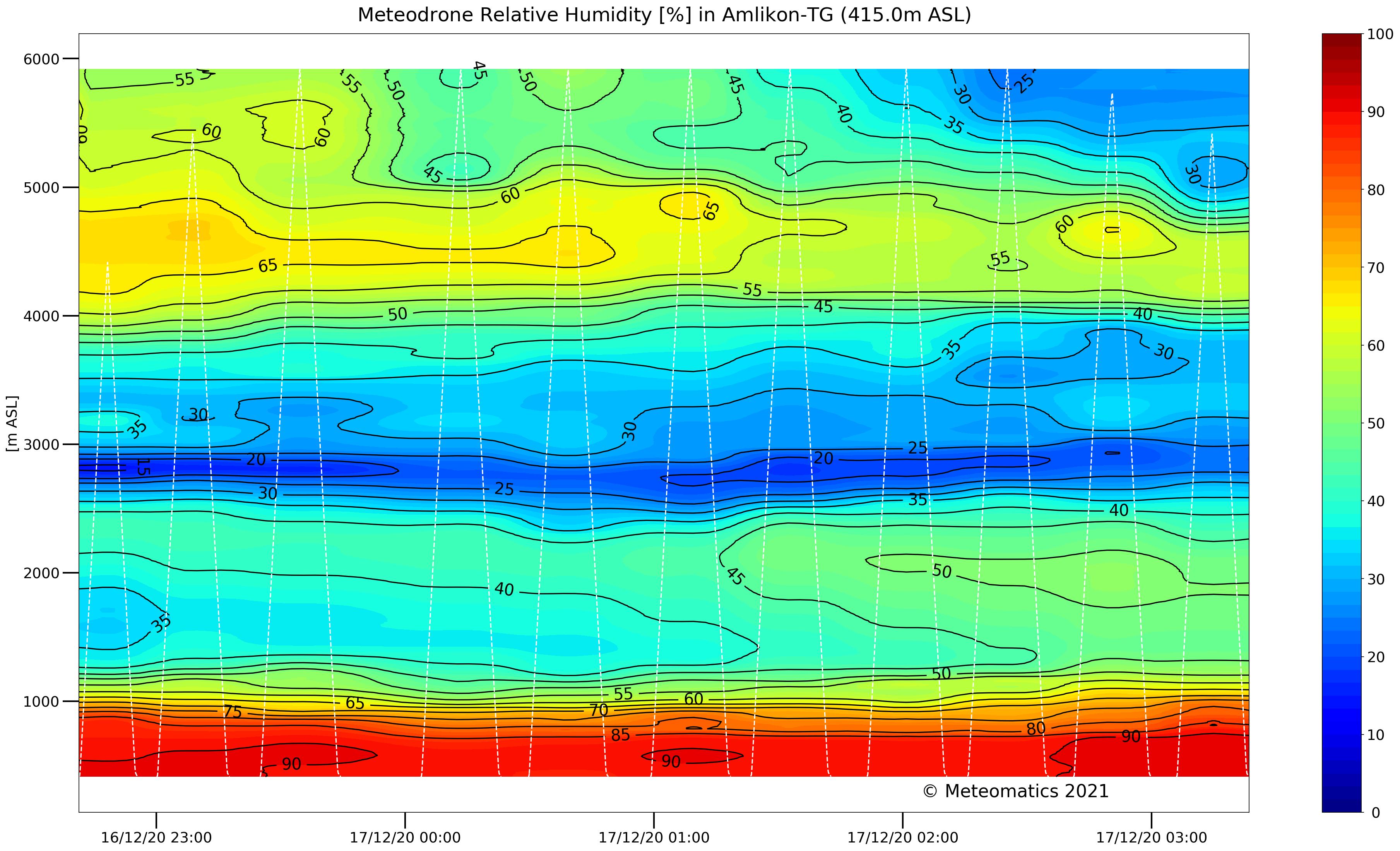
The following images show an interesting case of nighttime meteorological conditions. The white dashed lines show the flight tracks; the y-axis shows the altitude and the x-axis shows the time. The low temperatures, high humidity and weak winds near the ground indicate fog up to 1,000 m altitude.
A strong nocturnal jet is visible between 2,500 m and 3,000 m, bringing a dry layer of air into the atmosphere. At higher altitudes the wind is quite strong, up to ~40 knots.


Meteodrones help to refine humidity profiles within weather models. To highlight this capability, let's examine the occurrence of early fog and low stratus at Lake Constance, in northeastern Switzerland. In the comparison, we present the EURO1k model with assimilated Meteodrone data alongside one without. The first column showcases satellite cloud cover at 7 am (upper image) and 8 am (lower image), while the subsequent columns display the SWISSk model forecasts for early morning fog and stratus.
The model forecast incorporating Meteodrone data (far right) vividly delineates the fog-covered areas around Lake Constance. As early as the morning hours, the drone flights captured and detected the recorded humidity levels. Conversely, in the model lacking Meteodrone data (middle column), the depiction fails to resolve the shallow fog present in the regions of the western Swiss midlands and northern Italy.


Depending on the stability of the atmosphere, topographically induced storms can be observed in the Alpine region. Such a case occurred on 29 May 2017. The top left image shows the precipitation rendered from the model with Meteodrone data. The red dots show flight profiles with their effective impact radius (red dashed line) recorded in Schaffhausen, Amlikon and Marbach - all towns are close to Lake Constance. Compared to the right, the operational models without additional drone data such as ECMWF, NCEP and Met Office were not able to capture the severe storms. The lower left image shows the radar image data measured at the time.


Icing is not only a problem in passenger aviation, but also for UAVs. The ice accumulations cause a loss of controllability. As more and more UAVs are used in everyday life, the risk to the public increases. To cause ice accumulation on propellers, two conditions must be present:
Air temperature < 0°C
Relative humidity > 95
Drone-based predictions of temperature, relative humidity and wind speed enable the identification of icing conditions (red area in Figure 6). In this project, test flights were conducted under real icing conditions. In addition, icing was tested in different environments: outdoors in winter, in an indoor ski slope and in the Vienna Climatic Wind Tunnel (VCWT). Based on these tests, the effect of icing on the meteodrons was investigated and different anti-icing methods were analysed. A reliable heating method for the propellers is shown in the following figure.


How Our Customers Use the Meteodrone System
Meteodrones are currently being utilized worldwide in collaboration with several partners, including national meteorological services and armed forces. Here are some of our partnerships in the United States and Europe.
Partnerships in the United States
NOAA
To enhance tornado prediction accuracy, Meteodrones were deployed in November 2016 and May 2017 in Oklahoma, USA, covering over 140 km in more than 100 exploratory flights. These flights gathered crucial ground-level information, which was then integrated into a model. This integration allowed the National Oceanic and Atmospheric Administration (NOAA) to improve tornado forecasts.
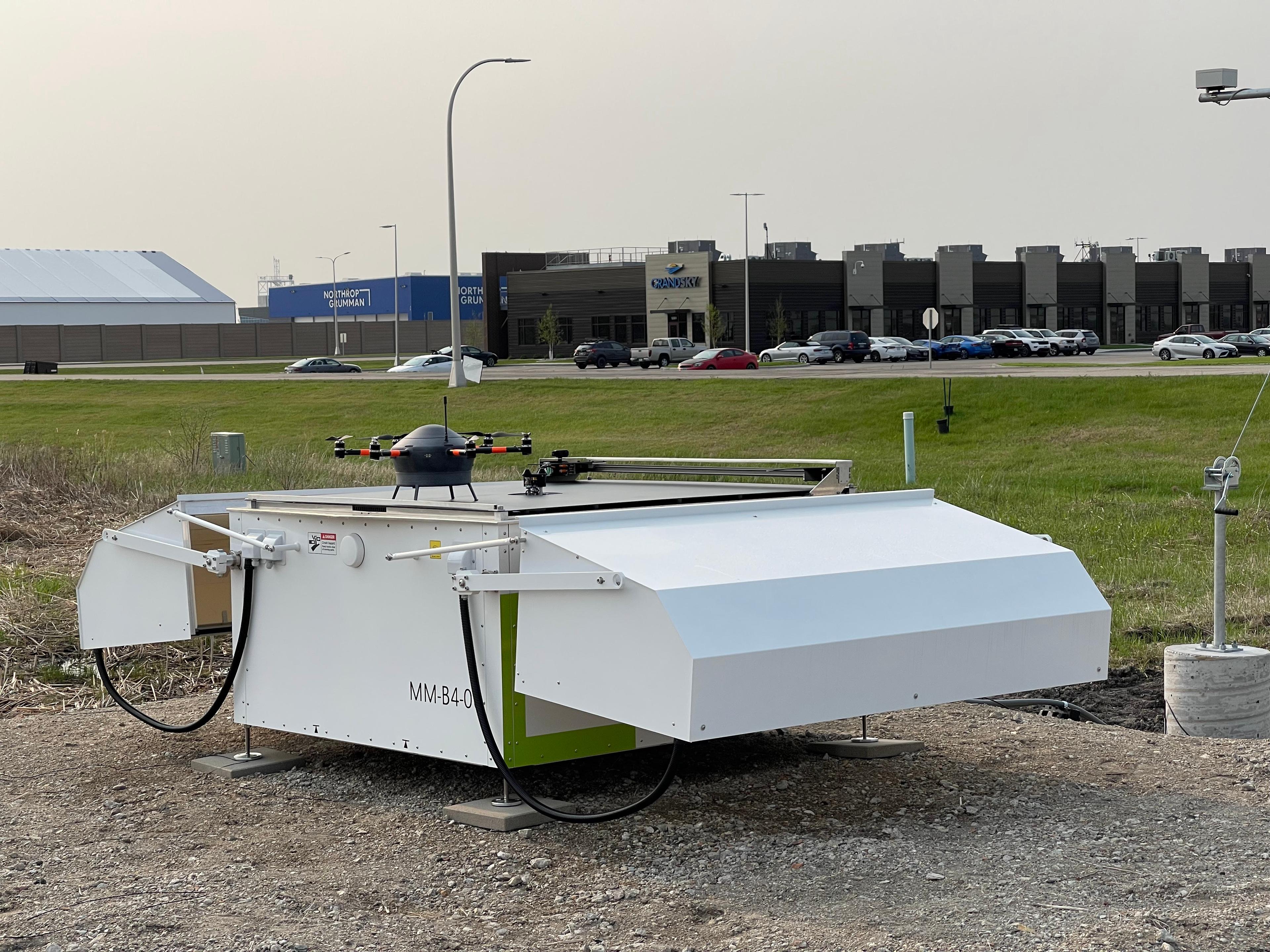
For two years starting in 2024, in partnership with NOAA, GrandSKY, Synoptic Data PBC and Meteomatics will deploy Meteodrones at the GrandSKY Aviation Park in North Dakota to gather observations at high altitudes to enhance forecasting. The goal is to gather and evaluate upper air data to improve weather forecasting. This collaboration underscores NOAA's commitment to working with private sector companies through CRADAs to conduct mutually beneficial research and development.
GrandSKY Aviation Park
Since 2023, Meteomatics has been collaborating with GrandSKY aviation park in North Dakota to power the country's first micro-weather service using Meteodrone data and a high-resolution weather model. This partnership empowers the Weather Operations Center at GrandSKY to detect weather phenomena that directly affect flight decision-making, safety measures, and scheduling.
Partnerships in Europe
Switzerland
The combination of the Meteomatics EURO1k model with Meteodrone data proves invaluable in producing specific forecasts for phenomena such as fog formation, icing, thunderstorms, and lightning, especially for airspace surveillance. A notable example showcasing the positive impact of drone data can be seen in the DETAF project (Drone Enhanced Terminal Aerodrome Forecasts) conducted at Zurich Airport.
Norway
In collaboration with the Norwegian Research Centre (NORCE), Meteomatics is undertaking a multi-million euro project in Norway. By the end of 2025, Meteomatics will install 30 Meteodrones and Meteobases across the entire country. This initiative is part of Norway’s efforts to future-proof its economy, people, and infrastructure against various weather-related challenges.
MAGDA Project
The MAGDA project, which is a part of the Horizon Europe program funded by the European Union and the Swiss State Secretariat for Education, Research, and Innovation. This project aims to enhance site-specific weather forecasts and provide irrigation advisories to proactively protect crops from severe weather impacts.
Ireland
Met Éireann, The Irish Meteorological Service, is interested in evaluating in evaluating the possibilities of complementing radiosonde measurements with Meteodrone measurements and potentially replacing them with Meteodrones in the long term.
Flight Permissions in Switzerland and Abroad
Meteomatics, a Swiss company, has received permission from the Federal Office of Civil Aviation (FOCA) to fly Meteodrones "Beyond Visual Line of Sight" (BVLOS) in Switzerland and the Principality of Liechtenstein. This means the drones can operate without the pilot's line of sight, including flying inside clouds, in fog, and at night, under certain conditions.
Meteomatics can also obtain flight approvals for Meteodrone demonstrations in most European countries, in collaboration with national flight authorities, and is willing to assist other organizations in obtaining approvals. Please note that each approval is subject to specific limitations in terms of area, altitude, and time period, depending on local requirements.
Dive Into Meteodrone Use Cases

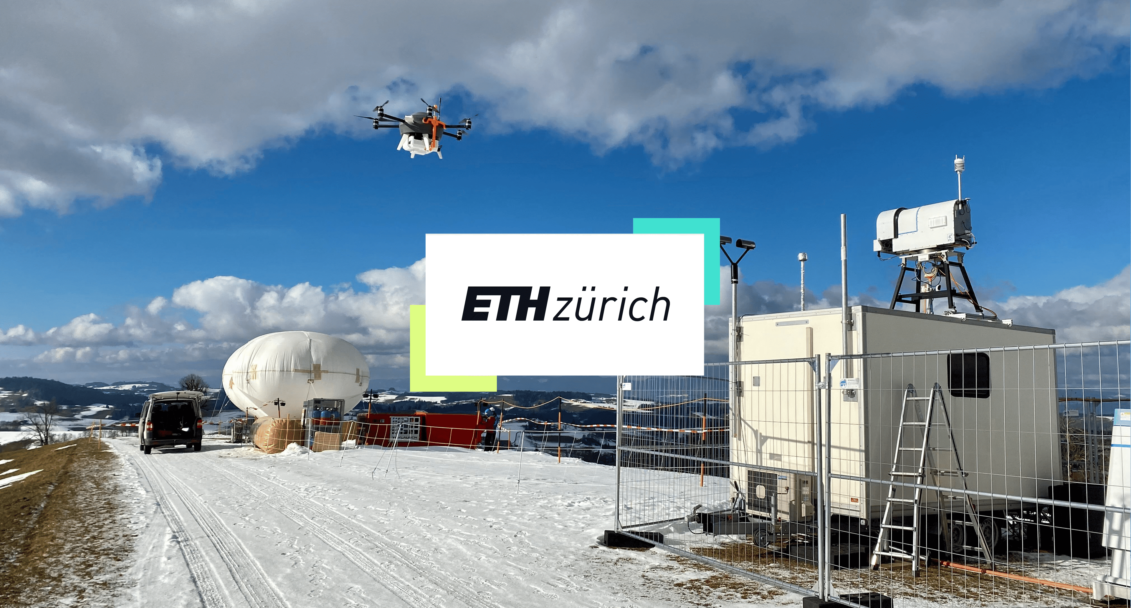
Video Use Case: Atmospheric Research With Meteodrones

Doctoral student in atmospheric science
ETH Zürich
Meteodrones are reliable and easy to use. They have significantly advanced our research and enabled us to explore new possibilities in atmospheric measurement.
Cloud Seeding Experiments
Watch the video to learn how ETH Zurich’s researchers are using Meteomatics’ Meteodrones to conduct cloud seeding experiments to study cloud-aerosol interactions and precipitation events.
Acquire a Meteodrone
Submit an inquiry to us and receive a bespoke offer tailored precisely to your requirements, regardless of the application.
Depending on your needs, you can tap into our expertise beyond the product and its accessories.
What else we offer:
- Collaboration for a test flight.
- Comprehensive training in Meteodrone operation.
- Flight operation on your behalf as part of a joint project.
Meteodrone Demonstration
If you’re interested in demonstrations in Europe, read the article below to learn more about receiving flight authorization.


Talk to an Expert