Aviation
Specifically targeted for the aviation business, MetX is able to visualize a range of aviation-related data, i.e. (international) SIGMETs, METARs, TAFs, and AIREPs. To display aviation data, click on the Layer Stack- Icon , select ”Add Layer” and ”Aviation” in the ”Mode” section.

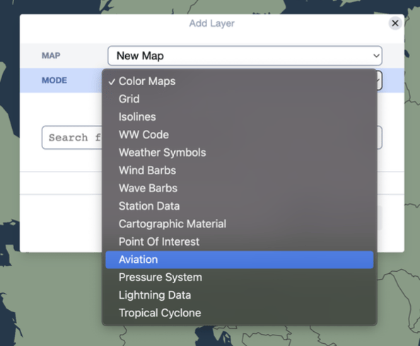
The aviation-related data is available as a dropdown list in the ”Aviation Data Type” section.

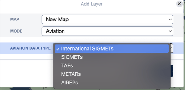
Click on the preferred data source and click the ”Apply” button. The layer is then added to the Layer Stack, where the aviation data type and text size can be modified.

