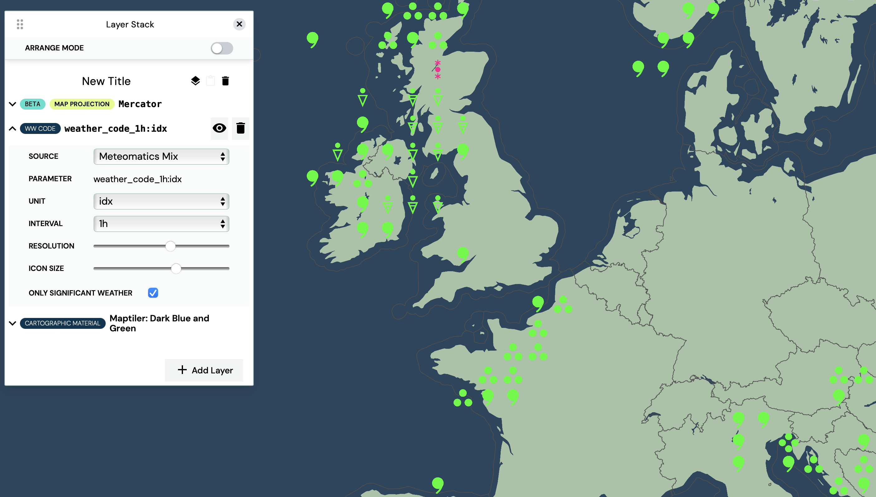
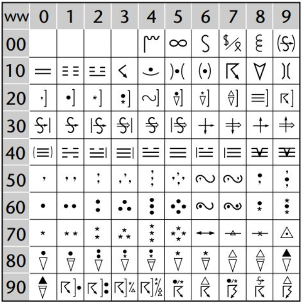
WW Codes
WW codes usually describe the present weather and the past weather with a reference time (i.e. amount rain within the last 24 hours) at weather stations. On a weather map, WW codes are displayed as symbols, following the convention of the World Meteorological Organization (WMO). An explanation of these symbols can be found within code table 4677 (pp. 356-358) of the WMO library.

Add WW codes in the Layer Stack section, click ”Add Layer” and select ”WW Code” as layer mode.

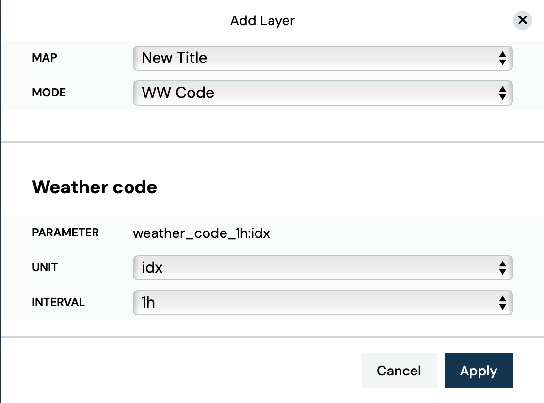
The Meteomatics Weather API has a dedicated parameter called ”weather_code_<interval>:idx”, which is why the parameter is already pre-selected. In the ”interval” section the user can determine an interval of either 1, 3, 6, 12, or 24h. When the user adds the layer through the ”Apply” button, the layer appears in the Layer Stack. A click on the added layer unfolds its adjustable attributes: source, interval, opacity and resolution.