Satellite Imagery
- Global: Images | Infrared Channels | Normalised Difference Vegetation Index
- Meteosat data for Europe: Cloud Types | Fog Images | Visible Images
Satellite data is available from the geostationary satellites GOES-16/17, Meteosat-8/11 and Himawari-8. The spatial resolution varies between 1 and 3 kilometers at the equator below the satellite. Images are available every 10 respectively 15 minutes depending on the source.
Please note that only certain parameters such as cloud_type(_transparent):idx or specific channels can be useful if queried as non-image data. The other parameters are intended for visualization purposes and are only meaningful if combined with an appropriate colormap (using png_default does that for you), as the values correspond to a specific color.
Images
A global false color composite that uses data from visible and near-infrared wavelengths and is consistent across all the satellites can be queried with the parameter
sat_rgb:idxAs Meteosat-11 provides a high resolution scan for limited areas, we provide another composite where we integrate it to provide increased fidelity over Europe. It can be queried with the parameter
sat_rgb_hd:idxExamples
-
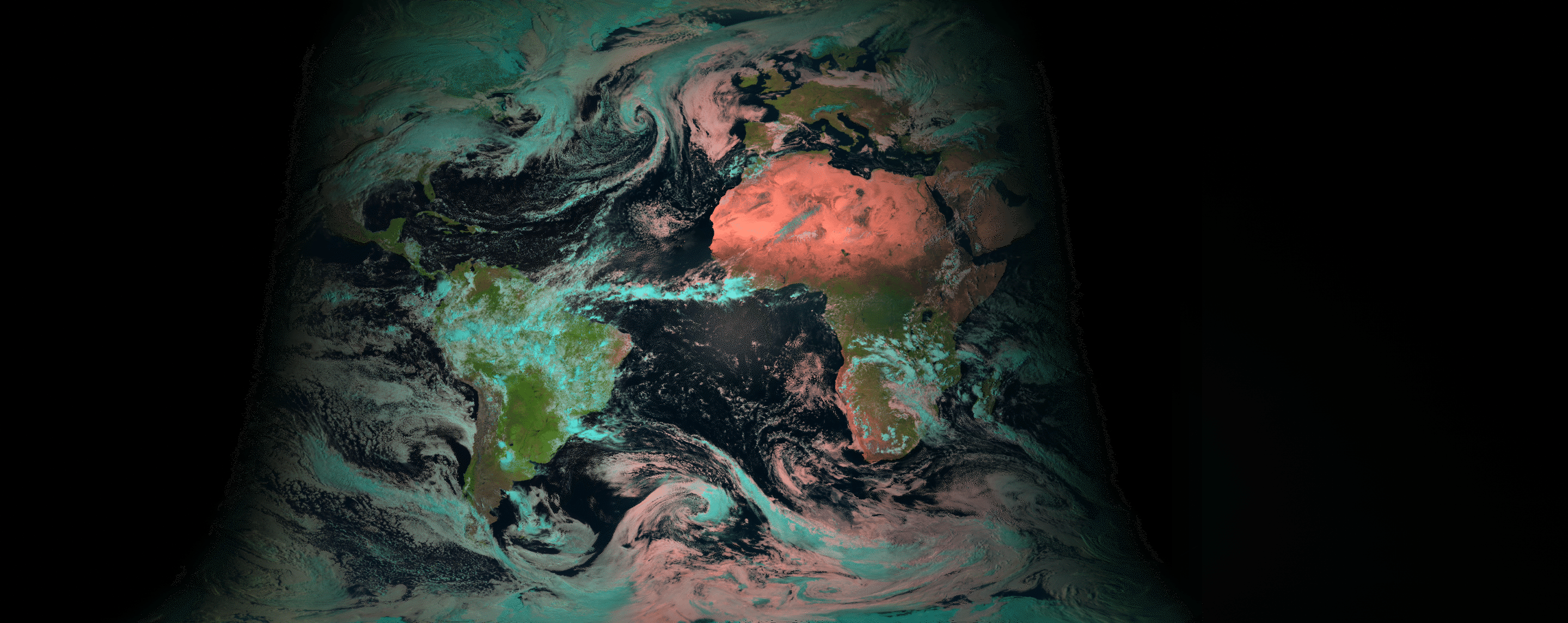
RGB channel global satellite image:
Current:
https://api.meteomatics.com/2026-07-21T18Z/sat_rgb:idx/71.5,-180.0_-71.5,180.0:0.1,0.1/png -
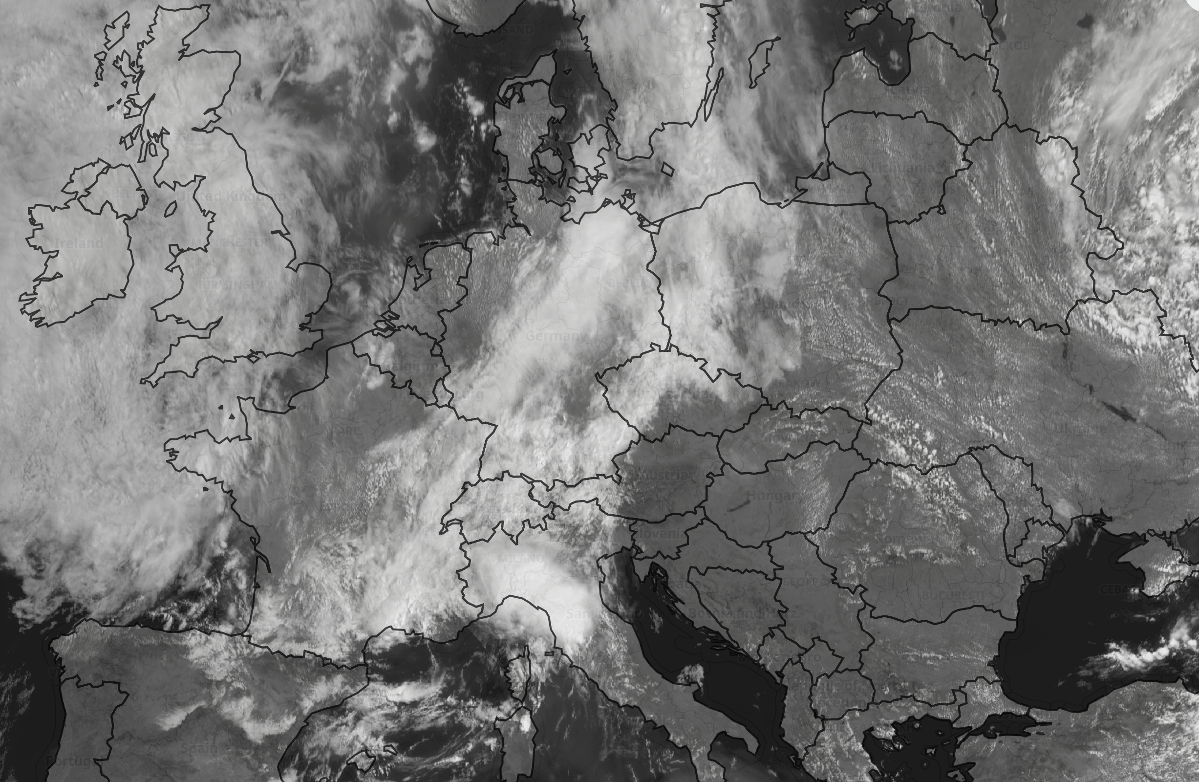
RGB channel high-definition satellite image of Europe:
Current:
https://api.meteomatics.com/2026-07-21T15Z/sat_rgb_hd:idx/60.0,-10.0_30.0,40.0:0.1,0.1/png


Infrared Channels
Infrared composites can be queried with the parameters
sat_vis_006:idx
sat_ir_008:idx
sat_ir_016:idxK with C.
sat_ir_039:K
sat_ir_062:K
sat_ir_104:K
The number indicates the wavelength in tenths of micrometers, e.g. sat_ir_039:idx corresponds to the channel with a central wavelength of 3.9 μm.
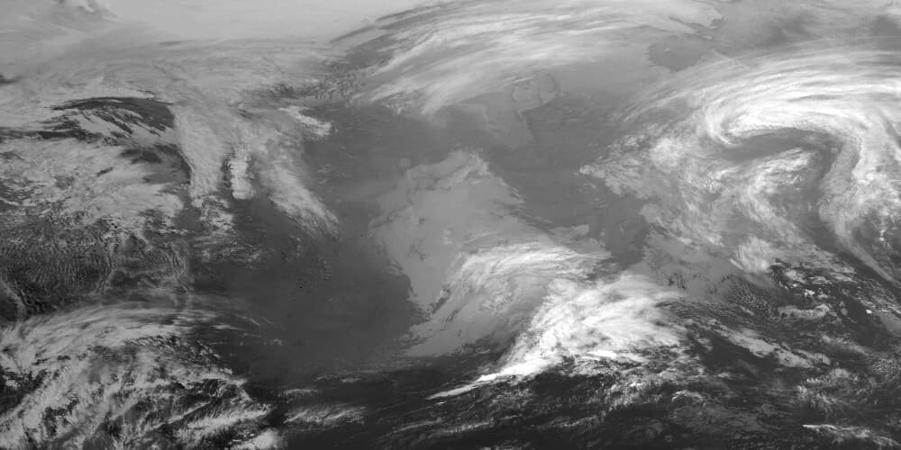
Example
-
Global satellite image of 3.9 μm channel:
Current:
https://api.meteomatics.com/2026-07-21T00Z/sat_ir_039:K/65.0,-120.0_23.0,-50.0:1000x500/png

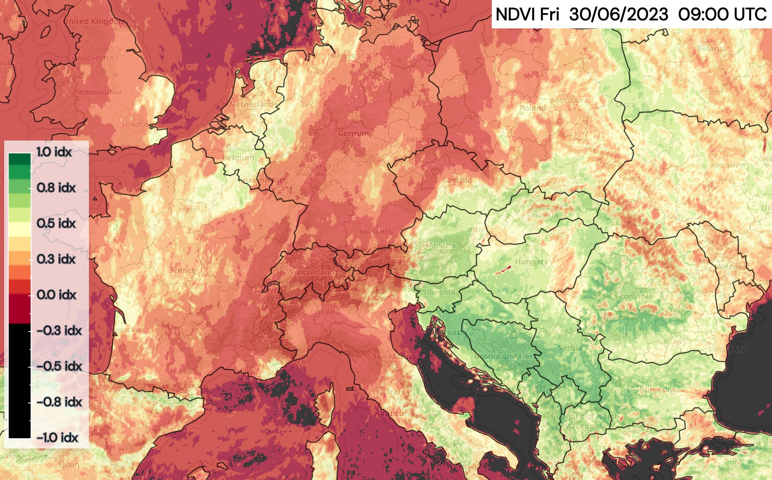
Normalised Difference Vegetation Index
The Normalised Difference Vegetation Index (NDVI) is a satellite product which indicates vegetation greenness. It is calculated as a normalised ratio between the red and near infrared satellite channels. The NDVI varies between 0 and 1, with a value close to 1 indicating high vegetation greenness and hence high vegetation density and health.
sat_ndvi:idxExamples
-
NDVI over the ALpine region, displayed in MetX:
Current:
https://api.meteomatics.com/2026-07-21T15Z/sat_ndvi:idx/60.0,-10.0_30.0,40.0:0.1,0.1/png

Meteosat data for Europe
Over Europe, there are additional parameters available that provide more information on clouds as seen from space.
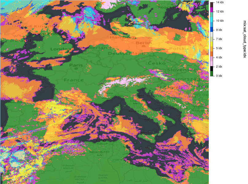
Cloud Types
By combining data from sensors at various wavelengths, it is possible to distinguish cloud types due to their differing temperature and constituents. Such an image can be queried with the two parameters
sat_cloud_type:idx
sat_cloud_type_transparent:idx-
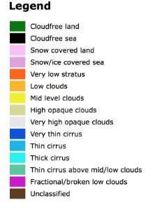
sat_cloud_type:idx: if cloud-free, the index differentiates between cloud-free land (0) and sea (1) as well as snow covered land (2) and snow/ice covered sea (3). The different cloud types are explained in the table below. -
sat_cloud_type_transparent:idx: cloud-free areas are set to -666 instead of 0, 1, 2 and 3. Also unclassified clouds (14) are set to -666.
| Index | Cloud Type |
|---|---|
| 0 | Cloudfree land |
| 1 | Cloudfree sea |
| 2 | Snow covered land |
| 3 | Snow/ice covered sea |
| 4 | Very low stratus |
| 5 | Low clouds |
| 6 | Mid level clouds |
| 7 | High opaque clouds |
| 8 | Very high opaque clouds |
| 9 | Very thin cirrus |
| 10 | Thin cirrus |
| 11 | Thick cirrus |
| 12 | Thin cirrus above mid/low clouds |
| 13 | Fractional/broken low clouds |
| 14 | Unclassified |
For visualization purposes, these indices are mapped onto colors according to the following legend:

If you wish to query an image that is transparent wherever there are no clouds and emplaces the HRV image data wherever there are clouds, you can do so by means of the parameter
sat_cloud_layer:idxPlease note that since the image data stems from HRV, the clouds will be black wherever there is no sunlight, e.g. during the night.
Examples
-
Type of clouds over Europe according to the table above:
Current:
https://api.meteomatics.com/2026-07-21T15Z/sat_cloud_type:idx/60.0,-10.0_30.0,25.0:0.1,0.1/html_map

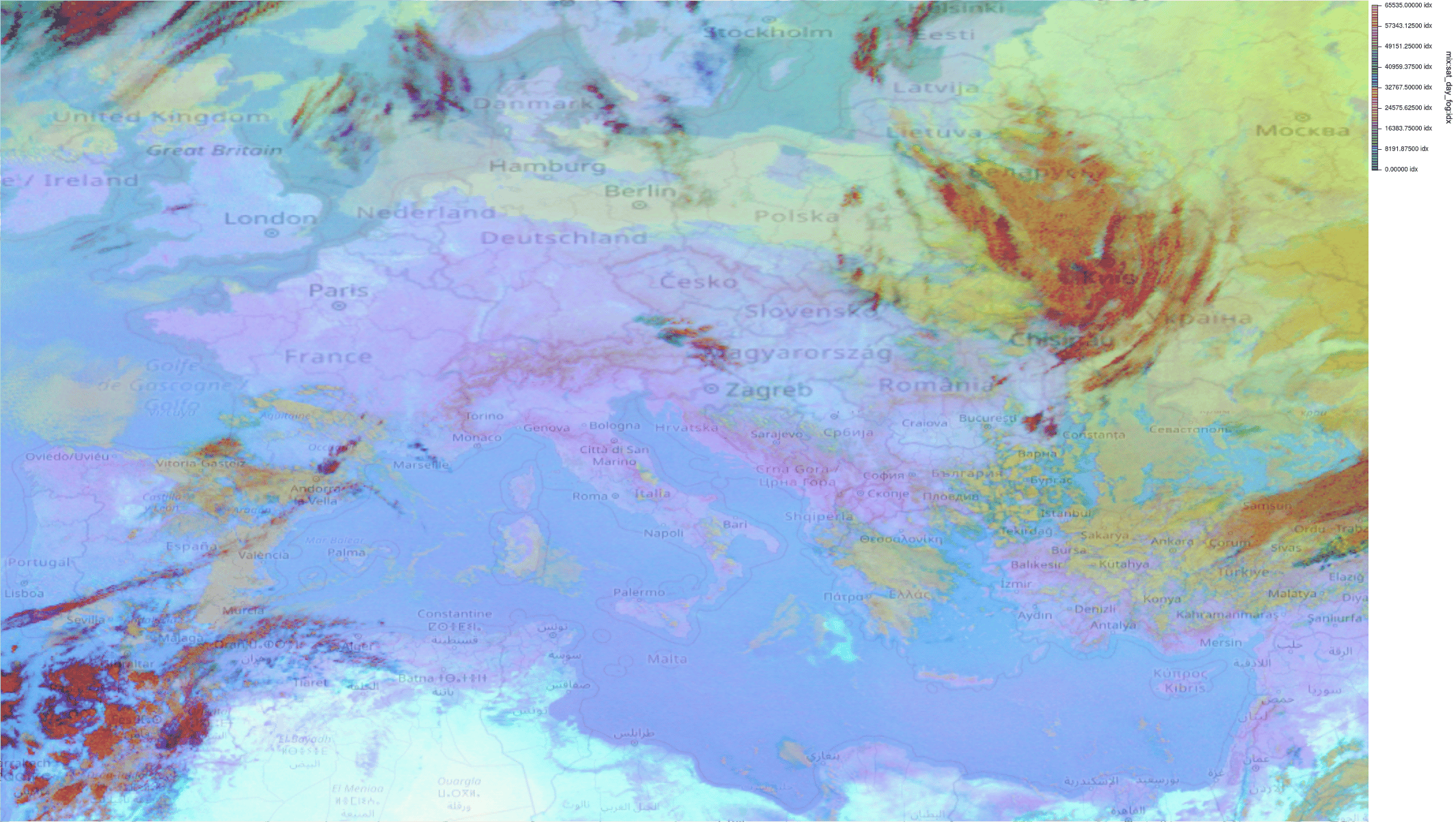
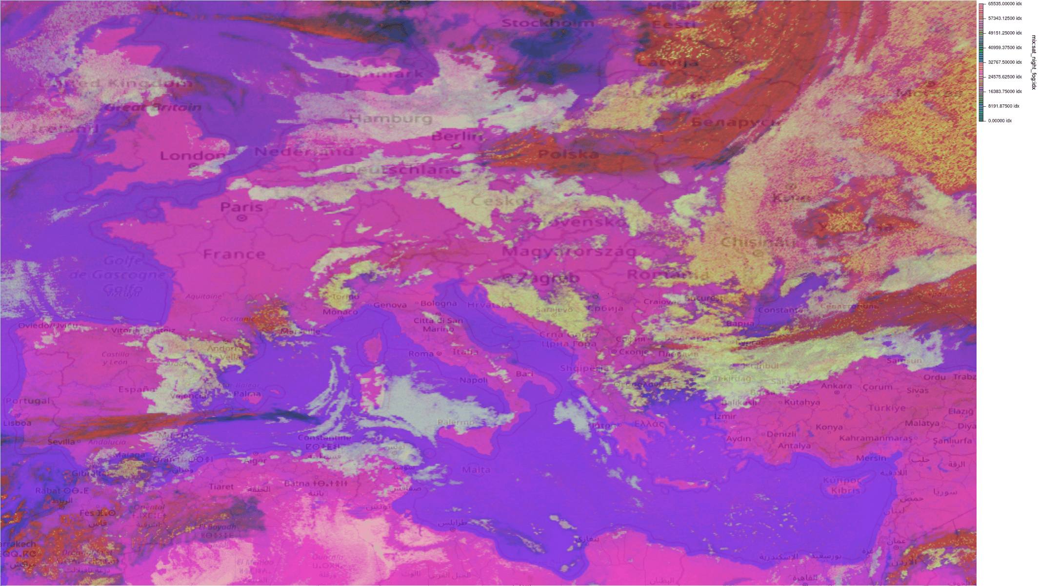
Fog Images
A clever combination of satellite images at certain wavelengths into an RGB can highlight low clouds and fog as well as distinguish them from one another. Two such RGB composite images queried by the following parameters:
sat_day_fog:idx
sat_night_fog:idx
For the interpretation of sat_day_fog:idx images please refer to the SEVIRI Dust RGB Quick Guide. As indicated in the guide, this is also helpful with tracking dust clouds.
A brief guide to reading the sat_night_fog:idx images can be found in the Night Microphysics RGB Quick Guide, with a more detailed presentation containing a lot of examples located here. Please note that the composite is tuned for night time and the presence of sunlight has a significant impact on both the contrast and interpretation of the colors.
Examples
-
Low clouds and fog over Europe during daytime:
Current:
https://api.meteomatics.com/2026-07-21T15Z/sat_day_fog:idx/60.0,-10.0_30.0,40.0:0.1,0.1/html_map -
Low clouds and fog over Europe during nighttime:
Current:
https://api.meteomatics.com/2026-07-21T03Z/sat_night_fog:idx/60.0,-10.0_30.0,40.0:0.1,0.1/html_map

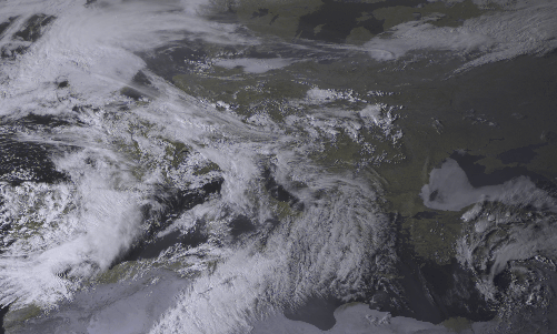
Visible Images
A high resolution visible (hrv) wavelength composite over Europe can be queried with
sat_hrv:idxExamples
-
Visible wavelength image, displayed in MetX:
Current:
https://api.meteomatics.com/2026-07-21T15Z/sat_hrv:idx/60.0,-10.0_30.0,40.0:0.1,0.1/png