This parameter computes an index to determine whether there is a Bise and its strength. The Bise is a typically cold wind from north-easterly directions in the Lake Constance area which affects local weather conditions, including those of the Swiss Plateau. It is mainly triggered by a large scale air pressure difference between a low in the south-west of the Alps and a high on the northern side of the Alps. As a rule of thumb, if the pressure difference between Geneva and Constance is less that -2 hPa and the wind direction is north-easterly at the queried location, then Bise conditions are expected. If all conditions are met the value of the index is 1 and Bise is expected, otherwise the index is 0.
bise_index:idx
The pressure difference between Geneva and Constance can also be queried. This gives an indication of the strength of the Bise. A more negative pressure difference will give stronger Bise conditions.
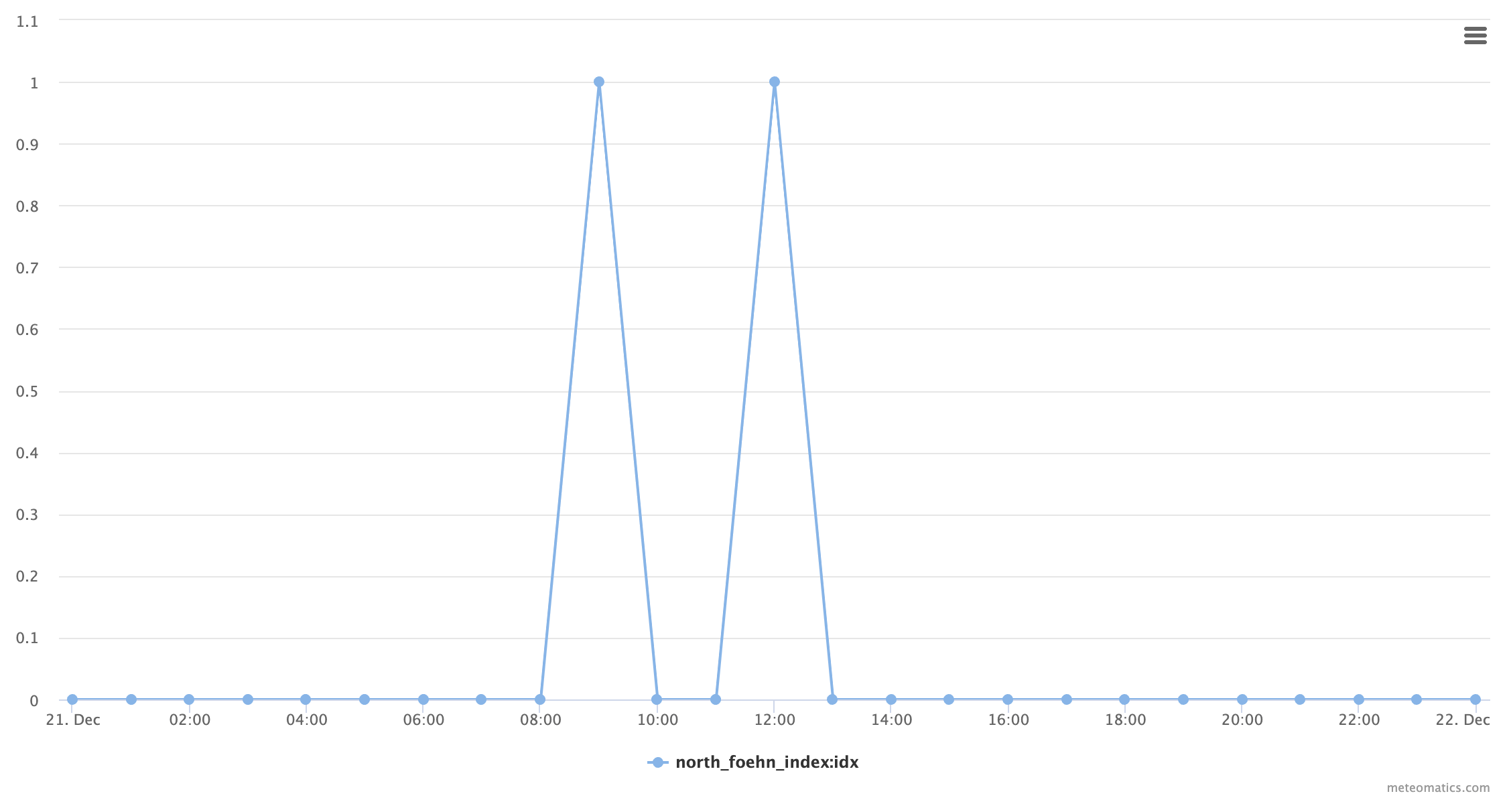
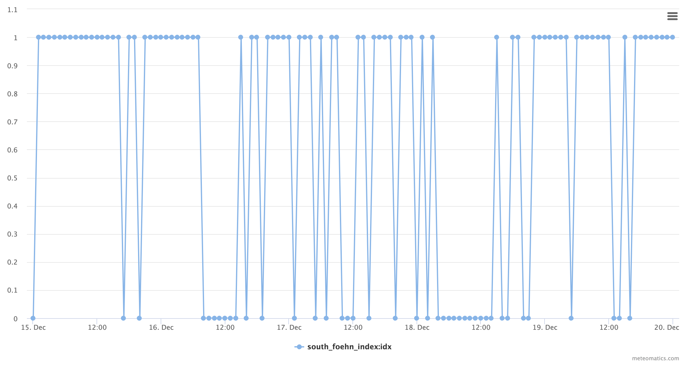
This parameter computes an index to determine the presence of the Alpine Foehn. The Foehn is a typically strong, warm, dry wind crossing the Alps from the south-east to the north, but can also move in the the opposite direction. It mainly affects Alpine valleys. Usually, it is triggered by large scale air pressure differences between a high south of the Alps and a low north-west of the Alps. As a rule of thumb, if the pressure difference between Lugano and Zurich is higher than 4 hPa and the wind direction is southerly, Foehn conditions are expected in the northern part of the Alps (South Foehn). If the pressure difference is less than -4 hPa, and the wind direction is northerly, Foehn conditions are expected in the southern part of the Alps (North Foehn). Note that the name refers to the direction from which the wind blows.
north_foehn_index:idx
If all conditions are met for North Foehn, the value of the index is 1 and North Foehn is expected, otherwise the index is 0.
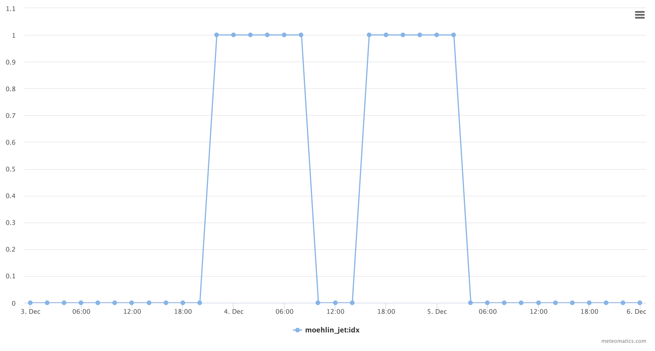
The Moehlin Jet is a south-easterly local wind that originates from the Frick Valley and is responsible for dissolving fog in the region of Basel. This is the reason why sunshine duration there clearly exceeds that elsewhere in the Swiss midlands in autumn. Favoring conditions are winterly high pressure situations over Switzerland, when the midlands act as a cold air pool. If the pool is full, the cold air masses spill over and follow gravity towards Moehlin, while the air is dried and heated on the way. The index takes values of 0 and 1, where 1 indicates the presence of a Moehlin Jet.
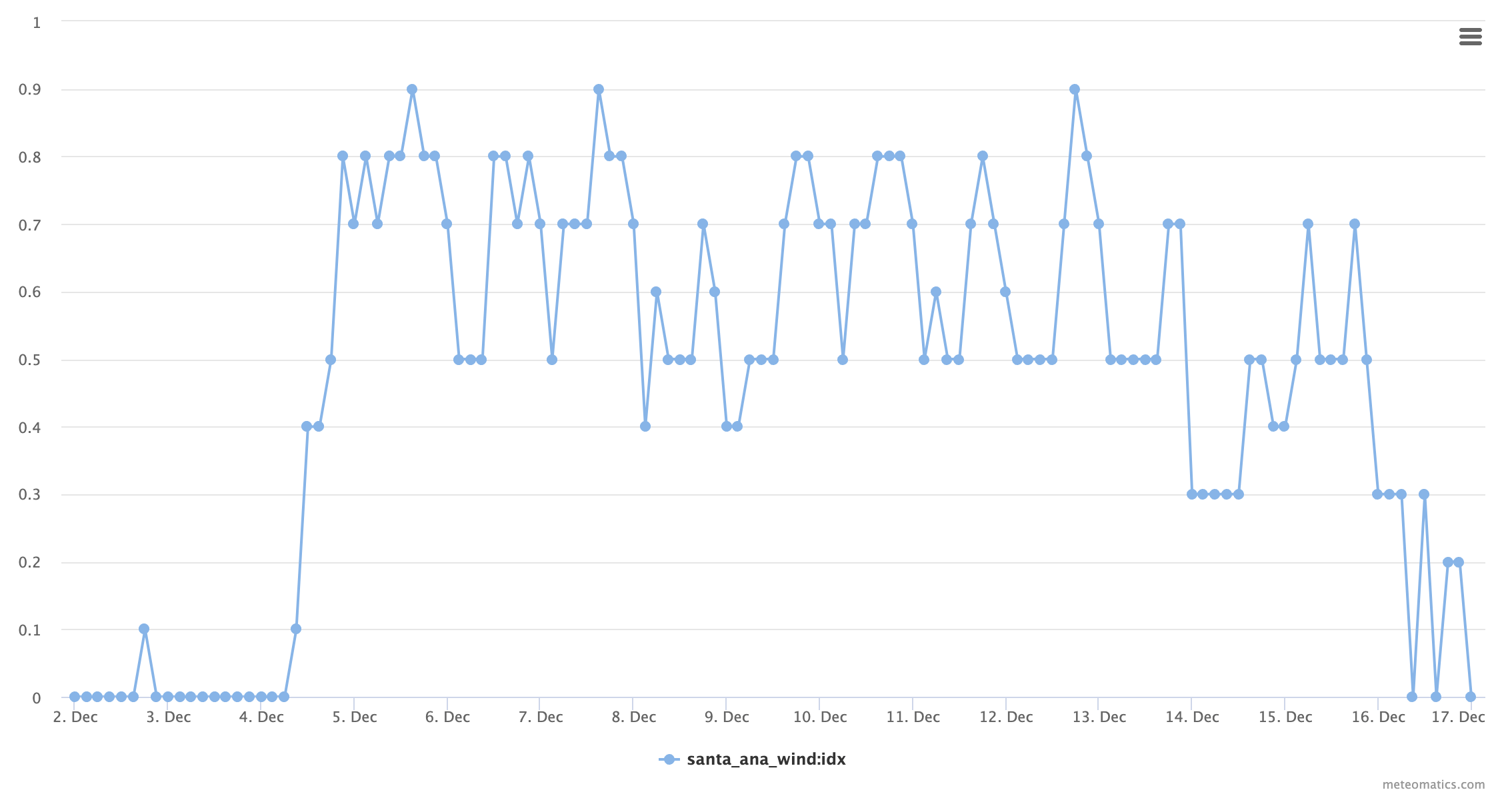
This parameter computes the presence and strength of the Santa Ana Winds in southern California. These are strong and extremely dry down-slope winds that originate from the desert and descend towards coastal areas. They develop if dry, cool high-pressure air masses are prevailing in the Great Basin and low pressure over the Pacific. Typically, these events occur in fall. Due to the extremely low relative humidities, such an event increases the chance of wildfires. The index takes values in the range of 0 to 1. If the index exceeds 0.6, Santa Ana Winds can be expected.
Your satisfaction is our goal, which is why we use cookies. With these cookies, we enable our website to run reliably and securely, keep an eye on performance, and better engage with you.
Cookies are necessary for everything to function technically, and they allow you to access external content. Additionally, we collect data, including information about visited pages, completed purchases, or clicked buttons, to enhance our services for you.
Learn more about the services we use in the "Cookie Settings" section. By clicking "Agree and Continue", you consent to the use of these services. You can revoke or modify your consent at any time with effect for the future.