Topography and Land Usage
Elevation | Topography Deviation | Land Usage | Roughness Length | Shadow | Water Bodies
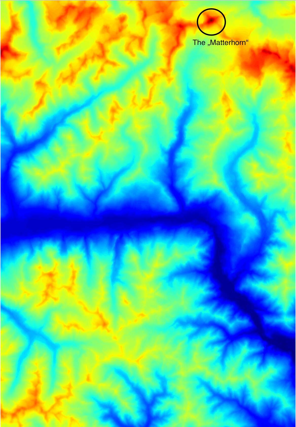
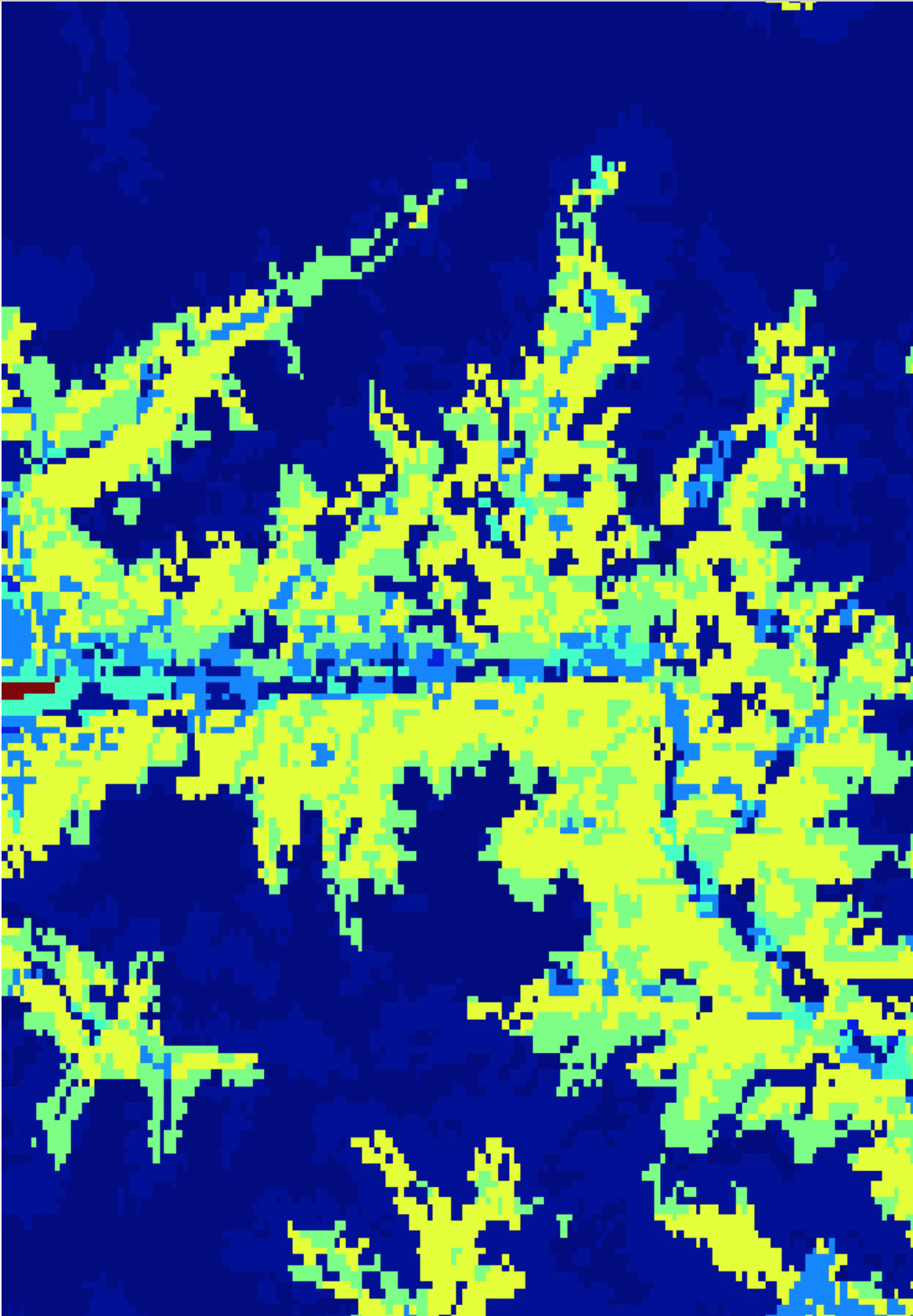
Elevation
Gives the elevation in meters above sea level. If source is set to a specific model, the model topography with the according resolution is returned. If no model or mix is selected, the topography from NASA SRTM/ASTER with a horizontal resolution of approximately 90 meters is returned.
elevation:<unit>Available units: m, ft, mi
Examples
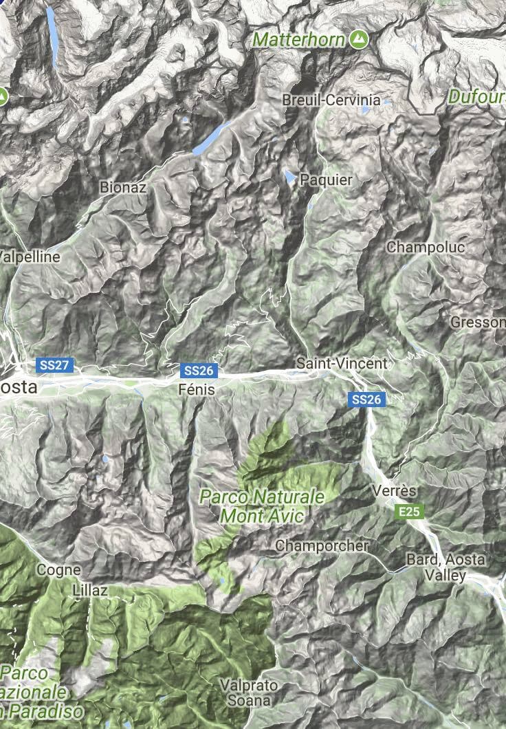
- The depicted area is located in the Swiss canton "Wallis" and its most famous mountain, the "Matterhorn", is encircled in the right image. A terrain map of the corresponding region is also shown for more intuitive comparison (Map data: Google, August 2017):
https://api.meteomatics.com/2026-07-30T18:00:00Z/elevation:m/46,7.3_45.5,7.8:0.001,0.001/html
- To obtain the data in a different output format, just replace the format parameter in the URL by one of the following:
csv, json, xml, png, html, netcdf.
Here is an example for the csv format:
https://api.meteomatics.com/2026-07-30Z/elevation:m/46,7.3_45.5,7.8:0.1,0.1/csvvaliddate;2017-07-02 18:00:00 parameter;elevation:m data;7.3;7.4;7.5;7.6;7.7;7.8 46;2606;3157;2588;3297;2394;2672 45.9;2300;3063;1912;2504;2586;3334 45.8;1105;2763;1699;1317;1665;2390 45.7;1283;1971;1294;2353;1028;2641 45.6;2796;2032;2776;2106;1086;369 45.5;2890;2848;1265;2190;1881;792


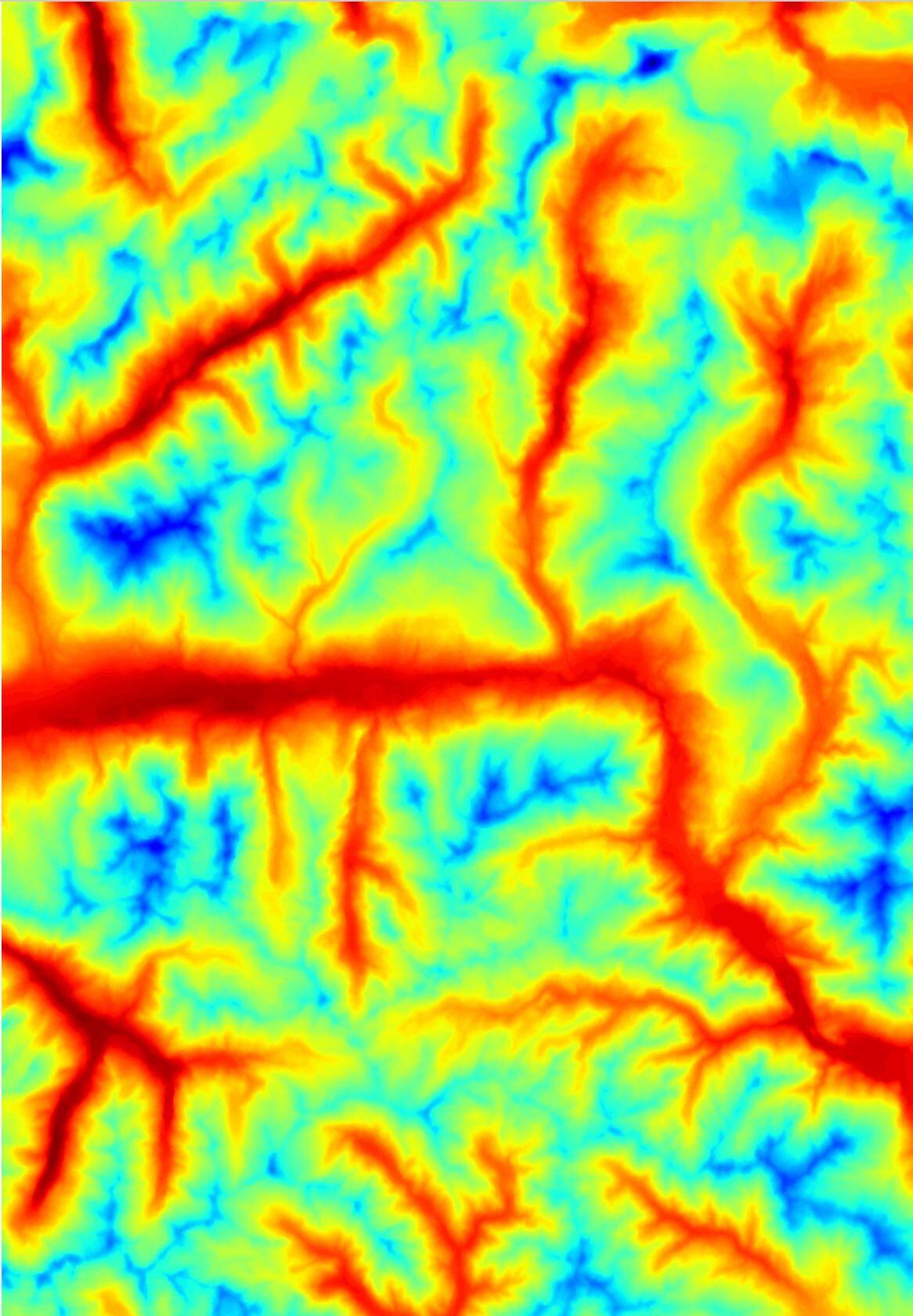
Topography Deviation
The deviation in topography of the specified weather model compared to the NASA SRTM/ASTER measured elevation.
model_topo_deviation:<unit>Available units: m, ft, mi
Examples
The depicted area is located in the Swiss canton "Wallis". A terrain map of the region is also shown for more intuitive comparison (Map data: Google, August 2017).
https://api.meteomatics.com/2026-07-30T18:00:00Z/model_topo_deviation:m/46,7.3_45.5,7.8:0.001,0.001/html- https://api.meteomatics.com/2026-07-30T18:00:00Z/model_topo_deviation:m/46,7.3_45.5,7.8:0.1,0.1/csv
validdate;2017-07-02 18:00:00
parameter;model_topo_deviation:m
data;7.3;7.4;7.5;7.6;7.7;7.8
46;39;59;-55;-147;-26;24
45.9;177;-191;260;-143;55;-89
45.8;-81;-191;81;-33;69;-12
45.7;59;176;336;-250;-91;-159
45.6;62;2;-25;13;70;121
45.5;40;-62;398;-321;-488;-30

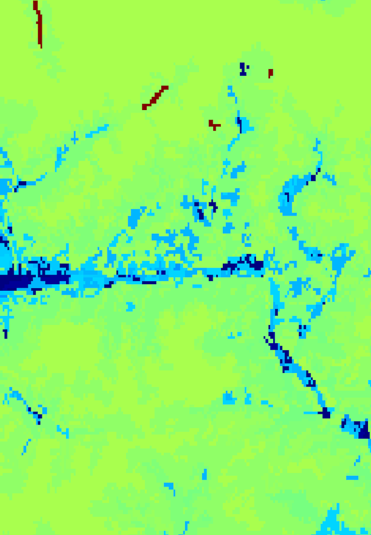
Land Usage
Examples
The depicted area is located in the Swiss canton "Wallis". A terrain map of the region is also shown for more intuitive comparison (Map data: Google, August 2017).
https://api.meteomatics.com/2026-07-30T18:00:00Z/land_usage:idx/46,7.3_45.5,7.8:0.001,0.001/htmlThe return values are integer codes, examples above are 512 for inland water bodies and 112 for discontinuous urban fabric.
Please consult https://www.eea.europa.eu/data-and-maps/data/clc-2006-raster-3/corine-land-cover-classes-and/clc_legend.csv for a table of the codes.- https://api.meteomatics.com/2026-07-30T18:00:00Z/land_usage:idx/46,7.3_45.5,7.8:0.5,0.5/json
{"version":"3.0","user":"api-test","dateGenerated":"2018-02-14T16:07:43Z","status":"OK","data":
[{"parameter":"land_usage:idx","coordinates":
[{"lat":45.5,"lon":7.3,"dates":[{"date":"2017-07-02T18:00:00Z","value":332}]},
{"lat":45.5,"lon":7.8,"dates":[{"date":"2017-07-02T18:00:00Z","value":243}]},
{"lat":46,"lon":7.3,"dates":[{"date":"2017-07-02T18:00:00Z","value":332}]},
{"lat":46,"lon":7.8,"dates":[{"date":"2017-07-02T18:00:00Z","value":332}]}]}]}
Roughness Length
Roughness length of the ground, depending of the land usage. Roughness length is a parameter of some vertical wind profile equations that model the horizontal mean wind speed near the ground; in the log wind profile, it is equivalent to the height at which the wind speed theoretically becomes zero.
roughness_length:<unit>Available units: m, ft
Examples
The depicted area is located in the Swiss canton "Wallis". A terrain map of the region is also shown for more intuitive comparison (Map data: Google, August 2017).
https://api.meteomatics.com/2026-07-30T18:00:00Z/roughness_length:m/46,7.3_45.5,7.8:0.001,0.001/html
- https://api.meteomatics.com/2026-07-30T18:00:00Z/roughness_length:m/46,7.3_45.5,7.8:0.5,0.5/json
{"version":"3.0","user":"api-test","dateGenerated":"2018-02-14T16:11:45Z","status":"OK","data":
[{"parameter":"roughness_length:m","coordinates":
[{"lat":45.5,"lon":7.3,"dates":[{"date":"2017-07-02T18:00:00Z","value":0.005}]},
{"lat":45.5,"lon":7.8,"dates":[{"date":"2017-07-02T18:00:00Z","value":0.3}]},
{"lat":46,"lon":7.3,"dates":[{"date":"2017-07-02T18:00:00Z","value":0.005}]},
{"lat":46,"lon":7.8,"dates":[{"date":"2017-07-02T18:00:00Z","value":0.005}]}]}]}
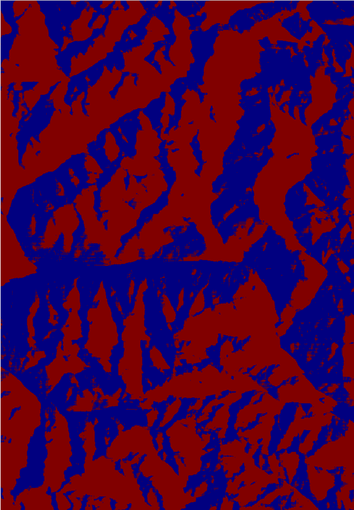
Shadow
This parameter returns 1 or 0 depending on whether the coordinate is in shadow of the topography at the specified time or not.
is_in_shadow:idxThe reverse parameter returns 1 for areas not in shadow at the specified time.
is_not_in_shadow:idxExamples
The depicted area is located in the Swiss canton "Wallis". Pixels lying in the shadow are marked red in the image. A terrain map of the region is also shown for more intuitive comparison (Map data: Google, August 2017).
https://api.meteomatics.com/2026-07-30T18:00:00Z/is_in_shadow:idx/46,7.3_45.5,7.8:0.001,0.001/html- https://api.meteomatics.com/2026-07-30T18:00:00Z/is_in_shadow:idx/46,7.3_45.5,7.8:0.1,0.1/csv
validdate;2017-07-02 18:00:00
parameter;is_in_shadow:idx
data;7.3;7.4;7.5;7.6;7.7;7.8
46;0;1;0;1;0;0
45.9;1;0;1;1;0;1
45.8;1;1;1;0;1;1
45.7;0;1;1;0;0;0
45.6;1;1;1;0;0;0
45.5;1;0;1;1;1;1
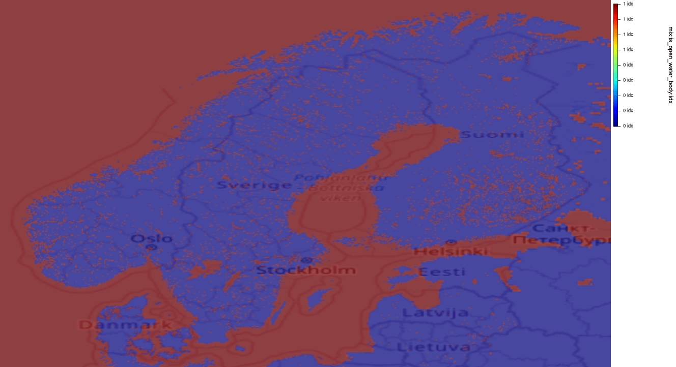
Open Water Body
This index tells you if a coordinate is located within a water body or on land. The index is either 1 for water bodies or 0 for land.
is_open_water_body:idxExamples
-
The chart below shows the water body mask for Scandinavia. Red colors represent water bodies (oceans and lakes):
https://api.meteomatics.com/2026-07-30T00:00:00Z/is_open_water_body:idx/scandinavia:0.05,0.05/html_map