ArcGIS
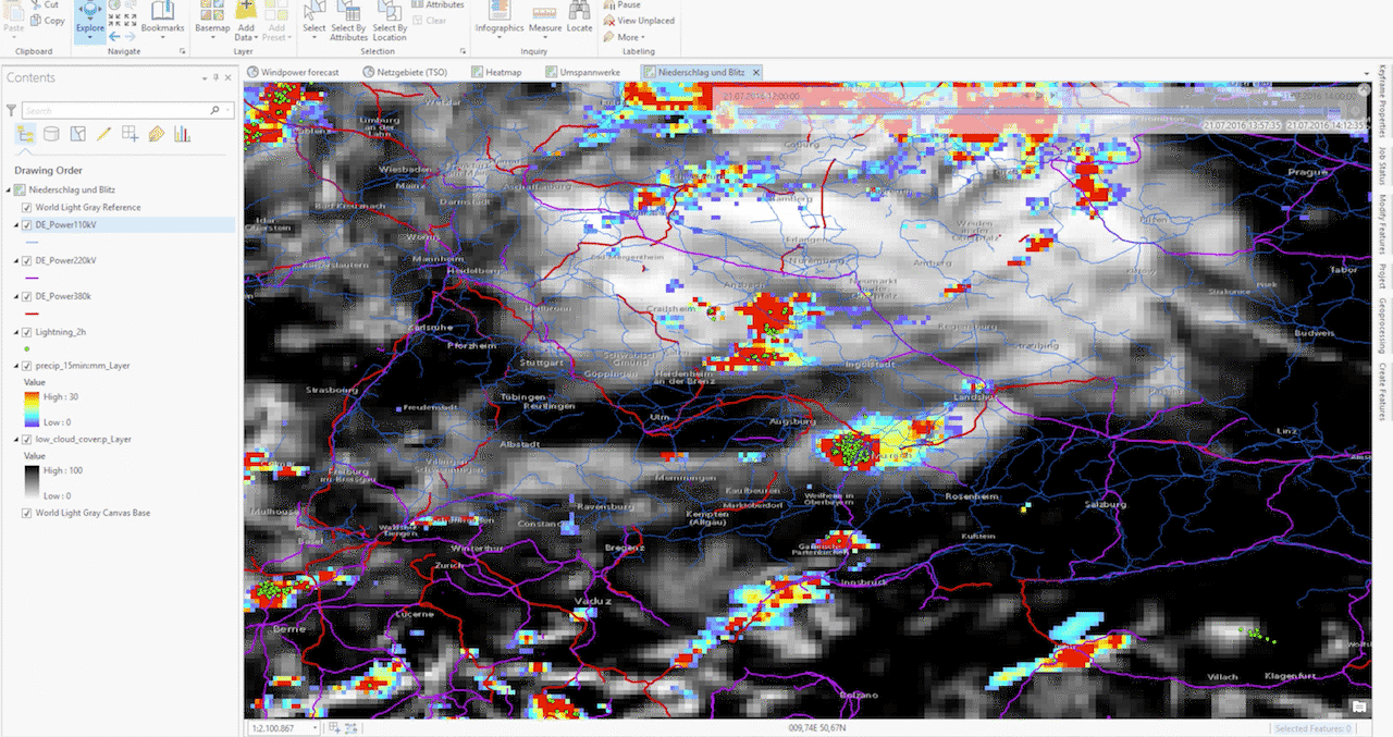
ArcGIS is the de facto standard of geo information systems (GIS). Thanks to WMS and WFS capability, arbitrary data layers can be easily integrated into your personal ArcGIS application. For instance, the following example shows real-time radar images, satellite images, and lightning data with the power line network of a major transmission system operator. A time slider allows operators to see past and short-term forecasted data, which enables them to estimate the impacts of severe storms to their infrastructure. As well as the aforementioned variables like radar, satellite, and lightning data, the weather API provides short-term forecasts (nowcasts) in 5-minutes resolution.
Please refer to ArcGIS (WMS) or ArcGIS (WFS) for further instructions on how to use our API in ArcGIS.

ArcGis Online
The following link shows an example how the API is used in ArcGIS Online:
https://www.arcgis.com/home/webmap/viewer.html?webmap=d0cdbda4e13c418da23c8aa86867166e

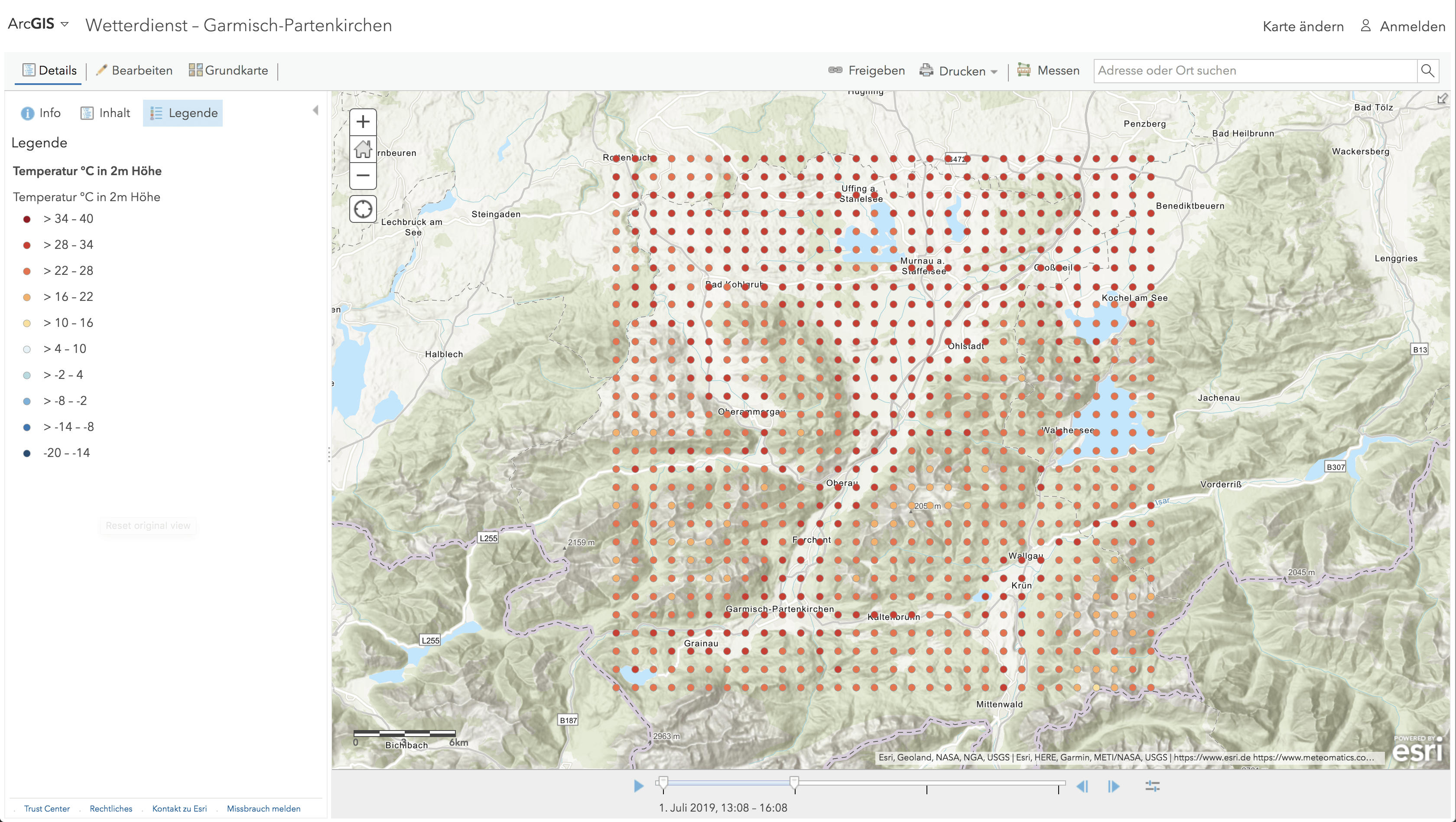
In this example a layer containing the temperature grid is added to a map showing the region around Garmisch-Partenkirchen.