GeoTIFF
GeoTIFF is a format that allows the integration of georeferencing information in a TIFF file. Typical geo-information are map projections, coordinate systems, ellipsoids and datums.
Examples-
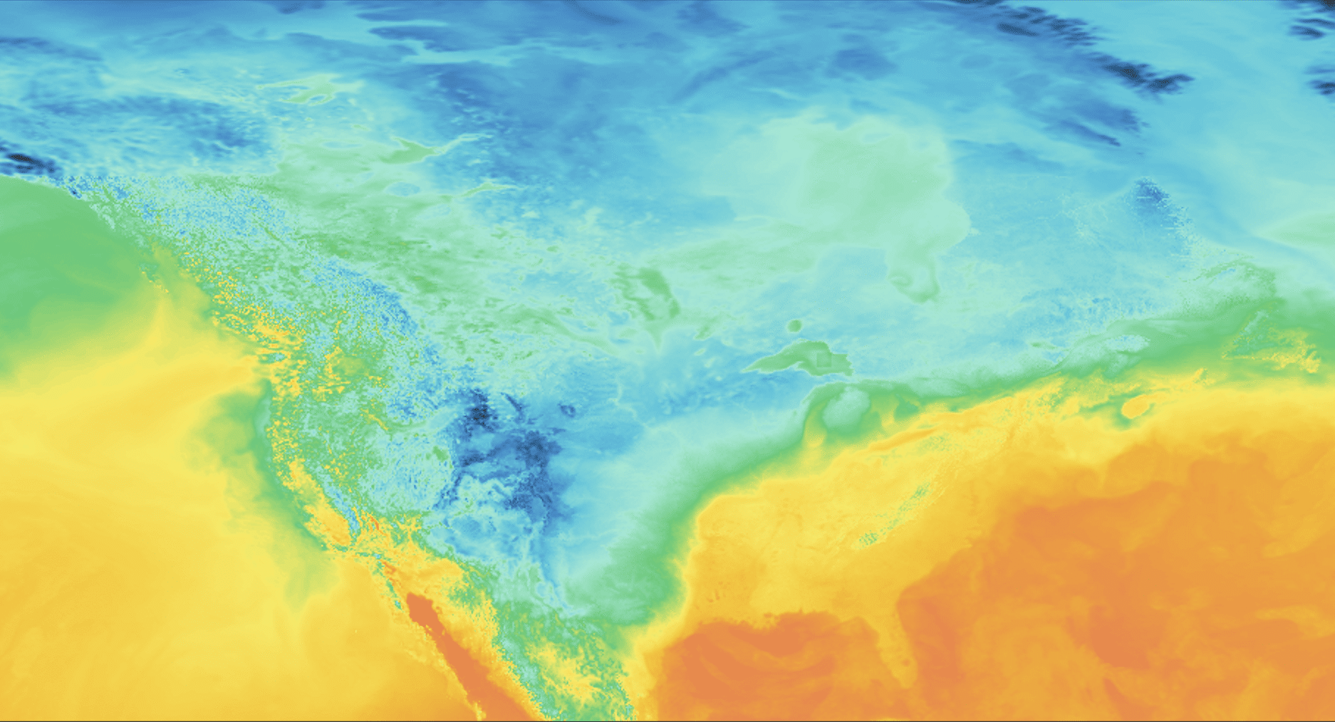
Temperature in North America
https://api.meteomatics.com/2025-06-30T06:00:00Z/t_2m:C/72,-170_23,-50:0.1,0.1/geotiff -
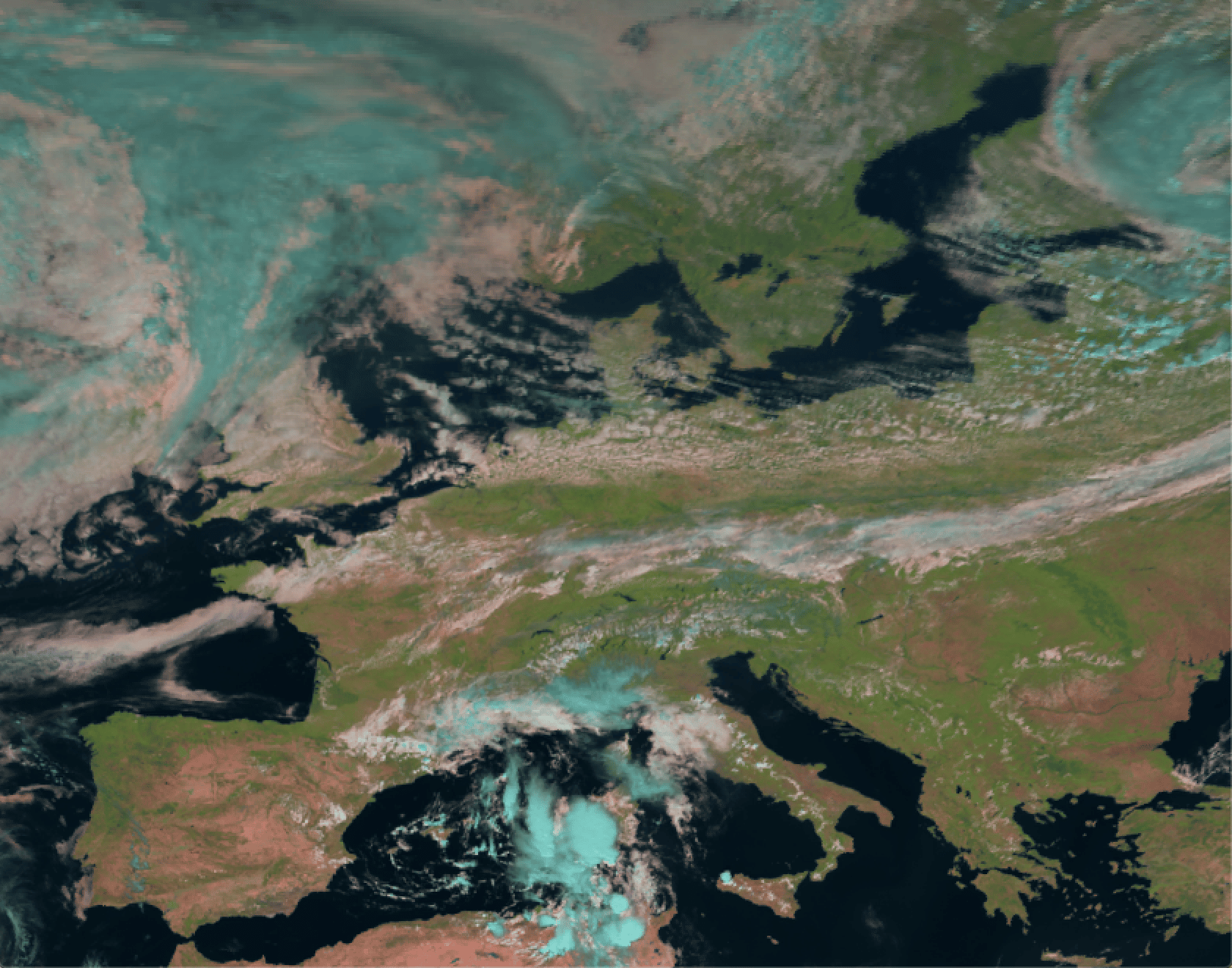
Satellite image for Europe
https://api.meteomatics.com/2025-06-29T11:00:00Z/sat_rgb:idx/67.96,-12_35,30:0.05,0.05/geotiff


geotiff format specification in the query, i.e. geotiff_magenta_blue